TopoQuest Logo
Do you find TopoQuest useful?
Help keep TopoQuest running and adding new maps/features by donating!
Bitcoin:  19c7KJd3qBynnjoSw5npx9KScwjBe4ifkT
Litecoin:  LXs6TkuXGGXo1vDsWCkWVdjQX94eUKd6ui
Home View Maps Find Maps Find Places Resources & Links


Magee South, Mississippi Topographic Map

USGS Map Title: Magee South, MS
USGS Map MRC: 31089G6
DRG (GeoTIFF) Download: o31089g6.tif


Neighboring USGS Topographic Map Quads:


  Mendenhall East, MS  
31089H7
 

  Magee North, MS  
31089H6
 

  Cohay, MS  
31089H5
 

  Mendenhall SE, MS  
31089G7
 

  Magee South, MS  
31089G6
 

  Mize, MS  
31089G5
 

  Mount Carmel, MS  
31089F7
 

  Lone Star, MS  
31089F6
 

  Collins, MS  
31089F5


Map MRC Location:

N32°
W90°
N32°
W89°
H8 H7 H6 H5 H4 H3 H2 H1
G8 G7 G6 G5 G4 G3 G2 G1
F8 F7 F6 F5 F4 F3 F2 F1
E8 E7 E6 E5 E4 E3 E2 E1
D8 D7 D6 D5 D4 D3 D2 D1
C8 C7 C6 C5 C4 C3 C2 C1
B8 B7 B6 B5 B4 B3 B2 B1
A8 A7 A6 A5 A4 A3 A2 A1
N31°
W90°
N31°
W89°

Magee South, MS USGS 1:24K Topographic Map Preview:
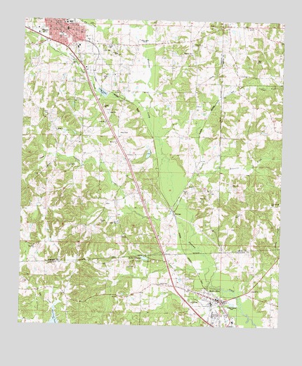
Magee South, MS USGS Topographic Map
Click on map above to begin viewing in our Map Viewer.

This topographic map contains these locations and features:
Feature Name Type Latitude Longitude GNIS ID View Map
Beulah ChurchChurchN31.8615°W89.7067°667044View Map
Big CreekStreamN31.8740°W89.6934°667101View Map
Calvary ChurchChurchN31.8060°W89.6590°667931View Map
City of MageeCivilN31.8730°W89.7340°2404997View Map
Coat Baptist ChurchChurchN31.8460°W89.7045°685121View Map
CoatsPopulated PlaceN31.8460°W89.7048°691775View Map
Concord ChurchChurchN31.8532°W89.6431°668736View Map
Dry Creek LakeReservoirN31.7510°W89.7328°669454View Map
Dry Creek Structure 3 DamDamN31.7502°W89.7234°680876View Map
East Side Baptist ChurchChurchN31.8696°W89.7226°685127View Map
First Baptist ChurchChurchN31.8740°W89.7340°685132View Map
First United Methodist Church of MageeChurchN31.8749°W89.7340°685134View Map
Goodwater CreekStreamN31.8382°W89.6917°670507View Map
Johnson School (historical)SchoolN31.7535°W89.7054°689837View Map
Low (historical)LocaleN31.8490°W89.6695°707251View Map
MageePopulated PlaceN31.8738°W89.7337°673055View Map
Magee Church of GodChurchN31.8657°W89.7306°685149View Map
Magee City HallBuildingN31.8740°W89.7320°685150View Map
Magee City Police DepartmentBuildingN31.8742°W89.7317°2754087View Map
Magee Elementary SchoolSchoolN31.8738°W89.7298°707305View Map
Magee General HospitalHospitalN31.8710°W89.7291°707306View Map
Magee High SchoolSchoolN31.8738°W89.7279°707307View Map
Magee Oil FieldOilfieldN31.8668°W89.6556°707252View Map
Magee Post OfficePost OfficeN31.8709°W89.7396°1959809View Map
Magee Presbyterian ChurchChurchN31.8707°W89.7345°685151View Map
McLauren CreekStreamN31.8013°W89.6742°673390View Map
McNairPopulated PlaceN31.7660°W89.6876°710672View Map
McNair CemeteryCemeteryN31.7669°W89.6816°673413View Map
McNair MillpondReservoirN31.7778°W89.6905°673414View Map
Merry HellPopulated PlaceN31.8066°W89.6626°707312View Map
Mount Mariah ChurchChurchN31.8202°W89.6967°674054View Map
Mount OlivePopulated PlaceN31.7613°W89.6551°674103View Map
Mount Olive Attendance CenterSchoolN31.7593°W89.6576°710680View Map
Mount Olive City CemeteryCemeteryN31.7646°W89.6687°710681View Map
Mount Olive City Police DepartmentBuildingN31.7608°W89.6536°2754246View Map
Mount Olive Methodist ChurchChurchN31.7616°W89.6576°710683View Map
Mount Olive Post OfficePost OfficeN31.7615°W89.6555°2768844View Map
Mount Olive Presbyterian ChurchChurchN31.7599°W89.6551°710684View Map
Mount Olive Volunteer Fire DepartmentBuildingN31.7618°W89.6553°2668009View Map
Mount Zion ChurchChurchN31.7960°W89.6456°674344View Map
New Hope Baptist ChurchChurchN31.7824°W89.7434°674688View Map
New Hope CemeteryCemeteryN31.7821°W89.7442°707313View Map
Oak Hill School (historical)SchoolN31.8540°W89.6417°685086View Map
Olivet Presbyterian Church (historical)ChurchN31.7757°W89.6940°710702View Map
Roger Parish Lake DamDamN31.7785°W89.6751°680888View Map
SaratogaPopulated PlaceN31.7971°W89.6776°692209View Map
Sharon CemeteryCemeteryN31.8615°W89.6690°1959823View Map
Sharon ChurchChurchN31.8621°W89.6712°677618View Map
Siloam CemeteryCemeteryN31.8304°W89.7337°1959824View Map
Siloam ChurchChurchN31.8302°W89.7340°677783View Map
The Church of Jesus Christ of Latter Day SaintsChurchN31.8671°W89.7217°685120View Map
Tom Sullivan CemeteryCemeteryN31.8001°W89.6297°678806View Map
Town of Mount OliveCivilN31.7538°W89.6559°2406208View Map
Uspoha CreekStreamN31.7999°W89.6756°666123View Map
Ware CemeteryCemeteryN31.8583°W89.6371°679342View Map
WSJC-AM (Magee)TowerN31.8668°W89.6931°680091View Map
WSJC-FM (Magee)TowerN31.8668°W89.6931°680202View Map
Zionell ChurchChurchN31.7868°W89.7017°680050View Map

Note: Coordinates in the location and feature list above are referenced to NAD83 datum.


Copyright (C) 2008-2024 Ryan Niemi / Sunset Dynamics ... All Rights Reserved