TopoQuest Logo
Do you find TopoQuest useful?
Help keep TopoQuest running and adding new maps/features by donating!
Bitcoin:  19c7KJd3qBynnjoSw5npx9KScwjBe4ifkT
Litecoin:  LXs6TkuXGGXo1vDsWCkWVdjQX94eUKd6ui
Home View Maps Find Maps Find Places Resources & Links


Mendenhall East, Mississippi Topographic Map

USGS Map Title: Mendenhall East, MS
USGS Map MRC: 31089H7
DRG (GeoTIFF) Download: o31089h7.tif


Neighboring USGS Topographic Map Quads:


  Braxton, MS  
32089A8
 

  Puckett, MS  
32089A7
 

  White Oak, MS  
32089A6
 

  Mendenhall West, MS  
31089H8
 

  Mendenhall East, MS  
31089H7
 

  Magee North, MS  
31089H6
 

  Shivers, MS  
31089G8
 

  Mendenhall SE, MS  
31089G7
 

  Magee South, MS  
31089G6


Map MRC Location:

N32°
W90°
N32°
W89°
H8 H7 H6 H5 H4 H3 H2 H1
G8 G7 G6 G5 G4 G3 G2 G1
F8 F7 F6 F5 F4 F3 F2 F1
E8 E7 E6 E5 E4 E3 E2 E1
D8 D7 D6 D5 D4 D3 D2 D1
C8 C7 C6 C5 C4 C3 C2 C1
B8 B7 B6 B5 B4 B3 B2 B1
A8 A7 A6 A5 A4 A3 A2 A1
N31°
W90°
N31°
W89°

Mendenhall East, MS USGS 1:24K Topographic Map Preview:
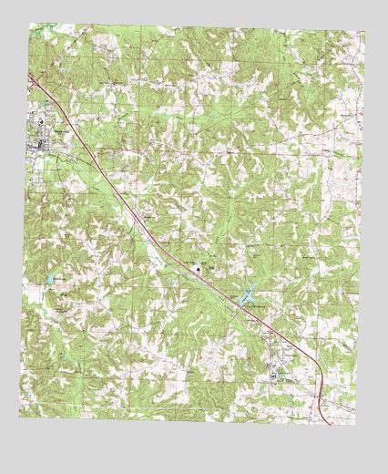
Mendenhall East, MS USGS Topographic Map
Click on map above to begin viewing in our Map Viewer.

This topographic map contains these locations and features:
Feature Name Type Latitude Longitude GNIS ID View Map
Athens ChurchChurchN31.8902°W89.8131°666414View Map
Bethlehem ChurchChurchN31.9610°W89.8017°666994View Map
Campbell CreekStreamN31.9990°W89.8701°667999View Map
Cat BranchStreamN31.9993°W89.7854°668148View Map
City of MendenhallCivilN31.9609°W89.8692°2405070View Map
Fayette School (historical)SchoolN31.9824°W89.7956°685129View Map
FayettehillPopulated PlaceN31.9607°W89.7690°685130View Map
Finley CemeteryCemeteryN31.9332°W89.8603°669963View Map
First Baptist ChurchChurchN31.9627°W89.8679°685133View Map
Good Hope ChurchChurchN31.9896°W89.7542°670473View Map
Goodwater CemeteryCemeteryN31.8760°W89.7662°1959803View Map
Goodwater ChurchChurchN31.8768°W89.7667°670503View Map
Goodwater School (historical)SchoolN31.8768°W89.7670°685139View Map
Hays Mill (historical)LocaleN31.9102°W89.8101°685142View Map
Immanuel ChurchChurchN31.9646°W89.7517°671655View Map
Little CreekStreamN31.9213°W89.8156°672582View Map
Macedonia CemeteryCemeteryN31.9082°W89.8592°1959807View Map
Macedonia ChurchChurchN31.9088°W89.8581°673003View Map
Macedonia School (historical)SchoolN31.9163°W89.8467°685148View Map
Main Street Baptist ChurchChurchN31.9502°W89.8731°685152View Map
MartinvillePopulated PlaceN31.9735°W89.7540°692046View Map
Martinville Oil FieldOilfieldN31.9943°W89.7620°673201View Map
Mary Grove Baptist ChurchChurchN31.9282°W89.7673°673211View Map
May School (historical)SchoolN31.9613°W89.8298°685153View Map
MendenhallPopulated PlaceN31.9618°W89.8701°673476View Map
Mendenhall City Police DepartmentBuildingN31.9622°W89.8710°2754224View Map
Mendenhall Elementary SchoolSchoolN31.9685°W89.8709°707309View Map
Mendenhall High SchoolSchoolN31.9685°W89.8695°707310View Map
Mendenhall Junior High SchoolSchoolN31.9685°W89.8706°707311View Map
Mendenhall Post OfficePost OfficeN31.9617°W89.8735°2768805View Map
Mendenhall United Methodist ChurchChurchN31.9627°W89.8687°685155View Map
Mendenhall Volunteer Fire DepartmentBuildingN31.9616°W89.8712°2667725View Map
New Galilee ChurchChurchN31.9074°W89.7876°674625View Map
New Prospect Church (historical)ChurchN31.9571°W89.8109°685165View Map
Patterson School (historical)SchoolN31.9118°W89.8051°685169View Map
Peacock LakeReservoirN31.9192°W89.8645°675534View Map
Peacock Lake DamDamN31.9168°W89.8667°680945View Map
Poplar Springs CemeteryCemeteryN31.9813°W89.8445°1959818View Map
Poplar Springs ChurchChurchN31.9818°W89.8448°676240View Map
SanatoriumPopulated PlaceN31.8988°W89.7776°677315View Map
Simmons BranchStreamN31.9107°W89.8684°677813View Map
Simpson AcademySchoolN31.9240°W89.8076°677828View Map
Simpson County Sheriff's OfficeBuildingN31.9636°W89.8702°2754128View Map
Simpson Legion Lake DamDamN31.9152°W89.7951°680942View Map
Simpson Legion State Fishing LakeReservoirN31.9154°W89.7914°679213View Map
Simpson Lookout TowerTowerN31.9040°W89.7812°711313View Map
Station 7 Fire DepartmentBuildingN31.9421°W89.7635°2667988View Map
Supervisor District 1CivilN31.9282°W89.7810°712065View Map
Supervisor District 3CivilN31.9841°W89.7542°712067View Map
Terrapin CreekStreamN31.9571°W89.8601°678633View Map
Turner CemeteryCemeteryN31.9377°W89.7537°678970View Map
WeathersbyPopulated PlaceN31.9393°W89.8317°679406View Map
Zion HillPopulated PlaceN31.9304°W89.7917°685188View Map
Zion Hill CemeteryCemeteryN31.9282°W89.7909°680008View Map
Zion Hill ChurchChurchN31.9310°W89.7929°680021View Map

Note: Coordinates in the location and feature list above are referenced to NAD83 datum.


Copyright (C) 2008-2025 Ryan Niemi / Sunset Dynamics ... All Rights Reserved