TopoQuest Logo
Do you find TopoQuest useful?
Help keep TopoQuest running and adding new maps/features by donating!
Bitcoin:  19c7KJd3qBynnjoSw5npx9KScwjBe4ifkT
Litecoin:  LXs6TkuXGGXo1vDsWCkWVdjQX94eUKd6ui
Home View Maps Find Maps Find Places Resources & Links


Mendenhall SE, Mississippi Topographic Map

USGS Map Title: Mendenhall SE, MS
USGS Map MRC: 31089G7
DRG (GeoTIFF) Download: o31089g7.tif


Neighboring USGS Topographic Map Quads:


  Mendenhall West, MS  
31089H8
 

  Mendenhall East, MS  
31089H7
 

  Magee North, MS  
31089H6
 

  Shivers, MS  
31089G8
 

  Mendenhall SE, MS  
31089G7
 

  Magee South, MS  
31089G6
 

  New Hebron, MS  
31089F8
 

  Mount Carmel, MS  
31089F7
 

  Lone Star, MS  
31089F6


Map MRC Location:

N32°
W90°
N32°
W89°
H8 H7 H6 H5 H4 H3 H2 H1
G8 G7 G6 G5 G4 G3 G2 G1
F8 F7 F6 F5 F4 F3 F2 F1
E8 E7 E6 E5 E4 E3 E2 E1
D8 D7 D6 D5 D4 D3 D2 D1
C8 C7 C6 C5 C4 C3 C2 C1
B8 B7 B6 B5 B4 B3 B2 B1
A8 A7 A6 A5 A4 A3 A2 A1
N31°
W90°
N31°
W89°

Mendenhall SE, MS USGS 1:24K Topographic Map Preview:
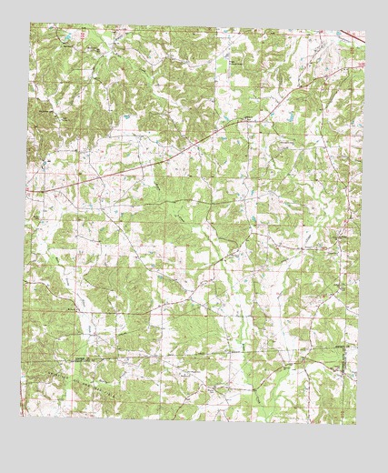
Mendenhall SE, MS USGS Topographic Map
Click on map above to begin viewing in our Map Viewer.

This topographic map contains these locations and features:
Feature Name Type Latitude Longitude GNIS ID View Map
Beaver BranchStreamN31.8685°W89.8470°666695View Map
Bowie School (historical)SchoolN31.8188°W89.8006°685114View Map
Cole CemeteryCemeteryN31.7535°W89.8134°691303View Map
Corinth CemeteryCemeteryN31.8463°W89.7937°1805883View Map
Corinth ChurchChurchN31.8465°W89.7951°668834View Map
CyclonePopulated PlaceN31.8704°W89.8001°685124View Map
Duncansville (historical)LocaleN31.8024°W89.7529°685126View Map
Good Hope ChurchChurchN31.8096°W89.7584°670470View Map
Graves CemeteryCemeteryN31.7760°W89.7820°691322View Map
Graves CemeteryCemeteryN31.7713°W89.8481°691323View Map
Harrington CemeteryCemeteryN31.8390°W89.7815°670965View Map
Hemby BranchStreamN31.7632°W89.8534°671095View Map
Hemby CemeteryCemeteryN31.7571°W89.8426°691305View Map
Hemby School (historical)SchoolN31.7685°W89.8406°689741View Map
Hen Magee CemeteryCemeteryN31.7657°W89.8137°691566View Map
Hopewell CemeteryCemeteryN31.7690°W89.7778°691302View Map
Hopewell ChurchChurchN31.7682°W89.7776°671416View Map
Hopewell School (historical)SchoolN31.7682°W89.7745°710593View Map
JaynesvillePopulated PlaceN31.7752°W89.7667°685145View Map
Macedonia CemeteryCemeteryN31.7643°W89.8117°691304View Map
Macedonia ChurchChurchN31.7646°W89.8123°673002View Map
Magee CemeteryCemeteryN31.7674°W89.7731°691301View Map
Magee Municipal AirportAirportN31.8652°W89.8016°680327View Map
Malloy CemeteryCemeteryN31.7604°W89.8034°691579View Map
McLaurin CemeteryCemeteryN31.8035°W89.7956°673391View Map
Mount Zion (historical)LocaleN31.7891°W89.7881°685159View Map
Mount Zion Baptist ChurchChurchN31.7843°W89.8551°674343View Map
Mount Zion CemeteryCemeteryN31.7852°W89.8551°1959811View Map
Mount Zion School (historical)SchoolN31.8196°W89.8684°685160View Map
Old Hickory (historical)LocaleN31.8607°W89.7631°685167View Map
Old Saint Peter CemeteryCemeteryN31.8468°W89.8659°675245View Map
Pleasant Grove CemeteryCemeteryN31.8052°W89.7587°1959816View Map
Pleasant Grove ChurchChurchN31.8054°W89.7581°676001View Map
Reed CemeteryCemeteryN31.8679°W89.8592°676561View Map
Rials Creek CemeteryCemeteryN31.8727°W89.8428°1959821View Map
Riles Creek School (historical)SchoolN31.8682°W89.8437°685174View Map
Saint John CemeteryCemeteryN31.7943°W89.7567°1959822View Map
Saint John ChurchChurchN31.7946°W89.7567°677051View Map
Saint Peter ChurchChurchN31.8446°W89.8629°677228View Map
Skiffer CreekStreamN31.7516°W89.7834°677863View Map
Supervisor District 2CivilN31.8169°W89.7907°712066View Map
Walker CemeteryCemeteryN31.8140°W89.8695°679263View Map
Welch CemeteryCemeteryN31.8665°W89.8509°679431View Map
Williamson CemeteryCemeteryN31.7649°W89.8590°691306View Map

Note: Coordinates in the location and feature list above are referenced to NAD83 datum.


Copyright (C) 2008-2025 Ryan Niemi / Sunset Dynamics ... All Rights Reserved