TopoQuest Logo
Do you find TopoQuest useful?
Help keep TopoQuest running and adding new maps/features by donating!
Bitcoin:  19c7KJd3qBynnjoSw5npx9KScwjBe4ifkT
Litecoin:  LXs6TkuXGGXo1vDsWCkWVdjQX94eUKd6ui
Home View Maps Find Maps Find Places Resources & Links


Malden, Missouri Topographic Map

USGS Map Title: Malden, MO
USGS Map MRC: 36089E8
DRG (GeoTIFF) Download: o36089e8.tif


Neighboring USGS Topographic Map Quads:


  Powe, MO  
36090F1
 

  Bernie, MO  
36089F8
 

  Hills Store, MO  
36089F7
 

  Valley Ridge, MO  
36090E1
 

  Malden, MO  
36089E8
 

  Parma, MO  
36089E7
 

  Campbell, MO  
36090D1
 

  Gideon, MO  
36089D8
 

  Boekerton, MO  
36089D7


Map MRC Location:

N37°
W90°
N37°
W89°
H8 H7 H6 H5 H4 H3 H2 H1
G8 G7 G6 G5 G4 G3 G2 G1
F8 F7 F6 F5 F4 F3 F2 F1
E8 E7 E6 E5 E4 E3 E2 E1
D8 D7 D6 D5 D4 D3 D2 D1
C8 C7 C6 C5 C4 C3 C2 C1
B8 B7 B6 B5 B4 B3 B2 B1
A8 A7 A6 A5 A4 A3 A2 A1
N36°
W90°
N36°
W89°

Malden, MO USGS 1:24K Topographic Map Preview:
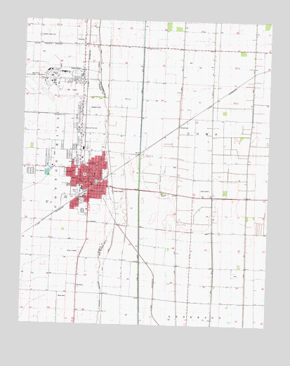
Malden, MO USGS Topographic Map
Click on map above to begin viewing in our Map Viewer.

This topographic map contains these locations and features:
Feature Name Type Latitude Longitude GNIS ID View Map
BaxterPopulated PlaceN36.5109°W89.9318°740078View Map
Bethel Church (historical)ChurchN36.6189°W89.9929°746883View Map
BroadwaterPopulated PlaceN36.5820°W89.9212°740695View Map
Broadwater AirportAirportN36.5837°W89.9203°758799View Map
Broadwater School (historical)SchoolN36.5851°W89.9348°746885View Map
Carver SwitchLocaleN36.5603°W89.9576°730265View Map
City of MaldenCivilN36.5873°W89.9825°2395822View Map
Ditch Number 0CanalN36.6137°W89.9623°755049View Map
Ditch Number 2CanalN36.5092°W89.9398°755072View Map
Ditch Number 3CanalN36.5698°W89.9215°755098View Map
Ditch Number 4CanalN36.5701°W89.9040°755111View Map
Ditch Number 5CanalN36.5367°W89.8856°755121View Map
Five Point (historical)LocaleN36.5256°W89.9362°740457View Map
Full Gospel MissionChurchN36.5539°W89.9295°718288View Map
KMAL-FM (Malden)TowerN36.5523°W89.9784°759052View Map
KTCB-AM (Malden)TowerN36.5523°W89.9756°759261View Map
Liberty School (historical)LocaleN36.6081°W89.9668°742625View Map
Lone Oak Church (historical)ChurchN36.6053°W89.9923°746884View Map
Macedonia CemeteryCemeteryN36.5889°W89.9665°721712View Map
MaldenPopulated PlaceN36.5570°W89.9665°721773View Map
Malden Army Air Field (historical)MilitaryN36.6006°W89.9911°2092792View Map
Malden City HallBuildingN36.5581°W89.9656°743097View Map
Malden Fire Department Station TwoBuildingN36.5566°W89.9584°2621220View Map
Malden High SchoolSchoolN36.5667°W89.9729°743098View Map
Malden Police DepartmentBuildingN36.5574°W89.9650°2752572View Map
Malden Post OfficePost OfficeN36.5590°W89.9709°2783063View Map
Malden Regional AirportAirportN36.5994°W89.9912°758798View Map
Malden Volunteer Fire Department Station 1BuildingN36.5552°W89.9682°2621081View Map
Maple Grove ChurchChurchN36.6137°W89.9326°721820View Map
Maple Grove School (historical)SchoolN36.6134°W89.9379°742626View Map
MelbyPopulated PlaceN36.6053°W89.8787°739602View Map
Memorial Park CemeteryCemeteryN36.5803°W89.9698°722221View Map
New Hope School (historical)LocaleN36.5837°W89.8773°742627View Map
Nordlow (historical)Populated PlaceN36.5970°W89.8954°739601View Map
Old Phillips School (historical)SchoolN36.5395°W89.9231°746887View Map
Park CemeteryCemeteryN36.5556°W89.9718°724014View Map
Phillips (historical)LocaleN36.5851°W89.9684°740455View Map
Pilgrims Rest Church (historical)ChurchN36.5853°W89.9143°746886View Map
Pilgrims Rest School (historical)SchoolN36.5853°W89.9123°730298View Map
ProvidencePopulated PlaceN36.5164°W89.9718°741174View Map
Providence School (historical)SchoolN36.5145°W89.9720°730266View Map
Ruma (historical)LocaleN36.5376°W89.9973°740456View Map
SommersLocaleN36.5409°W89.9679°740454View Map
SpoonervillePopulated PlaceN36.5495°W89.9706°730267View Map
Stevens Chapel CemeteryCemeteryN36.6187°W89.9920°730225View Map
Stubblefield School (historical)SchoolN36.5245°W89.9295°746888View Map
The Lighthouse ChurchChurchN36.5853°W89.9798°727556View Map
TownleyPopulated PlaceN36.6167°W89.9698°727742View Map
Township of Cotton HillCivilN36.5630°W89.9944°766637View Map
TurnerPopulated PlaceN36.5878°W89.9126°739603View Map
West DitchCanalN36.5678°W89.9845°736365View Map

Note: Coordinates in the location and feature list above are referenced to NAD83 datum.


Copyright (C) 2008-2025 Ryan Niemi / Sunset Dynamics ... All Rights Reserved