TopoQuest Logo
Do you find TopoQuest useful?
Help keep TopoQuest running and adding new maps/features by donating!
Bitcoin:  19c7KJd3qBynnjoSw5npx9KScwjBe4ifkT
Litecoin:  LXs6TkuXGGXo1vDsWCkWVdjQX94eUKd6ui
Home View Maps Find Maps Find Places Resources & Links


Hills Store, Missouri Topographic Map

USGS Map Title: Hills Store, MO
USGS Map MRC: 36089F7
DRG (GeoTIFF) Download: o36089f7.tif


Neighboring USGS Topographic Map Quads:


  Dexter, MO  
36089G8
 

  Essex, MO  
36089G7
 

  Morehouse, MO  
36089G6
 

  Bernie, MO  
36089F8
 

  Hills Store, MO  
36089F7
 

  Charter Oak, MO  
36089F6
 

  Malden, MO  
36089E8
 

  Parma, MO  
36089E7
 

  Catron, MO  
36089E6


Map MRC Location:

N37°
W90°
N37°
W89°
H8 H7 H6 H5 H4 H3 H2 H1
G8 G7 G6 G5 G4 G3 G2 G1
F8 F7 F6 F5 F4 F3 F2 F1
E8 E7 E6 E5 E4 E3 E2 E1
D8 D7 D6 D5 D4 D3 D2 D1
C8 C7 C6 C5 C4 C3 C2 C1
B8 B7 B6 B5 B4 B3 B2 B1
A8 A7 A6 A5 A4 A3 A2 A1
N36°
W90°
N36°
W89°

Hills Store, MO USGS 1:24K Topographic Map Preview:
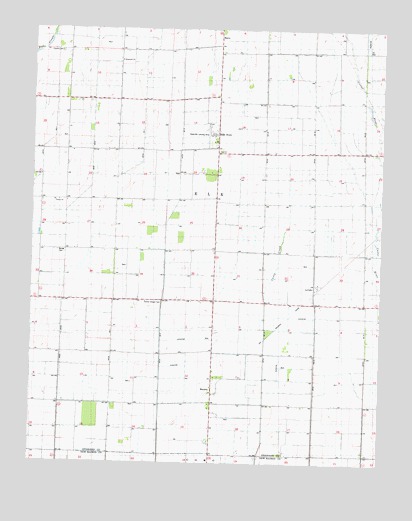
Hills Store, MO USGS Topographic Map
Click on map above to begin viewing in our Map Viewer.

This topographic map contains these locations and features:
Feature Name Type Latitude Longitude GNIS ID View Map
Barker CemeteryCemeteryN36.6862°W89.8656°754117View Map
Boyt Church (historical)ChurchN36.7406°W89.8434°742640View Map
Boyt SchoolSchoolN36.7298°W89.8359°742641View Map
Boyt School (historical)SchoolN36.7409°W89.8448°742639View Map
Bradhams (historical)LocaleN36.6314°W89.8181°740416View Map
Caney CreekStreamN36.6745°W89.7920°735477View Map
Cravins CemeteryCemeteryN36.7437°W89.8651°716471View Map
Ditch Number 41CanalN36.7187°W89.7568°755113View Map
Ditch Number 42CanalN36.7101°W89.7745°755114View Map
Ditch Number 43CanalN36.7051°W89.7920°755115View Map
Ditch Number 8CanalN36.6862°W89.8273°755155View Map
Frisco School (historical)LocaleN36.7428°W89.8615°742638View Map
Hills StorePopulated PlaceN36.7198°W89.8090°719619View Map
Hopewell ChurchChurchN36.7409°W89.8437°719798View Map
Ivester CemeteryCemeteryN36.6484°W89.8387°759463View Map
LaVallePopulated PlaceN36.6753°W89.7737°740998View Map
Main DitchCanalN36.7453°W89.8529°721769View Map
MarcoPopulated PlaceN36.7478°W89.8081°741040View Map
Marco School (historical)LocaleN36.7381°W89.8095°742642View Map
MaulsbyPopulated PlaceN36.6464°W89.8101°741044View Map
Radcliffe Landing Strip (historical)AirportN36.7195°W89.8123°743100View Map
Stones Chapel CemeteryCemeteryN36.6712°W89.8284°727144View Map
Township of ElkCivilN36.6930°W89.8097°767418View Map
Trammel School (historical)SchoolN36.6423°W89.7743°746882View Map
Vinson ChurchChurchN36.7003°W89.8668°730239View Map
Vinson SchoolLocaleN36.7012°W89.8723°742643View Map
Walker School (historical)SchoolN36.6951°W89.8101°746881View Map
West Pryor School (historical)SchoolN36.6420°W89.8293°746880View Map

Note: Coordinates in the location and feature list above are referenced to NAD83 datum.


Copyright (C) 2008-2025 Ryan Niemi / Sunset Dynamics ... All Rights Reserved