TopoQuest Logo
Do you find TopoQuest useful?
Help keep TopoQuest running and adding new maps/features by donating!
Bitcoin:  19c7KJd3qBynnjoSw5npx9KScwjBe4ifkT
Litecoin:  LXs6TkuXGGXo1vDsWCkWVdjQX94eUKd6ui
Home View Maps Find Maps Find Places Resources & Links


Manhead Mountain, Montana Topographic Map

USGS Map Title: Manhead Mountain, MT
USGS Map MRC: 45112F1
DRG (GeoTIFF) Download: o45112f1.tif


Neighboring USGS Topographic Map Quads:


  Vendome, MT  
45112G2
 

  Whitehall, MT  
45112G1
 

  Jefferson Island, MT  
45111G8
 

  Waterloo, MT  
45112F2
 

  Manhead Mountain, MT  
45112F1
 

  Pony, MT  
45111F8
 

  Old Baldy Mountain, MT  
45112E2
 

  Noble Peak, MT  
45112E1
 

  Potosi Peak, MT  
45111E8


Map MRC Location:

N46°
W113°
N46°
W112°
H8 H7 H6 H5 H4 H3 H2 H1
G8 G7 G6 G5 G4 G3 G2 G1
F8 F7 F6 F5 F4 F3 F2 F1
E8 E7 E6 E5 E4 E3 E2 E1
D8 D7 D6 D5 D4 D3 D2 D1
C8 C7 C6 C5 C4 C3 C2 C1
B8 B7 B6 B5 B4 B3 B2 B1
A8 A7 A6 A5 A4 A3 A2 A1
N45°
W113°
N45°
W112°

Manhead Mountain, MT USGS 1:24K Topographic Map Preview:
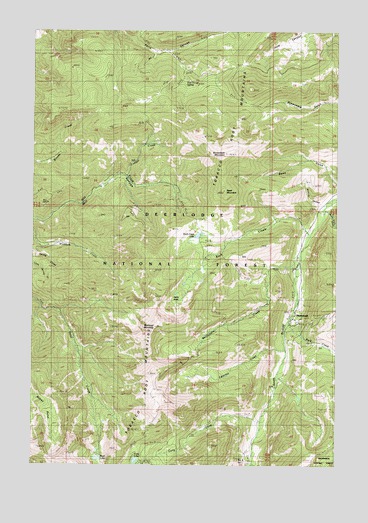
Manhead Mountain, MT USGS Topographic Map
Click on map above to begin viewing in our Map Viewer.

This topographic map contains these locations and features:
Feature Name Type Latitude Longitude GNIS ID View Map
Beall LakeLakeN45.6270°W112.0986°779462View Map
Bear GulchValleyN45.6974°W112.0061°779542View Map
Brooks Creek MineMineN45.7110°W112.1203°804396View Map
Brownback MountainSummitN45.7155°W112.0461°769288View Map
Cataract CreekStreamN45.6594°W112.0211°781051View Map
Coalpit CreekStreamN45.7083°W112.0867°781460View Map
Curly CreekStreamN45.6383°W112.0314°781995View Map
Curly LakeLakeN45.6264°W112.0831°781997View Map
Dead MountainSummitN45.7044°W112.0469°782146View Map
Five Trough SpringSpringN45.7344°W112.0633°793780View Map
Grouse HollowValleyN45.6994°W112.0058°784381View Map
Hells HoleBendN45.6738°W112.0664°784749View Map
MammothPopulated PlaceN45.6696°W112.0167°786807View Map
Mammoth MineMineN45.6666°W112.0119°804127View Map
Mammoth Post Office (historical)Post OfficeN45.6696°W112.0167°1797491View Map
Mammoth School (historical)SchoolN45.6696°W112.0167°1797492View Map
Mammoth TailingsMineN45.6705°W112.0142°804201View Map
Manhead MountainSummitN45.6655°W112.0744°786814View Map
McGovern CreekStreamN45.6858°W112.0155°787061View Map
Park CreekStreamN45.6663°W112.0203°788639View Map
Perry Canyon II MineMineN45.7360°W112.0842°804432View Map
Rock CreekStreamN45.6919°W112.0117°789666View Map
Rock Creek LakeLakeN45.6917°W112.0559°789695View Map
Sams GulchValleyN45.7063°W112.0008°789982View Map

Note: Coordinates in the location and feature list above are referenced to NAD83 datum.


Copyright (C) 2008-2024 Ryan Niemi / Sunset Dynamics ... All Rights Reserved