TopoQuest Logo
Do you find TopoQuest useful?
Help keep TopoQuest running and adding new maps/features by donating!
Bitcoin:  19c7KJd3qBynnjoSw5npx9KScwjBe4ifkT
Litecoin:  LXs6TkuXGGXo1vDsWCkWVdjQX94eUKd6ui
Home View Maps Find Maps Find Places Resources & Links


Waterloo, Montana Topographic Map

USGS Map Title: Waterloo, MT
USGS Map MRC: 45112F2
DRG (GeoTIFF) Download: o45112f2.tif


Neighboring USGS Topographic Map Quads:


  Grace, MT  
45112G3
 

  Vendome, MT  
45112G2
 

  Whitehall, MT  
45112G1
 

  Silver Star, MT  
45112F3
 

  Waterloo, MT  
45112F2
 

  Manhead Mountain, MT  
45112F1
 

  Twin Bridges, MT  
45112E3
 

  Old Baldy Mountain, MT  
45112E2
 

  Noble Peak, MT  
45112E1


Map MRC Location:

N46°
W113°
N46°
W112°
H8 H7 H6 H5 H4 H3 H2 H1
G8 G7 G6 G5 G4 G3 G2 G1
F8 F7 F6 F5 F4 F3 F2 F1
E8 E7 E6 E5 E4 E3 E2 E1
D8 D7 D6 D5 D4 D3 D2 D1
C8 C7 C6 C5 C4 C3 C2 C1
B8 B7 B6 B5 B4 B3 B2 B1
A8 A7 A6 A5 A4 A3 A2 A1
N45°
W113°
N45°
W112°

Waterloo, MT USGS 1:24K Topographic Map Preview:
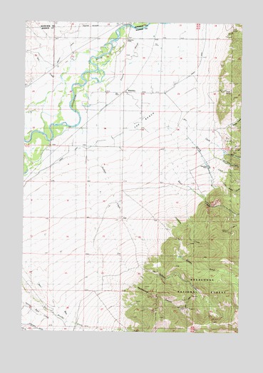
Waterloo, MT USGS Topographic Map
Click on map above to begin viewing in our Map Viewer.

This topographic map contains these locations and features:
Feature Name Type Latitude Longitude GNIS ID View Map
01S05W26ADCC01 WellWellN45.7216°W112.1769°811412View Map
01S05W26DCD_01 WellWellN45.7224°W112.1789°811419View Map
Antimony CreekStreamN45.6788°W112.1650°779084View Map
Beall CreekStreamN45.7069°W112.1747°779461View Map
Brooks CreekStreamN45.7088°W112.1339°780433View Map
Bumby Creek MineMineN45.6652°W112.1647°804390View Map
Bumby GulchValleyN45.6624°W112.1808°780594View Map
Cornforth DitchCanalN45.6266°W112.2444°798853View Map
Duffy DitchCanalN45.6405°W112.2361°782688View Map
Hellroaring CanyonValleyN45.6477°W112.2031°784735View Map
Hulbert CreekStreamN45.6996°W112.2117°785149View Map
Little Cherry CreekStreamN45.7274°W112.2300°786270View Map
Little Spring CreekStreamN45.6908°W112.1380°786369View Map
Loomont (historical)LocaleN45.7410°W112.1772°1797496View Map
Loomont Post Office (historical)Post OfficeN45.7410°W112.1772°1797495View Map
Mill CanyonValleyN45.6963°W112.1255°787348View Map
Mill CreekStreamN45.7185°W112.1736°787369View Map
Mill Creek MineMineN45.6971°W112.1286°804397View Map
Ohio Lode MineMineN45.6349°W112.1564°788394View Map
Ohio MineMineN45.6346°W112.1578°804592View Map
Parrot DitchCanalN45.7333°W112.1497°788661View Map
Parsons BridgeBridgeN45.7491°W112.1903°788664View Map
Parsons SloughStreamN45.7477°W112.1822°788666View Map
River Side RanchLocaleN45.7469°W112.1911°789607View Map
Shaky SpringSpringN45.7227°W112.1348°790270View Map
Shaky Spring MineMineN45.7221°W112.1355°804388View Map
Silver Bow RanchLocaleN45.7441°W112.1917°790499View Map
Spring CreekStreamN45.7152°W112.1789°791261View Map
Strawn MinesMineN45.6658°W112.1317°791598View Map
The BenchBenchN45.7099°W112.1828°792023View Map
Wagon Wheel RanchLocaleN45.7244°W112.2464°792749View Map
WaterlooPopulated PlaceN45.7219°W112.1922°792877View Map
Waterloo (historical)LocaleN45.7219°W112.1922°1797644View Map
Waterloo Post Office (historical)Post OfficeN45.7219°W112.1922°1797645View Map
Waterloo School (historical)SchoolN45.7219°W112.1922°1797643View Map
White Rock RanchLocaleN45.6921°W112.1442°793213View Map
Wickham CreekStreamN45.6977°W112.1369°793564View Map

Note: Coordinates in the location and feature list above are referenced to NAD83 datum.


Copyright (C) 2008-2025 Ryan Niemi / Sunset Dynamics ... All Rights Reserved