TopoQuest Logo
Do you find TopoQuest useful?
Help keep TopoQuest running and adding new maps/features by donating!
Bitcoin:  19c7KJd3qBynnjoSw5npx9KScwjBe4ifkT
Litecoin:  LXs6TkuXGGXo1vDsWCkWVdjQX94eUKd6ui
Home View Maps Find Maps Find Places Resources & Links


Stumpfield Mountain, California Topographic Map

USGS Map Title: Stumpfield Mountain, CA
USGS Map MRC: 37119D7
DRG (GeoTIFF) Download: o37119d7.tif


Neighboring USGS Topographic Map Quads:


  Feliciana Mountain, CA  
37119E8
 

  Buckingham Mountain, CA  
37119E7
 

  Wawona, CA  
37119E6
 

  Mariposa, CA  
37119D8
 

  Stumpfield Mountain, CA  
37119D7
 

  Fish Camp, CA  
37119D6
 

  Ben Hur, CA  
37119C8
 

  Horsecamp Mountain, CA  
37119C7
 

  Ahwahnee, CA  
37119C6


Map MRC Location:

N38°
W120°
N38°
W119°
H8 H7 H6 H5 H4 H3 H2 H1
G8 G7 G6 G5 G4 G3 G2 G1
F8 F7 F6 F5 F4 F3 F2 F1
E8 E7 E6 E5 E4 E3 E2 E1
D8 D7 D6 D5 D4 D3 D2 D1
C8 C7 C6 C5 C4 C3 C2 C1
B8 B7 B6 B5 B4 B3 B2 B1
A8 A7 A6 A5 A4 A3 A2 A1
N37°
W120°
N37°
W119°

Stumpfield Mountain, CA USGS 1:24K Topographic Map Preview:
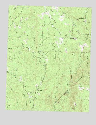
Stumpfield Mountain, CA USGS Topographic Map
Click on map above to begin viewing in our Map Viewer.

This topographic map contains these locations and features:
Feature Name Type Latitude Longitude GNIS ID View Map
Butler MountainSummitN37.3799°W119.8449°233585View Map
Camp Meeting CreekStreamN37.4780°W119.8066°233615View Map
Chowchilla SchoolSchoolN37.4630°W119.7802°221085View Map
Crooks MountainSummitN37.3791°W119.7732°253449View Map
De Long CreekStreamN37.4472°W119.7885°222083View Map
Department of Forestry and Fire Protection Usona Fire StationBuildingN37.4634°W119.7840°2624648View Map
Elliott CornerPopulated PlaceN37.4627°W119.7746°252670View Map
Fox CreekStreamN37.4866°W119.8213°233896View Map
Hillside Baptist ChurchChurchN37.4630°W119.7796°1809310View Map
Indian PeakSummitN37.3927°W119.8127°225891View Map
Indian Peak SchoolSchoolN37.3991°W119.8296°225893View Map
Italian CreekStreamN37.4152°W119.8632°226019View Map
Jones CreekStreamN37.4816°W119.8746°234095View Map
Magoon CreekStreamN37.4866°W119.8213°234224View Map
Magoon HillSummitN37.4933°W119.8371°1659037View Map
Metcalf GapGapN37.4049°W119.7668°228542View Map
Nelson CoveFlatN37.4094°W119.7852°229461View Map
Oliver CreekStreamN37.4227°W119.7765°234411View Map
Paloni MountainSummitN37.4502°W119.7729°1659339View Map
Snow CreekStreamN37.4816°W119.8746°249624View Map
Squaw HillSummitN37.4622°W119.7579°1659850View Map
Stumpfield MountainSummitN37.4383°W119.8043°235625View Map
Usona Fire StationLocaleN37.4638°W119.7843°275604View Map
Wildcat MountainSummitN37.4402°W119.8366°237801View Map

Note: Coordinates in the location and feature list above are referenced to NAD83 datum.


Copyright (C) 2008-2024 Ryan Niemi / Sunset Dynamics ... All Rights Reserved