TopoQuest Logo
Do you find TopoQuest useful?
Help keep TopoQuest running and adding new maps/features by donating!
Bitcoin:  19c7KJd3qBynnjoSw5npx9KScwjBe4ifkT
Litecoin:  LXs6TkuXGGXo1vDsWCkWVdjQX94eUKd6ui
Home View Maps Find Maps Find Places Resources & Links


Marksville North, Louisiana Topographic Map

USGS Map Title: Marksville North, LA
USGS Map MRC: 31092B1
DRG (GeoTIFF) Download: o31092b1.tif


Neighboring USGS Topographic Map Quads:


  Buckeye, LA  
31092C2
 

  Powell Point, LA  
31092C1
 

  Larto Lake South, LA  
31091C8
 

  Effie, LA  
31092B2
 

  Marksville North, LA  
31092B1
 

  Lac Sainte Agnes, LA  
31091B8
 

  Belle d'Eau, LA  
31092A2
 

  Marksville South, LA  
31092A1
 

  Moreauville, LA  
31091A8


Map MRC Location:

N32°
W93°
N32°
W92°
H8 H7 H6 H5 H4 H3 H2 H1
G8 G7 G6 G5 G4 G3 G2 G1
F8 F7 F6 F5 F4 F3 F2 F1
E8 E7 E6 E5 E4 E3 E2 E1
D8 D7 D6 D5 D4 D3 D2 D1
C8 C7 C6 C5 C4 C3 C2 C1
B8 B7 B6 B5 B4 B3 B2 B1
A8 A7 A6 A5 A4 A3 A2 A1
N31°
W93°
N31°
W92°

Marksville North, LA USGS 1:24K Topographic Map Preview:
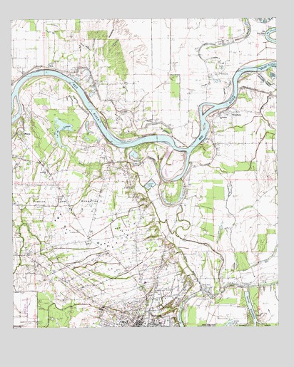
Marksville North, LA USGS Topographic Map
Click on map above to begin viewing in our Map Viewer.

This topographic map contains these locations and features:
Feature Name Type Latitude Longitude GNIS ID View Map
Alert School (historical)SchoolN31.1266°W92.0550°545479View Map
Avoyelles HospitalHospitalN31.1436°W92.0630°545529View Map
Avoyelles Parish CourthouseBuildingN31.1271°W92.0657°545482View Map
Bardin Landing (historical)LocaleN31.1780°W92.0557°557080View Map
Bayou BourbeuxLakeN31.1413°W92.0146°553738View Map
Bayou JohnsonStreamN31.1619°W92.0468°536079View Map
Bayou L'Eau NoireStreamN31.1474°W92.0196°553476View Map
BellevillePopulated PlaceN31.1571°W92.0979°1630187View Map
Bettevy Landing (historical)LocaleN31.1755°W92.0460°545486View Map
Bordelon CemeteryCemeteryN31.1941°W92.0807°545489View Map
BrouillettePopulated PlaceN31.2124°W92.0215°533422View Map
Brouillette Volunteer Fire Department SubstationBuildingN31.2104°W92.0278°2673149View Map
Colonial Nursing HomeBuildingN31.1269°W92.0629°545498View Map
Cushman CemeteryCemeteryN31.1327°W92.0665°545502View Map
DunlapPopulated PlaceN31.2094°W92.0590°545506View Map
Fort De RussyLocaleN31.1752°W92.0612°545514View Map
Fort Derussy CemeteryCemeteryN31.1768°W92.0623°545515View Map
Gardiner Landing (historical)LocaleN31.1938°W92.0310°545517View Map
Heifer Lake (historical)LakeN31.2319°W92.0476°545525View Map
Humana Hospital HeliportAirportN31.1441°W92.0615°1632844View Map
J B Aymons Landing (historical)LocaleN31.2257°W92.0904°545530View Map
Laborde Landing (historical)LocaleN31.2144°W92.0779°545531View Map
Lac Bois SecLakeN31.1645°W92.0246°553745View Map
Lac de JohnsonLakeN31.2057°W92.1021°554890View Map
MarksvillePopulated PlaceN31.1280°W92.0662°1629974View Map
Marksville City HallBuildingN31.1282°W92.0646°545538View Map
Marksville Elementary SchoolSchoolN31.1274°W92.0733°545539View Map
Marksville High SchoolSchoolN31.1273°W92.0715°545540View Map
Marksville Oil FieldOilfieldN31.1663°W92.0737°545542View Map
Marksville Police DepartmentBuildingN31.1281°W92.0650°2755242View Map
Marksville Post OfficePost OfficeN31.1280°W92.0677°1630217View Map
Marksville Public LibraryBuildingN31.1257°W92.0662°545543View Map
Marksville Townsite Oil FieldOilfieldN31.1432°W92.0815°545545View Map
Marksville Volunteer Fire DepartmentBuildingN31.1288°W92.0643°2672857View Map
MonclaPopulated PlaceN31.2044°W92.1190°545549View Map
MontclaPopulated PlaceN31.2030°W92.1196°543483View Map
Norman LandingLocaleN31.2155°W92.0212°545555View Map
Normand Landing (historical)LocaleN31.1941°W92.0723°545556View Map
Old Saint Paul CemeteryCemeteryN31.1863°W92.0668°545561View Map
Parish Governing Authority District 1CivilN31.2396°W92.1247°1929722View Map
Petit Bayou RougeStreamN31.1391°W92.0279°540745View Map
Prairie des AvoyellesFlatN31.1752°W92.1001°553332View Map
Progressive ChurchChurchN31.1882°W92.1098°538413View Map
Red River School (historical)SchoolN31.2121°W92.0246°545568View Map
Saint Genevieve ChurchChurchN31.2105°W92.0273°545572View Map
Saint Leo ChurchChurchN31.2274°W92.0260°538936View Map
Saint Marys Baptist ChurchChurchN31.1605°W92.0915°555920View Map
Saint Marys CemeteryCemeteryN31.1646°W92.0943°538982View Map
Saint Paul ChurchChurchN31.1819°W92.0696°539020View Map
Saline CutoffChannelN31.2307°W92.0043°541915View Map
Saucier LandingLocaleN31.2224°W92.0960°545577View Map
South Vick Oil FieldOilfieldN31.2177°W92.0532°545579View Map
Spring BayouStreamN31.1405°W92.0365°539559View Map
Spring Bayou Golf CourseLocaleN31.1363°W92.0351°545580View Map
Spring Bayou LandingPopulated PlaceN31.1413°W92.0365°543691View Map
VickPopulated PlaceN31.2302°W92.1057°543759View Map
Vick Baptist ChurchChurchN31.2244°W92.0862°556329View Map
Vick Post OfficePost OfficeN31.2302°W92.1032°1630233View Map
Wadill CemeteryCemeteryN31.1288°W92.0846°556339View Map
Ward TwoCivilN31.1452°W92.0687°544911View Map
Wares Landing (historical)LocaleN31.1780°W92.0443°545586View Map

Note: Coordinates in the location and feature list above are referenced to NAD83 datum.


Copyright (C) 2008-2025 Ryan Niemi / Sunset Dynamics ... All Rights Reserved