TopoQuest Logo
Do you find TopoQuest useful?
Help keep TopoQuest running and adding new maps/features by donating!
Bitcoin:  19c7KJd3qBynnjoSw5npx9KScwjBe4ifkT
Litecoin:  LXs6TkuXGGXo1vDsWCkWVdjQX94eUKd6ui
Home View Maps Find Maps Find Places Resources & Links


Marlinton, West Virginia Topographic Map

USGS Map Title: Marlinton, WV
USGS Map MRC: 38080B1
DRG (GeoTIFF) Download: o38080b1.tif


Neighboring USGS Topographic Map Quads:


  Woodrow, WV  
38080C2
 

  Edray, WV  
38080C1
 

  Clover Lick, WV  
38079C8
 

  Hillsboro, WV  
38080B2
 

  Marlinton, WV  
38080B1
 

  Minnehaha Springs, WV  
38079B8
 

  Denmar, WV  
38080A2
 

  Lake Sherwood, WV  
38080A1
 

  Mountain Grove, VA  
38079A8


Map MRC Location:

N39°
W81°
N39°
W80°
H8 H7 H6 H5 H4 H3 H2 H1
G8 G7 G6 G5 G4 G3 G2 G1
F8 F7 F6 F5 F4 F3 F2 F1
E8 E7 E6 E5 E4 E3 E2 E1
D8 D7 D6 D5 D4 D3 D2 D1
C8 C7 C6 C5 C4 C3 C2 C1
B8 B7 B6 B5 B4 B3 B2 B1
A8 A7 A6 A5 A4 A3 A2 A1
N38°
W81°
N38°
W80°

Marlinton, WV USGS 1:24K Topographic Map Preview:
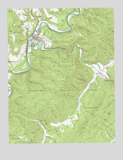
Marlinton, WV USGS Topographic Map
Click on map above to begin viewing in our Map Viewer.

This topographic map contains these locations and features:
Feature Name Type Latitude Longitude GNIS ID View Map
Adam Moore Chalybeate SpringSpringN38.2373°W80.1063°1558056View Map
Airport HillSummitN38.2382°W80.0578°1550082View Map
Alder Lick RunStreamN38.2451°W80.0628°1550083View Map
Allen RunStreamN38.1440°W80.0637°1550095View Map
AugustLocaleN38.2423°W80.0495°1550124View Map
Beard HeightsPopulated PlaceN38.2073°W80.1073°1553819View Map
Beartree RunStreamN38.2440°W80.0234°1550210View Map
Beaver Creek CemeteryCemeteryN38.1329°W80.0692°1550219View Map
Big HillSummitN38.1432°W80.0820°1553893View Map
Big RidgeRidgeN38.2457°W80.0123°1550304View Map
Briery KnobSummitN38.1387°W80.0356°1550464View Map
Browns CreekStreamN38.1987°W80.0212°1550486View Map
Brush Lick RunStreamN38.2432°W80.0520°1550498View Map
Brushy MountainSummitN38.1560°W80.0184°1554010View Map
Buck Run School (historical)SchoolN38.2126°W80.1226°1728014View Map
Buckeye TrailTrailN38.1746°W80.0984°1550533View Map
Buckley MountainSummitN38.1757°W80.0631°1554020View Map
Buckley Mountain TrailTrailN38.1637°W80.0640°1550538View Map
Bucks MountainSummitN38.2290°W80.1184°1554021View Map
CampbelltownPopulated PlaceN38.2418°W80.0906°1554057View Map
Cold SpringSpringN38.1868°W80.0106°1558080View Map
Cold SpringsSpringN38.1467°W80.0869°1550764View Map
Cummings CreekStreamN38.1982°W80.0240°1550859View Map
Cummings Creek ChurchChurchN38.1482°W80.0553°1550860View Map
Cummins Creek School (historical)SchoolN38.1537°W80.0481°1728036View Map
Curry Neil SpringSpringN38.1890°W80.0123°1558083View Map
Devils BackboneRidgeN38.1810°W80.0073°1550911View Map
Double the MountainSummitN38.1568°W80.0256°1554322View Map
First Baptist ChurchChurchN38.1957°W80.0234°1728059View Map
Fort Greenbrier (historical)MilitaryN38.2178°W80.0886°1728062View Map
Fred Moore SpringSpringN38.1829°W80.0081°1558093View Map
Gilden HollowValleyN38.1801°W80.0315°1551229View Map
Green Hill School (historical)SchoolN38.2498°W80.1084°1728073View Map
Griffin RunStreamN38.1640°W80.1170°1551304View Map
Halfway RunStreamN38.2340°W80.0517°1551327View Map
Herald KnobSummitN38.1515°W80.0092°1554687View Map
Holcomb RunStreamN38.1407°W80.0840°1551473View Map
HuntersvillePopulated PlaceN38.1887°W80.0162°1551527View Map
Huntersville Census Designated PlaceCensusN38.1860°W80.0152°2586830View Map
Huntersville Presbyterian ChurchChurchN38.1901°W80.0178°1728086View Map
Huntersville United Methodist ChurchChurchN38.1887°W80.0176°1728088View Map
Indian DraftValleyN38.2401°W80.0865°1550067View Map
Jakes RunStreamN38.1440°W80.0670°1551561View Map
Jericho FlatFlatN38.2354°W80.0970°1728091View Map
John Lee HollowValleyN38.1646°W80.0437°1551588View Map
Kee FlatsFlatN38.1979°W80.1167°1551625View Map
Kee HollowValleyN38.2215°W80.1017°1551626View Map
KnappPopulated PlaceN38.2340°W80.0509°1551662View Map
Knapp CreekStreamN38.2171°W80.1003°1551663View Map
Lewis Lick RunStreamN38.2446°W80.0476°1551781View Map
Lonetree KnobSummitN38.2290°W80.1184°1554989View Map
Marlin MountainSummitN38.2273°W80.0145°1555051View Map
Marlin Mountain TrailTrailN38.2337°W80.0034°1552001View Map
Marlin RunStreamN38.2196°W80.0931°1552002View Map
Marlin Run Structure One DamDamN38.2201°W80.0798°1559222View Map
MarlintonPopulated PlaceN38.2235°W80.0945°1552003View Map
Marlinton City BridgeBridgeN38.2245°W80.0960°2647544View Map
Marlinton District Ranger StationLocaleN38.2157°W80.0798°1553586View Map
Marlinton Elementary SchoolSchoolN38.2208°W80.0936°1728105View Map
Marlinton Middle SchoolSchoolN38.2005°W80.1108°2088259View Map
Marlinton Police DepartmentBuildingN38.2239°W80.0937°2728132View Map
Marlinton Post OfficePost OfficeN38.2215°W80.0933°1728106View Map
Marlinton Presbyterian ChurchChurchN38.2235°W80.0948°1728107View Map
Marlinton Rescue SquadBuildingN38.2239°W80.0936°2581031View Map
Marlinton United Methodist ChurchChurchN38.2210°W80.0920°1728108View Map
Marlinton Volunteer Fire DepartmentBuildingN38.2239°W80.0936°2577730View Map
Mary Sharp RunStreamN38.1321°W80.0817°1552009View Map
McClintic Public LibraryBuildingN38.2209°W80.0924°2727364View Map
Messir CemeteryCemeteryN38.1723°W80.0698°1552055View Map
Middle KnobSummitN38.1440°W80.0317°1555112View Map
Monday Lick RunStreamN38.1926°W80.1012°1552172View Map
Mountain View CemeteryCemeteryN38.2143°W80.0798°1552238View Map
Muddy RunStreamN38.1271°W80.0009°1552257View Map
Newroad RunStreamN38.2435°W80.0326°1552307View Map
North Fork Beaver CreekStreamN38.1454°W80.0915°1552322View Map
Pine RunStreamN38.1632°W80.0409°1552487View Map
Pocahontas Country Club Golf CourseLocaleN38.2049°W80.1123°2634159View Map
Pocahontas County CourthouseBuildingN38.2179°W80.0888°1728142View Map
Pocahontas County JailBuildingN38.2176°W80.0881°1728144View Map
Pocahontas County Sheriff's OfficeBuildingN38.2177°W80.0879°2728131View Map
Pocahontas Memorial HospitalHospitalN38.2009°W80.1090°1728145View Map
Price RunStreamN38.2223°W80.0987°1552560View Map
Ramsey HollowValleyN38.1532°W80.0398°1552584View Map
Saint Johns Episcopal ChurchChurchN38.2212°W80.0928°1728153View Map
Second RunStreamN38.2432°W80.0259°1552824View Map
Sharp RunStreamN38.2423°W80.0951°1552848View Map
Sharp SpringSpringN38.2449°W80.1102°1558150View Map
Shrader HollowValleyN38.1715°W80.0387°1552882View Map
Spice RunStreamN38.2037°W80.1017°1552995View Map
Spring RunStreamN38.2443°W80.0970°1553006View Map
Stillhouse RunStreamN38.2037°W80.1017°1553056View Map
StillwellPopulated PlaceN38.2085°W80.0984°1553058View Map
Stony CreekStreamN38.2368°W80.0845°1553075View Map
Sulfur RunStreamN38.1360°W80.0806°1553138View Map
Sunday Lick RunStreamN38.1951°W80.0992°1553144View Map
Thorny CreekStreamN38.2471°W80.0398°1553224View Map
Town of MarlintonCivilN38.2242°W80.0904°2391287View Map
Trooper Doug W. Bland Memorial BridgeBridgeN38.1825°W80.0058°2647545View Map
Wade HollowValleyN38.1268°W80.0051°1553348View Map
West Virginia Division of Forestry Pocahontas County Field OfficeBuildingN38.2232°W80.0936°2577807View Map
West Virginia State Police Troop 3 - Marlinton DetachmentBuildingN38.2003°W80.1134°2728130View Map

Note: Coordinates in the location and feature list above are referenced to NAD83 datum.


Copyright (C) 2008-2024 Ryan Niemi / Sunset Dynamics ... All Rights Reserved