TopoQuest Logo
Do you find TopoQuest useful?
Help keep TopoQuest running and adding new maps/features by donating!
Bitcoin:  19c7KJd3qBynnjoSw5npx9KScwjBe4ifkT
Litecoin:  LXs6TkuXGGXo1vDsWCkWVdjQX94eUKd6ui
Home View Maps Find Maps Find Places Resources & Links


Hillsboro, West Virginia Topographic Map

USGS Map Title: Hillsboro, WV
USGS Map MRC: 38080B2
DRG (GeoTIFF) Download: o38080b2.tif


Neighboring USGS Topographic Map Quads:


  Webster Springs SE, WV  
38080C3
 

  Woodrow, WV  
38080C2
 

  Edray, WV  
38080C1
 

  Lobelia, WV  
38080B3
 

  Hillsboro, WV  
38080B2
 

  Marlinton, WV  
38080B1
 

  Droop, WV  
38080A3
 

  Denmar, WV  
38080A2
 

  Lake Sherwood, WV  
38080A1


Map MRC Location:

N39°
W81°
N39°
W80°
H8 H7 H6 H5 H4 H3 H2 H1
G8 G7 G6 G5 G4 G3 G2 G1
F8 F7 F6 F5 F4 F3 F2 F1
E8 E7 E6 E5 E4 E3 E2 E1
D8 D7 D6 D5 D4 D3 D2 D1
C8 C7 C6 C5 C4 C3 C2 C1
B8 B7 B6 B5 B4 B3 B2 B1
A8 A7 A6 A5 A4 A3 A2 A1
N38°
W81°
N38°
W80°

Hillsboro, WV USGS 1:24K Topographic Map Preview:
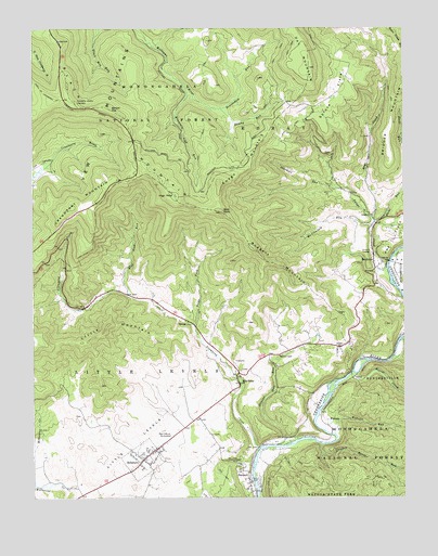
Hillsboro, WV USGS Topographic Map
Click on map above to begin viewing in our Map Viewer.

This topographic map contains these locations and features:
Feature Name Type Latitude Longitude GNIS ID View Map
Advent ChurchChurchN38.1651°W80.1470°1550081View Map
Bald KnobSummitN38.2010°W80.1865°1550156View Map
Barlow TopSummitN38.2287°W80.2237°1553801View Map
Beard SpringSpringN38.1626°W80.1873°1558062View Map
Beaver CreekStreamN38.1579°W80.1428°1550216View Map
Beaverdam RunStreamN38.2287°W80.1862°1550230View Map
Beaverdam School (historical)SchoolN38.2415°W80.1815°1678259View Map
Black MountainSummitN38.2351°W80.2381°1553912View Map
Blue Lick RunStreamN38.1793°W80.2181°1550397View Map
Blue Lick School (historical)SchoolN38.1798°W80.2262°1728004View Map
Blue SpringSpringN38.1612°W80.1873°1558066View Map
Bridger MountainRidgeN38.2240°W80.1295°1550457View Map
BuckeyePopulated PlaceN38.1860°W80.1345°1554019View Map
Buckeye Post OfficePost OfficeN38.1886°W80.1354°1728015View Map
Buckeye School (historical)SchoolN38.1862°W80.1351°1728016View Map
Bucks RunStreamN38.1979°W80.1351°1550540View Map
Cave SpringSpringN38.2062°W80.1428°1558073View Map
Chicken House RunStreamN38.1393°W80.1528°1550702View Map
Cranberry Glades OverlookLocaleN38.2307°W80.2351°1550823View Map
Cranberry MountainRidgeN38.2023°W80.2320°1550824View Map
Downy RunStreamN38.2287°W80.1862°1550950View Map
Dry CreekStreamN38.1987°W80.1351°1550959View Map
Dry Creek School (historical)SchoolN38.2010°W80.1342°1728047View Map
East Buckeye School (historical)SchoolN38.1876°W80.1276°1728053View Map
Grimes School (historical)SchoolN38.1773°W80.1934°1728075View Map
Hefner School (historical)SchoolN38.2082°W80.1523°1728079View Map
High RockSummitN38.2057°W80.2023°1554707View Map
HillsboroPopulated PlaceN38.1354°W80.2131°1551448View Map
Hillsboro Elementary SchoolSchoolN38.1372°W80.2093°1728080View Map
Hillsboro Post OfficePost OfficeN38.1364°W80.2119°1728082View Map
Hillsboro Public LibraryBuildingN38.1373°W80.2084°2727365View Map
Hillsboro Volunteer Fire DepartmentBuildingN38.1358°W80.2120°2577583View Map
Improvement Lick RunStreamN38.1626°W80.1284°1551542View Map
Little LevelsFlatN38.1396°W80.2153°1551870View Map
Little Levels Emergency Ambulance PatrolBuildingN38.1358°W80.2121°2581208View Map
Little MountainSummitN38.1712°W80.2248°1554966View Map
Marvin United Methodist ChurchChurchN38.1626°W80.1670°1552005View Map
McClintock RunStreamN38.1971°W80.1356°1552022View Map
McNeel Mill (historical)LocaleN38.1573°W80.1820°1728111View Map
McNeil Farm SpringSpringN38.1668°W80.1817°1558131View Map
McNeil SpringSpringN38.1612°W80.1859°1558132View Map
Mill PointPopulated PlaceN38.1582°W80.1809°1552112View Map
Mill Point Post OfficePost OfficeN38.1537°W80.1823°1728112View Map
Millstone CreekStreamN38.1273°W80.2381°1552154View Map
Mountain Lick RunStreamN38.2343°W80.1981°1552232View Map
Overholt RunStreamN38.2082°W80.1487°1552401View Map
Pearl S Buck BirthplaceLocaleN38.1418°W80.2040°1552445View Map
Pearl S. Buck Birthplace MuseumBuildingN38.1413°W80.2035°2727833View Map
Pleasant Grove School (historical)SchoolN38.1465°W80.1942°1728138View Map
RaintownPopulated PlaceN38.1773°W80.2303°1728146View Map
Riverside School (historical)SchoolN38.1515°W80.1562°1728151View Map
Rodgers MountainRidgeN38.1871°W80.1676°1552724View Map
Ruckman School (historical)SchoolN38.1637°W80.1645°1728152View Map
SeebertPopulated PlaceN38.1290°W80.1776°1555589View Map
Seebert United Methodist ChurchChurchN38.1273°W80.1781°1728157View Map
Spruce FlatsFlatN38.2321°W80.1473°1553013View Map
Spruce Flats School (historical)SchoolN38.2335°W80.1470°1728162View Map
Stamping CreekStreamN38.1379°W80.1742°1553042View Map
Stevens Hole RunStreamN38.1390°W80.1681°1553052View Map
Swago ChurchChurchN38.2001°W80.1356°1553149View Map
Swago CreekStreamN38.1862°W80.1309°1553150View Map
Swago MountainRidgeN38.2126°W80.1778°1553151View Map
Thomas C. Edgar Memorial BridgeBridgeN38.1269°W80.1745°2647543View Map
Tilda ForkStreamN38.1710°W80.1959°1553237View Map
Town of HillsboroCivilN38.1353°W80.2135°2390248View Map
Trinity Church (historical)ChurchN38.1710°W80.1953°1728183View Map
VioletPopulated PlaceN38.1571°W80.1420°1555894View Map
WatogaPopulated PlaceN38.1457°W80.1512°1555926View Map
Webster RunStreamN38.1418°W80.1484°1553397View Map

Note: Coordinates in the location and feature list above are referenced to NAD83 datum.


Copyright (C) 2008-2024 Ryan Niemi / Sunset Dynamics ... All Rights Reserved