TopoQuest Logo
Do you find TopoQuest useful?
Help keep TopoQuest running and adding new maps/features by donating!
Bitcoin:  19c7KJd3qBynnjoSw5npx9KScwjBe4ifkT
Litecoin:  LXs6TkuXGGXo1vDsWCkWVdjQX94eUKd6ui
Home View Maps Find Maps Find Places Resources & Links


Marquette, Wisconsin Topographic Map

USGS Map Title: Marquette, WI
USGS Map MRC: 43089F2
DRG (GeoTIFF) Download: o43089f2.tif


Neighboring USGS Topographic Map Quads:


  Montello, WI  
43089G3
 

  Princeton West, WI  
43089G2
 

  Princeton East, WI  
43089G1
 

  Observatory Hill, WI  
43089F3
 

  Marquette, WI  
43089F2
 

  Manchester, WI  
43089F1
 

  Pardeeville, WI  
43089E3
 

  Sand Spring Creek, WI  
43089E2
 

  Randolph, WI  
43089E1


Map MRC Location:

N44°
W90°
N44°
W89°
H8 H7 H6 H5 H4 H3 H2 H1
G8 G7 G6 G5 G4 G3 G2 G1
F8 F7 F6 F5 F4 F3 F2 F1
E8 E7 E6 E5 E4 E3 E2 E1
D8 D7 D6 D5 D4 D3 D2 D1
C8 C7 C6 C5 C4 C3 C2 C1
B8 B7 B6 B5 B4 B3 B2 B1
A8 A7 A6 A5 A4 A3 A2 A1
N43°
W90°
N43°
W89°

Marquette, WI USGS 1:24K Topographic Map Preview:
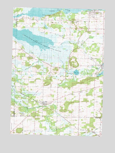
Marquette, WI USGS Topographic Map
Click on map above to begin viewing in our Map Viewer.

This topographic map contains these locations and features:
Feature Name Type Latitude Longitude GNIS ID View Map
Belle Fountain SchoolSchoolN43.6425°W89.2279°1561531View Map
Belle Fountain SpringSpringN43.6449°W89.2322°1843710View Map
DaltonPopulated PlaceN43.6569°W89.2065°1563680View Map
Dalton Census Designated PlaceCensusN43.6562°W89.2068°2586471View Map
Dalton Volunteer Fire DepartmentBuildingN43.6570°W89.2061°2698150View Map
Dartt CemeteryCemeteryN43.7011°W89.1412°1843725View Map
Engle SchoolSchoolN43.6253°W89.1473°1564657View Map
Fountain Creek Wet Prairie State Natural AreaParkN43.6978°W89.2048°2057272View Map
Grand Lake 102ReservoirN43.6966°W89.1268°1791923View Map
Grand River Marsh State Public Hunting GroundsParkN43.7139°W89.2096°1843737View Map
Grand View CemeteryCemeteryN43.7422°W89.1387°1843738View Map
Grays RocksSummitN43.7269°W89.1459°1843739View Map
Greenwood CemeteryCemeteryN43.6661°W89.1684°1565864View Map
Hickory PointCapeN43.7491°W89.1801°1843749View Map
KingstonPopulated PlaceN43.6955°W89.1276°1567512View Map
Kingston 1850c189 DamDamN43.6966°W89.1268°1791922View Map
Kingston Volunteer Fire DepartmentBuildingN43.6931°W89.1281°2697779View Map
MarquettePopulated PlaceN43.7475°W89.1387°1569063View Map
Marquette Volunteer Fire DepartmentBuildingN43.7481°W89.1406°2697741View Map
Pleasant Hill CemeteryCemeteryN43.6261°W89.1279°1843001View Map
Rock HillSummitN43.7369°W89.1676°1802837View Map
Rock Hill CemeteryCemeteryN43.6683°W89.1562°1843772View Map
Rock Hill SchoolSchoolN43.6691°W89.1562°1572448View Map
Rocky Ridge SchoolSchoolN43.6667°W89.1367°2716559View Map
Salem ChurchChurchN43.6728°W89.1873°1573621View Map
Spring LakeLakeN43.6874°W89.1620°1574662View Map
Spring Lake County ParkParkN43.6861°W89.1654°1843815View Map
Town of KingstonCivilN43.6799°W89.1866°1583484View Map
Village of KingstonCivilN43.6935°W89.1304°1583483View Map
Village of MarquetteCivilN43.7464°W89.1383°1583660View Map
Zacharias IslandIslandN43.7461°W89.2479°1837631View Map

Note: Coordinates in the location and feature list above are referenced to NAD83 datum.


Copyright (C) 2008-2024 Ryan Niemi / Sunset Dynamics ... All Rights Reserved