TopoQuest Logo
Do you find TopoQuest useful?
Help keep TopoQuest running and adding new maps/features by donating!
Bitcoin:  19c7KJd3qBynnjoSw5npx9KScwjBe4ifkT
Litecoin:  LXs6TkuXGGXo1vDsWCkWVdjQX94eUKd6ui
Home View Maps Find Maps Find Places Resources & Links


Randolph, Wisconsin Topographic Map

USGS Map Title: Randolph, WI
USGS Map MRC: 43089E1
DRG (GeoTIFF) Download: o43089e1.tif


Neighboring USGS Topographic Map Quads:


  Marquette, WI  
43089F2
 

  Manchester, WI  
43089F1
 

  Markesan, WI  
43088F8
 

  Sand Spring Creek, WI  
43089E2
 

  Randolph, WI  
43089E1
 

  Fox Lake, WI  
43088E8
 

  Rio, WI  
43089D2
 

  Fall River, WI  
43089D1
 

  Lost Lake, WI  
43088D8


Map MRC Location:

N44°
W90°
N44°
W89°
H8 H7 H6 H5 H4 H3 H2 H1
G8 G7 G6 G5 G4 G3 G2 G1
F8 F7 F6 F5 F4 F3 F2 F1
E8 E7 E6 E5 E4 E3 E2 E1
D8 D7 D6 D5 D4 D3 D2 D1
C8 C7 C6 C5 C4 C3 C2 C1
B8 B7 B6 B5 B4 B3 B2 B1
A8 A7 A6 A5 A4 A3 A2 A1
N43°
W90°
N43°
W89°

Randolph, WI USGS 1:24K Topographic Map Preview:
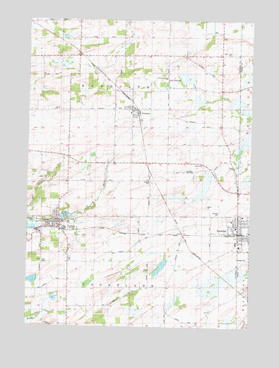
Randolph, WI USGS Topographic Map
Click on map above to begin viewing in our Map Viewer.

This topographic map contains these locations and features:
Feature Name Type Latitude Longitude GNIS ID View Map
Alsum FarmsLocaleN43.6075°W89.0494°2705133View Map
Bethany Presbyterian ChurchChurchN43.5414°W89.0073°1842933View Map
Blaen Y Cae CemeteryCemeteryN43.6116°W89.0120°1561906View Map
CambriaPopulated PlaceN43.5422°W89.1073°1562559View Map
Cambria CemeteryCemeteryN43.5272°W89.1009°1562560View Map
Cambria Friesland Elementary SchoolSchoolN43.5425°W89.1019°2716826View Map
Cambria Friesland Middle / High SchoolSchoolN43.5425°W89.1019°1842938View Map
Cambria Police DepartmentBuildingN43.5434°W89.1085°2759686View Map
Cambria Volunteer Fire Department / Cambria Village Ambulance ServiceBuildingN43.5430°W89.1103°2697940View Map
Cambria WP53 DamDamN43.5450°W89.1084°1791726View Map
Diamond S DairyLocaleN43.5261°W89.0211°2705132View Map
East FrieslandPopulated PlaceN43.6008°W89.0471°1842954View Map
Faith Christian SchoolSchoolN43.5452°W89.0021°2716639View Map
First Methodist ChurchChurchN43.5397°W89.0073°1842960View Map
First Presbyterian ChurchChurchN43.5425°W89.1090°1842963View Map
First Reformed ChurchChurchN43.5344°W89.0065°1850715View Map
Friedens Evangelical Lutheran ChurchChurchN43.5350°W89.0046°1850725View Map
FrieslandPopulated PlaceN43.5886°W89.0673°1565337View Map
Friesland Fire DepartmentBuildingN43.5879°W89.0675°2698151View Map
Friesland Post OfficePost OfficeN43.5872°W89.0678°2723979View Map
Hutchinson Memorial LibraryBuildingN43.5397°W89.0068°1850741View Map
Penrhos SchoolSchoolN43.5186°W89.1023°1571182View Map
RandolphPopulated PlaceN43.5392°W89.0068°1572065View Map
Randolph CemeteryCemeteryN43.5466°W89.0162°1843010View Map
Randolph Center CemeteryCemeteryN43.5869°W89.0662°1955179View Map
Randolph Christian SchoolSchoolN43.6014°W89.0479°1843011View Map
Randolph Christian SchoolSchoolN43.5433°W89.0104°2716349View Map
Randolph ChurchChurchN43.6011°W89.0471°1572066View Map
Randolph Elementary / Middle SchoolSchoolN43.5408°W89.0082°1843012View Map
Randolph Fire Department / Randolph Ambulance AssociationBuildingN43.5379°W89.0088°2697988View Map
Randolph Police DepartmentBuildingN43.5379°W89.0087°2759704View Map
Randolph Post OfficePost OfficeN43.5383°W89.0073°1843013View Map
Randolph Protestant Reformed ChurchChurchN43.5442°W89.0034°1850804View Map
Randolph Village HallBuildingN43.5380°W89.0087°1843014View Map
Randolph Wastewater Treatment FacilityLocaleN43.5272°W89.0036°2723972View Map
Retzlaff FarmLocaleN43.5697°W89.0136°2705134View Map
Second Christian ChurchChurchN43.5414°W89.0032°1850855View Map
Stone SchoolSchoolN43.6100°W89.0973°1574932View Map
Tarrant LakeLakeN43.5452°W89.1040°1575261View Map
Town of CourtlandCivilN43.5003°W89.0661°1583022View Map
Town of RandolphCivilN43.5631°W89.0673°1583996View Map
Village of CambriaCivilN43.5416°W89.1109°1582908View Map
Village of FrieslandCivilN43.5886°W89.0669°1583250View Map
Village of RandolphCivilN43.5396°W89.0028°1583995View Map
Zion Lutheran ChurchChurchN43.5422°W89.1104°1843060View Map

Note: Coordinates in the location and feature list above are referenced to NAD83 datum.


Copyright (C) 2008-2024 Ryan Niemi / Sunset Dynamics ... All Rights Reserved