TopoQuest Logo
Do you find TopoQuest useful?
Help keep TopoQuest running and adding new maps/features by donating!
Bitcoin:  19c7KJd3qBynnjoSw5npx9KScwjBe4ifkT
Litecoin:  LXs6TkuXGGXo1vDsWCkWVdjQX94eUKd6ui
Home View Maps Find Maps Find Places Resources & Links


Marshall NW, Texas Topographic Map

USGS Map Title: Marshall NW, TX
USGS Map MRC: 32094F4
DRG (GeoTIFF) Download: o32094f4.tif


Neighboring USGS Topographic Map Quads:


  Lassater, TX  
32094G5
 

  Kellyville, TX  
32094G4
 

  Jefferson, TX  
32094G3
 

  Harleton, TX  
32094F5
 

  Marshall NW, TX  
32094F4
 

  Woodlawn, TX  
32094F3
 

  Hallsville, TX  
32094E5
 

  Marshall West, TX  
32094E4
 

  Marshall East, TX  
32094E3


Map MRC Location:

N33°
W95°
N33°
W94°
H8 H7 H6 H5 H4 H3 H2 H1
G8 G7 G6 G5 G4 G3 G2 G1
F8 F7 F6 F5 F4 F3 F2 F1
E8 E7 E6 E5 E4 E3 E2 E1
D8 D7 D6 D5 D4 D3 D2 D1
C8 C7 C6 C5 C4 C3 C2 C1
B8 B7 B6 B5 B4 B3 B2 B1
A8 A7 A6 A5 A4 A3 A2 A1
N32°
W95°
N32°
W94°

Marshall NW, TX USGS 1:24K Topographic Map Preview:
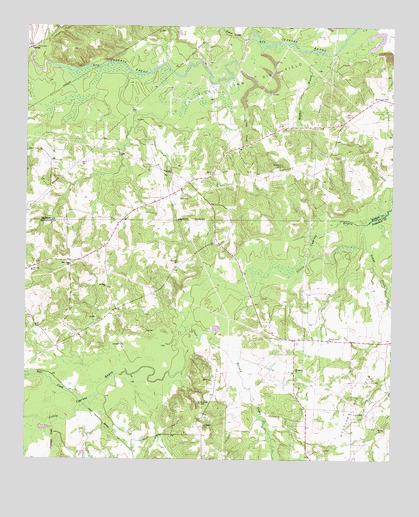
Marshall NW, TX USGS Topographic Map
Click on map above to begin viewing in our Map Viewer.

This topographic map contains these locations and features:
Feature Name Type Latitude Longitude GNIS ID View Map
Bear CreekStreamN32.6418°W94.4794°1330223View Map
Brantly CemeteryCemeteryN32.7215°W94.4135°1331199View Map
Evergreen ChurchChurchN32.6510°W94.4080°1335585View Map
French CreekStreamN32.7457°W94.4252°1336196View Map
Friendly SchoolSchoolN32.6793°W94.4980°1336219View Map
Goodwill ChurchChurchN32.6821°W94.4480°1336719View Map
Grays CreekStreamN32.6935°W94.3835°1336890View Map
Hickory Grove ChurchChurchN32.6599°W94.3969°1337679View Map
Lawrence CreekStreamN32.6349°W94.4908°1339740View Map
Little CreekStreamN32.7393°W94.4277°1340065View Map
Maddox BranchStreamN32.7426°W94.3983°1340821View Map
Meadows CemeteryCemeteryN32.7101°W94.4127°1341304View Map
Mount Pleasant ChurchChurchN32.7296°W94.3771°1342105View Map
New Hope ChurchChurchN32.6813°W94.4846°1342476View Map
New Zion ChurchChurchN32.7076°W94.4499°1342555View Map
Rainey CreekStreamN32.6626°W94.4449°1344715View Map
Saint James CemeteryCemeteryN32.6415°W94.4399°1345908View Map
Saint James ChurchChurchN32.6349°W94.4391°1345914View Map
Saint Mark ChurchChurchN32.6751°W94.4724°1346005View Map
Vickie Lynn Oil FieldOilfieldN32.7338°W94.4205°1349263View Map

Note: Coordinates in the location and feature list above are referenced to NAD83 datum.


Copyright (C) 2008-2025 Ryan Niemi / Sunset Dynamics ... All Rights Reserved