TopoQuest Logo
Do you find TopoQuest useful?
Help keep TopoQuest running and adding new maps/features by donating!
Bitcoin:  19c7KJd3qBynnjoSw5npx9KScwjBe4ifkT
Litecoin:  LXs6TkuXGGXo1vDsWCkWVdjQX94eUKd6ui
Home View Maps Find Maps Find Places Resources & Links


Hallsville, Texas Topographic Map

USGS Map Title: Hallsville, TX
USGS Map MRC: 32094E5
DRG (GeoTIFF) Download: o32094e5.tif


Neighboring USGS Topographic Map Quads:


  Ashland, TX  
32094F6
 

  Harleton, TX  
32094F5
 

  Marshall NW, TX  
32094F4
 

  Longview Heights, TX  
32094E6
 

  Hallsville, TX  
32094E5
 

  Marshall West, TX  
32094E4
 

  Lakeport, TX  
32094D6
 

  Easton, TX  
32094D5
 

  Darco, TX  
32094D4


Map MRC Location:

N33°
W95°
N33°
W94°
H8 H7 H6 H5 H4 H3 H2 H1
G8 G7 G6 G5 G4 G3 G2 G1
F8 F7 F6 F5 F4 F3 F2 F1
E8 E7 E6 E5 E4 E3 E2 E1
D8 D7 D6 D5 D4 D3 D2 D1
C8 C7 C6 C5 C4 C3 C2 C1
B8 B7 B6 B5 B4 B3 B2 B1
A8 A7 A6 A5 A4 A3 A2 A1
N32°
W95°
N32°
W94°

Hallsville, TX USGS 1:24K Topographic Map Preview:
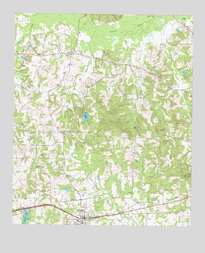
Hallsville, TX USGS Topographic Map
Click on map above to begin viewing in our Map Viewer.

This topographic map contains these locations and features:
Feature Name Type Latitude Longitude GNIS ID View Map
Athens ChurchChurchN32.5774°W94.5483°1329817View Map
Barnes DamDamN32.5901°W94.5069°1861303View Map
Big Rock DamDamN32.5668°W94.5752°1861295View Map
Big Rock LakeReservoirN32.5668°W94.5763°1330635View Map
Bucksville ChurchChurchN32.5365°W94.5241°1331521View Map
Caney CreekStreamN32.6238°W94.5202°1332091View Map
CartervillePopulated PlaceN32.6013°W94.5860°1378095View Map
City of HallsvilleCivilN32.5027°W94.5701°2410689View Map
Evergreen ChurchChurchN32.5754°W94.6005°1335584View Map
Frances LakeReservoirN32.5901°W94.5069°1861304View Map
Friendship (historical)Populated PlaceN32.5793°W94.6005°2585687View Map
Friendship CemeteryCemeteryN32.5872°W94.5877°2575698View Map
Gum CreekStreamN32.6149°W94.5471°1337117View Map
HallsvillePopulated PlaceN32.5043°W94.5741°1373984View Map
Hallsville City HallBuildingN32.5042°W94.5748°2753208View Map
Hallsville Police DepartmentBuildingN32.5042°W94.5748°2751247View Map
Hallsville Post OfficePost OfficeN32.5045°W94.5716°2731873View Map
Hallsville Volunteer Fire DepartmentBuildingN32.5050°W94.5739°2655222View Map
Harrison County Constable's Office Precinct 3BuildingN32.5045°W94.5763°2751449View Map
Highway LakeReservoirN32.5015°W94.6180°1337766View Map
Highway Lake AReservoirN32.5078°W94.6160°1861298View Map
Highway Lake BReservoirN32.5052°W94.6148°1861300View Map
Highway Lake CReservoirN32.5017°W94.6165°1861302View Map
Highway Lake Dam ADamN32.5068°W94.6152°1861297View Map
Highway Lake Dam BDamN32.5035°W94.6152°1861299View Map
Highway Lake Dam CDamN32.5018°W94.6169°1861301View Map
Holiness ChurchChurchN32.5321°W94.5899°1337942View Map
Hynson SpringsSpringN32.5585°W94.5919°2025141View Map
KeokukLocaleN32.5110°W94.5019°1378523View Map
Lick CreekStreamN32.6238°W94.5277°1339900View Map
Mill PondReservoirN32.5583°W94.5387°1341637View Map
Mission Point ChurchChurchN32.5149°W94.5838°1341748View Map
Morris CemeteryCemeteryN32.5182°W94.5016°1341935View Map
Mount Pleasant CemeteryCemeteryN32.5340°W94.5985°1342098View Map
Mount Pleasant ChurchChurchN32.5204°W94.6088°1342104View Map
Mulberry SpringsPopulated PlaceN32.5996°W94.6063°1378717View Map
NoondayPopulated PlaceN32.5540°W94.5883°1378761View Map
Page CreekStreamN32.6151°W94.5680°1343417View Map
Rock LakeLakeN32.6232°W94.5077°1345398View Map
Springhill CemeteryCemeteryN32.5199°W94.5408°1347759View Map
Walkers MillPopulated PlaceN32.5893°W94.5533°1379225View Map

Note: Coordinates in the location and feature list above are referenced to NAD83 datum.


Copyright (C) 2008-2025 Ryan Niemi / Sunset Dynamics ... All Rights Reserved