TopoQuest Logo
Do you find TopoQuest useful?
Help keep TopoQuest running and adding new maps/features by donating!
Bitcoin:  19c7KJd3qBynnjoSw5npx9KScwjBe4ifkT
Litecoin:  LXs6TkuXGGXo1vDsWCkWVdjQX94eUKd6ui
Home View Maps Find Maps Find Places Resources & Links


Martinsville, Ohio Topographic Map

USGS Map Title: Martinsville, OH
USGS Map MRC: 39083C7
DRG (GeoTIFF) Download: o39083c7.tif


Neighboring USGS Topographic Map Quads:


  Clarksville, OH  
39083D8
 

  Wilmington, OH  
39083D7
 

  Sabina, OH  
39083D6
 

  Blanchester, OH  
39083C8
 

  Martinsville, OH  
39083C7
 

  New Vienna, OH  
39083C6
 

  Fayetteville, OH  
39083B8
 

  Lynchburg, OH  
39083B7
 

  New Market, OH  
39083B6


Map MRC Location:

N40°
W84°
N40°
W83°
H8 H7 H6 H5 H4 H3 H2 H1
G8 G7 G6 G5 G4 G3 G2 G1
F8 F7 F6 F5 F4 F3 F2 F1
E8 E7 E6 E5 E4 E3 E2 E1
D8 D7 D6 D5 D4 D3 D2 D1
C8 C7 C6 C5 C4 C3 C2 C1
B8 B7 B6 B5 B4 B3 B2 B1
A8 A7 A6 A5 A4 A3 A2 A1
N39°
W84°
N39°
W83°

Martinsville, OH USGS 1:24K Topographic Map Preview:
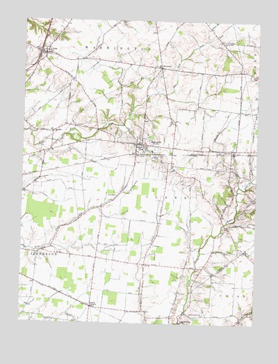
Martinsville, OH USGS Topographic Map
Click on map above to begin viewing in our Map Viewer.

This topographic map contains these locations and features:
Feature Name Type Latitude Longitude GNIS ID View Map
Barnett AirparkAirportN39.3341°W83.8551°1082502View Map
Betterton Farm CemeteryCemeteryN39.3020°W83.7641°1963036View Map
Big OnionLocaleN39.2623°W83.8541°1054204View Map
Clark Township Life SquadBuildingN39.3224°W83.8092°2550801View Map
Cowan Creek CemeteryCemeteryN39.3670°W83.7696°1963043View Map
Cowans Creek ChurchChurchN39.3665°W83.7696°1039416View Map
CubaPopulated PlaceN39.3612°W83.8638°1061011View Map
Cuba Post OfficePost OfficeN39.3612°W83.8638°1966630View Map
FarmersPopulated PlaceN39.3217°W83.7635°1064640View Map
Farmers Station Post Office (historical)Post OfficeN39.3223°W83.7638°1966640View Map
Glady ChurchChurchN39.2740°W83.8091°1040887View Map
Glady School (historical)SchoolN39.2745°W83.8088°1054203View Map
Independent Order of Odd Fellows CemeteryCemeteryN39.3189°W83.8021°1054201View Map
Johnson CemeteryCemeteryN39.3092°W83.7596°1963047View Map
JonesboroPopulated PlaceN39.3020°W83.8252°1062831View Map
Klocks CrossingPopulated PlaceN39.2567°W83.8374°1062840View Map
Lieurance CemeteryCemeteryN39.3747°W83.8232°1042556View Map
Macedonia ChurchChurchN39.3292°W83.8583°1068208View Map
MartinsvillePopulated PlaceN39.3240°W83.8149°1043032View Map
Martinsville CemeteryCemeteryN39.3226°W83.8099°1963051View Map
Martinsville Elementary SchoolSchoolN39.3212°W83.8058°1054202View Map
Martinsville Fire DepartmentBuildingN39.3224°W83.8092°2550121View Map
Martinsville Post OfficePost OfficeN39.3237°W83.8152°1966632View Map
Martinsville Road BridgeBridgeN39.3320°W83.8213°1054200View Map
MorrisvillePopulated PlaceN39.3553°W83.8027°1062905View Map
Pfister FarmLocaleN39.2547°W83.8064°2724752View Map
Township of ClarkCivilN39.2989°W83.8006°1085878View Map
Township of WashingtonCivilN39.3623°W83.8429°1085886View Map
Turner Family CemeteryCemeteryN39.3187°W83.8030°1963060View Map
Village of MartinsvilleCivilN39.3224°W83.8109°2399267View Map
WallopsburgPopulated PlaceN39.3542°W83.7594°1067383View Map
West Chapel CemeteryCemeteryN39.2942°W83.7605°1047745View Map
WSWO-FM (Wilmington)TowerN39.3651°W83.7688°1085423View Map

Note: Coordinates in the location and feature list above are referenced to NAD83 datum.


Copyright (C) 2008-2025 Ryan Niemi / Sunset Dynamics ... All Rights Reserved