TopoQuest Logo
Do you find TopoQuest useful?
Help keep TopoQuest running and adding new maps/features by donating!
Bitcoin:  19c7KJd3qBynnjoSw5npx9KScwjBe4ifkT
Litecoin:  LXs6TkuXGGXo1vDsWCkWVdjQX94eUKd6ui
Home View Maps Find Maps Find Places Resources & Links


New Market, Ohio Topographic Map

USGS Map Title: New Market, OH
USGS Map MRC: 39083B6
DRG (GeoTIFF) Download: o39083b6.tif


Neighboring USGS Topographic Map Quads:


  Martinsville, OH  
39083C7
 

  New Vienna, OH  
39083C6
 

  Leesburg, OH  
39083C5
 

  Lynchburg, OH  
39083B7
 

  New Market, OH  
39083B6
 

  Hillsboro, OH  
39083B5
 

  Sardinia, OH  
39083A7
 

  Sugar Tree Ridge, OH  
39083A6
 

  Belfast, OH  
39083A5


Map MRC Location:

N40°
W84°
N40°
W83°
H8 H7 H6 H5 H4 H3 H2 H1
G8 G7 G6 G5 G4 G3 G2 G1
F8 F7 F6 F5 F4 F3 F2 F1
E8 E7 E6 E5 E4 E3 E2 E1
D8 D7 D6 D5 D4 D3 D2 D1
C8 C7 C6 C5 C4 C3 C2 C1
B8 B7 B6 B5 B4 B3 B2 B1
A8 A7 A6 A5 A4 A3 A2 A1
N39°
W84°
N39°
W83°

New Market, OH USGS 1:24K Topographic Map Preview:
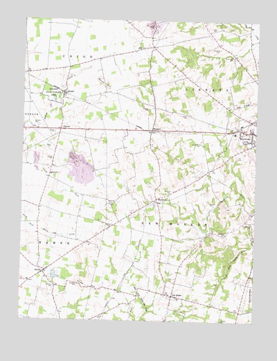
New Market, OH USGS Topographic Map
Click on map above to begin viewing in our Map Viewer.

This topographic map contains these locations and features:
Feature Name Type Latitude Longitude GNIS ID View Map
Ambrose CemeteryCemeteryN39.1781°W83.6710°1037399View Map
Ambrose Chapel (historical)ChurchN39.1776°W83.6705°1058555View Map
Baptist CemeteryCemeteryN39.1345°W83.6655°1806541View Map
Barber FarmLocaleN39.2333°W83.7169°2724619View Map
Barnes CemeteryCemeteryN39.2034°W83.7327°1037637View Map
Branded RanchLocaleN39.1556°W83.6556°2724735View Map
Brick School (historical)SchoolN39.2409°W83.6821°1053152View Map
Brier College School (historical)SchoolN39.1898°W83.7335°1065488View Map
Calebs HillSummitN39.1406°W83.7185°1056233View Map
Chapman CemeteryCemeteryN39.1402°W83.7197°1038996View Map
Chapman CemeteryCemeteryN39.1742°W83.6496°1038997View Map
Chapman School (historical)SchoolN39.1840°W83.6560°1053160View Map
Church of ChristChurchN39.2040°W83.7277°1058558View Map
DanvillePopulated PlaceN39.1448°W83.7380°1064506View Map
Danville Church of ChristChurchN39.1445°W83.7391°1073246View Map
Dobbs Hill FarmLocaleN39.1725°W83.6497°2724633View Map
Duckwall CemeteryCemeteryN39.2131°W83.6835°1039850View Map
Dunn ChapelChurchN39.2390°W83.6871°1061029View Map
Dunns Chapel CemeteryCemeteryN39.2387°W83.6860°1806549View Map
Ervin School (historical)SchoolN39.2240°W83.6580°1053171View Map
FairviewPopulated PlaceN39.2045°W83.7302°1064634View Map
Fenner Number 1 CemeteryCemeteryN39.1987°W83.6549°1080099View Map
Fenner Number 2 CemeteryCemeteryN39.2384°W83.6477°1080100View Map
Fenner Number 3 CemeteryCemeteryN39.2351°W83.6388°1080101View Map
Fraysier FarmsLocaleN39.2308°W83.6817°2724629View Map
Gibler CemeteryCemeteryN39.1970°W83.7349°1040853View Map
Glascock CemeteryCemeteryN39.1614°W83.6408°1040890View Map
Hamer Township CemeteryCemeteryN39.1390°W83.7319°1806552View Map
Harrisburg School (historical)SchoolN39.1290°W83.6330°1053175View Map
Hillsboro Elks Country ClubLocaleN39.1934°W83.6333°1073251View Map
HoaglandPopulated PlaceN39.2042°W83.6813°1064844View Map
Horner HillSummitN39.2231°W83.7066°1056343View Map
Hussey RunStreamN39.2451°W83.6269°1041898View Map
Kansas College School (historical)SchoolN39.1553°W83.6569°1053183View Map
Lucky Lane FarmsLocaleN39.1819°W83.6575°2724681View Map
McKenzie FarmsLocaleN39.2372°W83.7239°2724741View Map
Mount Zion CemeteryCemeteryN39.1648°W83.7013°1043644View Map
New MarketPopulated PlaceN39.1353°W83.6688°1057869View Map
New Market Baptist ChurchChurchN39.1351°W83.6660°1058567View Map
New Market Station (historical)LocaleN39.1376°W83.6983°1053194View Map
Newmarket Post Office (historical)Post OfficeN39.1348°W83.6694°2009713View Map
Old Dutch CemeteryCemeteryN39.1737°W83.7033°1044103View Map
Oldaker ChapelChurchN39.2178°W83.7283°1058568View Map
Oldaker State Wildlife AreaParkN39.2190°W83.7344°1044144View Map
Pea RidgeRidgeN39.2165°W83.6260°1044338View Map
Peace Lutheran ChurchChurchN39.1995°W83.6260°1073257View Map
Persimmon Ridge School (historical)SchoolN39.2465°W83.6519°1053199View Map
Pleasant Hill CemeteryCemeteryN39.1659°W83.6274°1806572View Map
Pleasant Hill School (historical)SchoolN39.1670°W83.6294°1053200View Map
Presbyterian CemeteryCemeteryN39.1381°W83.6716°1806575View Map
RussellPopulated PlaceN39.2195°W83.7285°1065260View Map
Russell Post Office (historical)Post OfficeN39.2195°W83.7291°2013530View Map
Sanders CemeteryCemeteryN39.1253°W83.6419°1045943View Map
ShackletonPopulated PlaceN39.1756°W83.6780°1065304View Map
Shakeltown Post Office (historical)Post OfficeN39.1751°W83.6777°2013531View Map
Smith Acres FarmLocaleN39.2414°W83.6317°2724669View Map
South Fork Dodson CreekStreamN39.2009°W83.7477°1046462View Map
South Liberty ChurchChurchN39.1859°W83.7349°1046482View Map
Spickard CemeteryCemeteryN39.2064°W83.7435°1046528View Map
Spring Hill FarmLocaleN39.1375°W83.7092°2724667View Map
Steele's OrchardLocaleN39.1297°W83.7025°2516122View Map
Steritz FarmsLocaleN39.1875°W83.7364°2724724View Map
Strain CemeteryCemeteryN39.2103°W83.6627°1046759View Map
Strange CemeteryCemeteryN39.1920°W83.7339°1046762View Map
Thomas FarmsLocaleN39.2031°W83.7081°2724617View Map
Township of HamerCivilN39.1537°W83.7424°1086304View Map
Township of New MarketCivilN39.1526°W83.6712°1086309View Map
Walking Spots FarmLocaleN39.1267°W83.6942°2724675View Map
Zink CemeteryCemeteryN39.2465°W83.6499°1048244View Map

Note: Coordinates in the location and feature list above are referenced to NAD83 datum.


Copyright (C) 2008-2025 Ryan Niemi / Sunset Dynamics ... All Rights Reserved