TopoQuest Logo
Do you find TopoQuest useful?
Help keep TopoQuest running and adding new maps/features by donating!
Bitcoin:  19c7KJd3qBynnjoSw5npx9KScwjBe4ifkT
Litecoin:  LXs6TkuXGGXo1vDsWCkWVdjQX94eUKd6ui
Home View Maps Find Maps Find Places Resources & Links


Lynchburg, Ohio Topographic Map

USGS Map Title: Lynchburg, OH
USGS Map MRC: 39083B7
DRG (GeoTIFF) Download: o39083b7.tif


Neighboring USGS Topographic Map Quads:


  Blanchester, OH  
39083C8
 

  Martinsville, OH  
39083C7
 

  New Vienna, OH  
39083C6
 

  Fayetteville, OH  
39083B8
 

  Lynchburg, OH  
39083B7
 

  New Market, OH  
39083B6
 

  Mount Orab, OH  
39083A8
 

  Sardinia, OH  
39083A7
 

  Sugar Tree Ridge, OH  
39083A6


Map MRC Location:

N40°
W84°
N40°
W83°
H8 H7 H6 H5 H4 H3 H2 H1
G8 G7 G6 G5 G4 G3 G2 G1
F8 F7 F6 F5 F4 F3 F2 F1
E8 E7 E6 E5 E4 E3 E2 E1
D8 D7 D6 D5 D4 D3 D2 D1
C8 C7 C6 C5 C4 C3 C2 C1
B8 B7 B6 B5 B4 B3 B2 B1
A8 A7 A6 A5 A4 A3 A2 A1
N39°
W84°
N39°
W83°

Lynchburg, OH USGS 1:24K Topographic Map Preview:
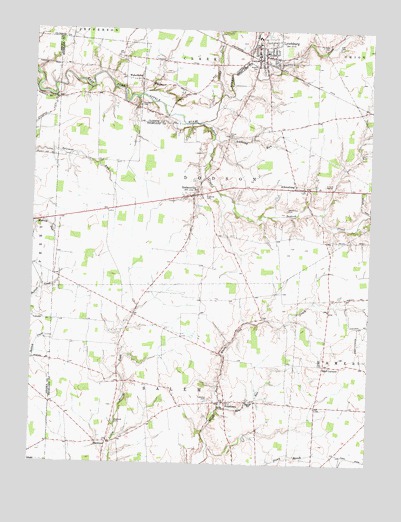
Lynchburg, OH USGS Topographic Map
Click on map above to begin viewing in our Map Viewer.

This topographic map contains these locations and features:
Feature Name Type Latitude Longitude GNIS ID View Map
Adams FarmLocaleN39.2294°W83.8561°2724747View Map
AllensburgPopulated PlaceN39.2045°W83.7771°1085451View Map
Allensburgh Post Office (historical)Post OfficeN39.2042°W83.7777°2005910View Map
Anderson Pike (historical)LocaleN39.2273°W83.7513°1053143View Map
Anthony RunStreamN39.2187°W83.8071°1037436View Map
Barr CemeteryCemeteryN39.1540°W83.7663°1037646View Map
Barr CornersLocaleN39.1537°W83.7658°1037647View Map
Barr RunStreamN39.1423°W83.8041°1037648View Map
Bobbitt CemeteryCemeteryN39.2400°W83.7924°1038163View Map
Brown School (historical)SchoolN39.1590°W83.8530°1053154View Map
Chaney School (historical)SchoolN39.1370°W83.8305°1053159View Map
Dodson CreekStreamN39.2231°W83.8119°1066681View Map
DodsonvillePopulated PlaceN39.2023°W83.8146°1056260View Map
Dodsonville CemeteryCemeteryN39.2034°W83.8155°1806547View Map
Dodsonville Post Office (historical)Post OfficeN39.2028°W83.8152°2009679View Map
Ellis CemeteryCemeteryN39.2453°W83.7621°1040143View Map
Fawley FarmsLocaleN39.2258°W83.7519°2724751View Map
Glady CreekStreamN39.2312°W83.8052°1040885View Map
HarwoodPopulated PlaceN39.1312°W83.8460°1056317View Map
Harwood CemeteryCemeteryN39.1370°W83.8437°1041387View Map
Harwood Methodist ChapelChurchN39.1315°W83.8458°1058563View Map
Henderson CemeteryCemeteryN39.1984°W83.7808°1041481View Map
Honolulu (historical)Populated PlaceN39.1676°W83.8371°1067595View Map
Honolulu Post Office (historical)Post OfficeN39.1667°W83.8374°2009691View Map
Honolulu School (historical)SchoolN39.1687°W83.8360°1053178View Map
Independent Order of Oddfellows CemeteryCemeteryN39.2456°W83.7902°1806559View Map
Laymon School (historical)SchoolN39.2306°W83.8452°1053185View Map
Littleton School (historical)SchoolN39.1670°W83.7910°1053187View Map
Luttleton (historical)Populated PlaceN39.1670°W83.7888°1067596View Map
LynchburgPopulated PlaceN39.2417°W83.7913°1085472View Map
Lynchburg BridgeBridgeN39.2451°W83.7944°1055313View Map
Lynchburg Fire Department and Ambulance DistrictBuildingN39.2319°W83.7895°2549595View Map
Lynchburg Post OfficePost OfficeN39.2417°W83.7916°2009698View Map
Lynchburg Village Police DepartmentBuildingN39.2406°W83.7922°2732748View Map
Lynchburg-Clay Elementary SchoolSchoolN39.2437°W83.7891°1055314View Map
Lynchburg-Clay High SchoolSchoolN39.2481°W83.7921°1055315View Map
Maple Grove School (historical)SchoolN39.2245°W83.7699°1053189View Map
Masonic CemeteryCemeteryN39.2495°W83.7891°1806560View Map
Mullen Hill School (historical)SchoolN39.2337°W83.8213°1053423View Map
Ohio Valley Flower FarmLocaleN39.1564°W83.7672°2724754View Map
PricetownPopulated PlaceN39.1431°W83.8019°1056482View Map
Pricetown Church of ChristChurchN39.1426°W83.8019°1073258View Map
Pricetown Post Office (historical)Post OfficeN39.1431°W83.8019°2013526View Map
Robb School (historical)SchoolN39.1976°W83.8474°1053204View Map
Roosterville School (historical)SchoolN39.1828°W83.8230°1053206View Map
Ruble CemeteryCemeteryN39.1409°W83.8024°1045247View Map
Runk CemeteryCemeteryN39.2461°W83.7679°1045260View Map
Salem SchoolSchoolN39.1426°W83.7921°1045901View Map
Salem Township CemeteryCemeteryN39.1431°W83.8088°1806579View Map
Stahl FarmLocaleN39.1758°W83.8544°2724738View Map
Stroud FarmsLocaleN39.2286°W83.8383°2724749View Map
Stroup CemeteryCemeteryN39.2195°W83.8013°1046775View Map
Stroup School (historical)SchoolN39.2170°W83.8033°1053212View Map
Thompson School (historical)SchoolN39.1895°W83.7916°1053214View Map
Township of DodsonCivilN39.2106°W83.8092°1086302View Map
Township of SalemCivilN39.1477°W83.8217°1086312View Map
Troutwine CemeteryCemeteryN39.2282°W83.8357°1047168View Map
Turtle CreekStreamN39.2406°W83.7944°1047221View Map
Twin Brook FarmLocaleN39.1769°W83.8642°2724753View Map
Village of LynchburgCivilN39.2402°W83.7882°2399207View Map
Walnut School (historical)SchoolN39.1276°W83.7991°1053220View Map
WebertownPopulated PlaceN39.2356°W83.8374°1056564View Map
Webertown Post Office (historical)Post OfficeN39.2362°W83.8374°1966658View Map

Note: Coordinates in the location and feature list above are referenced to NAD83 datum.


Copyright (C) 2008-2025 Ryan Niemi / Sunset Dynamics ... All Rights Reserved