TopoQuest Logo
Do you find TopoQuest useful?
Help keep TopoQuest running and adding new maps/features by donating!
Bitcoin:  19c7KJd3qBynnjoSw5npx9KScwjBe4ifkT
Litecoin:  LXs6TkuXGGXo1vDsWCkWVdjQX94eUKd6ui
Home View Maps Find Maps Find Places Resources & Links


Silerton, Tennessee Topographic Map

USGS Map Title: Silerton, TN
USGS Map MRC: 35088C7
DRG (GeoTIFF) Download: o35088c7.tif


Neighboring USGS Topographic Map Quads:


  Teague, TN  
35088D8
 

  Medon, TN  
35088D7
 

  Henderson, TN  
35088D6
 

  Bolivar East, TN  
35088C8
 

  Silerton, TN  
35088C7
 

  Masseyville, TN  
35088C6
 

  Hebron, TN  
35088B8
 

  Hornsby, TN  
35088B7
 

  Rose Creek, TN  
35088B6


Map MRC Location:

N36°
W89°
N36°
W88°
H8 H7 H6 H5 H4 H3 H2 H1
G8 G7 G6 G5 G4 G3 G2 G1
F8 F7 F6 F5 F4 F3 F2 F1
E8 E7 E6 E5 E4 E3 E2 E1
D8 D7 D6 D5 D4 D3 D2 D1
C8 C7 C6 C5 C4 C3 C2 C1
B8 B7 B6 B5 B4 B3 B2 B1
A8 A7 A6 A5 A4 A3 A2 A1
N35°
W89°
N35°
W88°

Silerton, TN USGS 1:24K Topographic Map Preview:
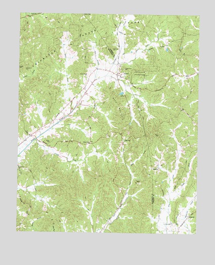
Silerton, TN USGS Topographic Map
Click on map above to begin viewing in our Map Viewer.

This topographic map contains these locations and features:
Feature Name Type Latitude Longitude GNIS ID View Map
Antioch CemeteryCemeteryN35.3648°W88.7970°1316647View Map
Chickasaw Fire TowerBuildingN35.3747°W88.8312°2654265View Map
Chickasaw State ForestForestN35.3501°W88.8667°1319748View Map
Chickasaw State ParkParkN35.3654°W88.8295°1305895View Map
Coopers Chapel CemeteryCemeteryN35.3398°W88.8281°1281223View Map
Gaylor CreekStreamN35.3184°W88.8389°1285263View Map
Greasy CreekStreamN35.3031°W88.8626°1286037View Map
Hickory Grove CemeteryCemeteryN35.3440°W88.8020°1287583View Map
Hickory Grove Church (historical)ChurchN35.3429°W88.8014°1316679View Map
Little Piney CreekStreamN35.3467°W88.8098°1291614View Map
Old Center CemeteryCemeteryN35.3554°W88.8103°1296289View Map
Old Concord CemeteryCemeteryN35.3437°W88.8706°1296293View Map
PalestinePopulated PlaceN35.2876°W88.7773°1315670View Map
Palestine CemeteryCemeteryN35.2620°W88.7914°1319773View Map
Palestine ChurchChurchN35.2790°W88.7912°1296681View Map
Palestine Church (historical)ChurchN35.2904°W88.7776°1316695View Map
Pine TopPopulated PlaceN35.3031°W88.8009°1315715View Map
Piney GrovePopulated PlaceN35.3009°W88.8253°1315721View Map
Piney Grove Baptist ChurchChurchN35.3015°W88.8251°1319774View Map
Right Fork Kise CreekStreamN35.2687°W88.7684°1269896View Map
Ross MountainSummitN35.3162°W88.8042°1300128View Map
SilertonPopulated PlaceN35.3404°W88.8062°1303620View Map
Silerton Baptist ChurchChurchN35.3392°W88.8042°1319781View Map
Silerton School (historical)SchoolN35.3401°W88.8039°1319782View Map
Silerton Volunteer Fire DepartmentBuildingN35.3235°W88.8409°2653774View Map
Sour BranchStreamN35.3370°W88.8231°1270831View Map
Todd SidingLocaleN35.2562°W88.8112°1272717View Map
Town of SilertonCivilN35.3424°W88.8105°2407338View Map
Wesley CemeteryCemeteryN35.3015°W88.8531°1274120View Map
WoodvillePopulated PlaceN35.2598°W88.7553°1314537View Map
Woodville School (historical)SchoolN35.2598°W88.7551°1316712View Map

Note: Coordinates in the location and feature list above are referenced to NAD83 datum.


Copyright (C) 2008-2025 Ryan Niemi / Sunset Dynamics ... All Rights Reserved