TopoQuest Logo
Do you find TopoQuest useful?
Help keep TopoQuest running and adding new maps/features by donating!
Bitcoin:  19c7KJd3qBynnjoSw5npx9KScwjBe4ifkT
Litecoin:  LXs6TkuXGGXo1vDsWCkWVdjQX94eUKd6ui
Home View Maps Find Maps Find Places Resources & Links


Alsup Mountain, Oregon Topographic Map

USGS Map Title: Alsup Mountain, OR
USGS Map MRC: 43119H3
DRG (GeoTIFF) Download: o43119h3.tif


Neighboring USGS Topographic Map Quads:


  Izee, OR  
44119A4
 

  Lewis Creek, OR  
44119A3
 

  Five Hundred Flat, OR  
44119A2
 

  Whiskey Mountain, OR  
43119H4
 

  Alsup Mountain, OR  
43119H3
 

  West Myrtle Butte, OR  
43119H2
 

  Bear Canyon Butte, OR  
43119G4
 

  Hughet Valley, OR  
43119G3
 

  Landing Creek, OR  
43119G2


Map MRC Location:

N44°
W120°
N44°
W119°
H8 H7 H6 H5 H4 H3 H2 H1
G8 G7 G6 G5 G4 G3 G2 G1
F8 F7 F6 F5 F4 F3 F2 F1
E8 E7 E6 E5 E4 E3 E2 E1
D8 D7 D6 D5 D4 D3 D2 D1
C8 C7 C6 C5 C4 C3 C2 C1
B8 B7 B6 B5 B4 B3 B2 B1
A8 A7 A6 A5 A4 A3 A2 A1
N43°
W120°
N43°
W119°

Alsup Mountain, OR USGS 1:24K Topographic Map Preview:
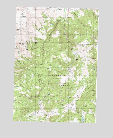
Alsup Mountain, OR USGS Topographic Map
Click on map above to begin viewing in our Map Viewer.

This topographic map contains these locations and features:
Feature Name Type Latitude Longitude GNIS ID View Map
Alsup CreekStreamN43.9996°W119.3011°1137173View Map
Alsup MountainSummitN43.9715°W119.2775°1137174View Map
Alsup SpringSpringN43.9806°W119.2737°1137175View Map
Bear CreekStreamN43.9510°W119.2833°1137680View Map
Bear Tree Guard Station (historical)LocaleN43.9426°W119.2833°1137755View Map
Bear Tree SpringSpringN43.9591°W119.2747°1137756View Map
Brown Ranch (historical)LocaleN43.9885°W119.3625°1138678View Map
Browns ReservoirReservoirN43.9335°W119.3230°1138693View Map
Burnt MountainSummitN43.9563°W119.3569°1138998View Map
Burnt Mountain CreekStreamN43.9476°W119.3680°1139001View Map
Burnt SpringSpringN43.9536°W119.3585°1139010View Map
Buttes RanchLocaleN43.8849°W119.3377°1139073View Map
Carey Ranch (historical)LocaleN43.9743°W119.3666°1139371View Map
Chris Borg SpringSpringN43.9776°W119.2506°1139713View Map
Clemens DamDamN43.8769°W119.2684°1155541View Map
Cougar CreekStreamN43.9546°W119.2663°1140217View Map
Cougar MountainSummitN43.9454°W119.2511°1140238View Map
Crystal ReservoirReservoirN43.9260°W119.3344°1140511View Map
Crystal SpringSpringN43.9192°W119.3351°1140513View Map
Deer SpringSpringN43.9049°W119.2521°1140864View Map
Delles CreekStreamN43.9929°W119.3627°1140878View Map
Delles Creek CampLocaleN43.9596°W119.3455°1140879View Map
Devils Garden SpringSpringN43.9671°W119.2527°1140954View Map
Divide ReservoirReservoirN43.8967°W119.3065°1141069View Map
Donivan CreekStreamN43.9890°W119.3000°1141177View Map
Donivan MountainSummitN43.9738°W119.3388°1141178View Map
Dons SpringSpringN43.9047°W119.3235°1141188View Map
Fall CreekStreamN43.9468°W119.3652°1141967View Map
Forty-five SpringSpringN43.9586°W119.3550°1142328View Map
Four Bar SpringSpringN43.9820°W119.3216°1142352View Map
Hunter Cabin (historical)LocaleN43.8824°W119.3205°1122145View Map
K B SpringSpringN43.8925°W119.2691°1144471View Map
Link SpringSpringN43.9066°W119.2805°1145050View Map
Mud SpringsSpringN43.9561°W119.3739°1158387View Map
Mud Springs CreekStreamN43.9574°W119.3741°1146610View Map
Muddy SpringSpringN43.9401°W119.3706°1146619View Map
Rickman RanchLocaleN43.9988°W119.3258°1148427View Map
Rickman ReservoirReservoirN43.9982°W119.3114°1154200View Map
Rock CreekStreamN43.9368°W119.2897°1148571View Map
Sage Hen FlatFlatN43.8829°W119.2502°1148930View Map
Sawtooth MeadowsFlatN43.9109°W119.3731°1149099View Map
Sawtooth SpringSpringN43.8801°W119.3521°1149107View Map
Scharff Cabin CreekStreamN43.8893°W119.2816°1149119View Map
Siamese SpringSpringN43.8854°W119.3625°1149462View Map
Spring Valley meadowFlatN43.8929°W119.3705°1156185View Map
Sunflower FlatFlatN43.9282°W119.2883°1150662View Map
Turner CabinLocaleN43.8815°W119.2697°1151528View Map
Yellowjacket FieldFlatN43.8943°W119.2863°1116635View Map
Yellowjacket LakeReservoirN43.8790°W119.2691°1154202View Map
Yellowjacket Recreation SiteLocaleN43.8771°W119.2730°1167265View Map
Yellowjacket SpringSpringN43.9016°W119.2916°1152722View Map

Note: Coordinates in the location and feature list above are referenced to NAD83 datum.


Copyright (C) 2008-2024 Ryan Niemi / Sunset Dynamics ... All Rights Reserved