TopoQuest Logo
Do you find TopoQuest useful?
Help keep TopoQuest running and adding new maps/features by donating!
Bitcoin:  19c7KJd3qBynnjoSw5npx9KScwjBe4ifkT
Litecoin:  LXs6TkuXGGXo1vDsWCkWVdjQX94eUKd6ui
Home View Maps Find Maps Find Places Resources & Links


Sturgeon, Kentucky Topographic Map

USGS Map Title: Sturgeon, KY
USGS Map MRC: 37083D7
DRG (GeoTIFF) Download: o37083d7.tif


Neighboring USGS Topographic Map Quads:


  Leighton, KY  
37083E8
 

  Heidelberg, KY  
37083E7
 

  Beattyville, KY  
37083E6
 

  McKee, KY  
37083D8
 

  Sturgeon, KY  
37083D7
 

  Booneville, KY  
37083D6
 

  Tyner, KY  
37083C8
 

  Maulden, KY  
37083C7
 

  Oneida, KY  
37083C6


Map MRC Location:

N38°
W84°
N38°
W83°
H8 H7 H6 H5 H4 H3 H2 H1
G8 G7 G6 G5 G4 G3 G2 G1
F8 F7 F6 F5 F4 F3 F2 F1
E8 E7 E6 E5 E4 E3 E2 E1
D8 D7 D6 D5 D4 D3 D2 D1
C8 C7 C6 C5 C4 C3 C2 C1
B8 B7 B6 B5 B4 B3 B2 B1
A8 A7 A6 A5 A4 A3 A2 A1
N37°
W84°
N37°
W83°

Sturgeon, KY USGS 1:24K Topographic Map Preview:
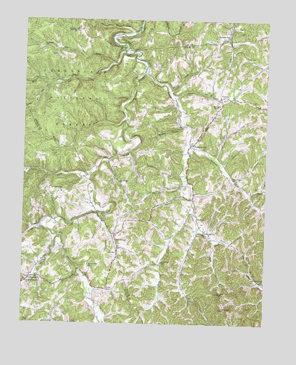
Sturgeon, KY USGS Topographic Map
Click on map above to begin viewing in our Map Viewer.

This topographic map contains these locations and features:
Feature Name Type Latitude Longitude GNIS ID View Map
Beals ForkStreamN37.4209°W83.7874°510438View Map
Bethlehem SchoolSchoolN37.4006°W83.8030°510576View Map
Big Spring Neighborhood (historical)Populated PlaceN37.4330°W83.8257°2416549View Map
Big Springs SchoolSchoolN37.4331°W83.8260°510701View Map
Blackwater CreekStreamN37.4109°W83.8560°510764View Map
Blackwater School (historical)SchoolN37.3945°W83.8675°2505027View Map
Botner CemeteryCemeteryN37.4493°W83.7926°2416553View Map
Botner Post Office (historical)Post OfficeN37.4481°W83.8498°2416352View Map
Bradshaw SchoolSchoolN37.4890°W83.8652°510890View Map
Brewer ForkStreamN37.4081°W83.7763°510903View Map
Brewer Neighborhood (historical)Populated PlaceN37.4285°W83.7873°2416554View Map
Brewer Post Office (historical)Post OfficeN37.4291°W83.7868°2416353View Map
Brushy CreekStreamN37.4590°W83.8221°510972View Map
Calvary ChurchChurchN37.4848°W83.8583°511138View Map
Cannon Chapel (historical)ChurchN37.3969°W83.8462°2505045View Map
Chadwell Post Office (historical)Post OfficeN37.4159°W83.8650°2505028View Map
Crane CreekStreamN37.4706°W83.8002°511621View Map
Dry ForkStreamN37.4826°W83.8296°511928View Map
EarnestvilleLocaleN37.4923°W83.8288°511983View Map
Earnestville Post Office (historical)Post OfficeN37.4870°W83.8244°2416356View Map
EliasPopulated PlaceN37.3895°W83.8310°512025View Map
Elias Post Office (historical)Post OfficeN37.3896°W83.8309°2505077View Map
EndeePopulated PlaceN37.4298°W83.7541°512070View Map
Endee Post Office (historical)Post OfficeN37.4306°W83.7542°2416357View Map
Granny Dismal CreekStreamN37.4959°W83.8160°512365View Map
Grassy CreekStreamN37.4151°W83.8652°512381View Map
Green HallLocaleN37.4043°W83.8263°512436View Map
Green Hall Post Office (historical)Post OfficeN37.4043°W83.8263°2504893View Map
Greenhill Post OfficePost OfficeN37.4068°W83.8256°2416579View Map
Hartsock BranchStreamN37.4568°W83.7921°512580View Map
Hickory Flat (historical)Populated PlaceN37.3984°W83.8408°2504898View Map
Hickory Flat SchoolSchoolN37.3981°W83.8408°512680View Map
High RockParkN37.3842°W83.7544°2416582View Map
Hunters KnobSummitN37.3876°W83.7741°512852View Map
Island Creek KnobSummitN37.3812°W83.7730°512938View Map
John Tyler Brewer CemeteryCemeteryN37.4305°W83.7792°2091378View Map
Leroy SchoolSchoolN37.4851°W83.7605°513342View Map
Little Sturgeon CreekStreamN37.4784°W83.8133°513531View Map
Little Wild Dog CreekStreamN37.4734°W83.8621°513539View Map
Lower Blackwater Baptist ChurchChurchN37.3918°W83.8727°513673View Map
Lynch Post Office (historical)Post OfficeN37.4364°W83.8629°2504922View Map
Mills BranchStreamN37.4112°W83.8299°2504928View Map
Moores SchoolSchoolN37.4748°W83.8066°514049View Map
Moors Neighborhood (historical)Populated PlaceN37.4745°W83.8066°2416592View Map
MummiePopulated PlaceN37.3937°W83.8710°514157View Map
Mummie Post Office (historical)Post OfficeN37.3935°W83.8699°2504931View Map
Needmore Neighborhood (historical)Populated PlaceN37.4687°W83.7736°2416594View Map
Needmore SchoolSchoolN37.4696°W83.7772°2416595View Map
New Hope ChurchChurchN37.4343°W83.7655°514240View Map
Powell Post Office (historical)Post OfficeN37.4366°W83.8500°2504947View Map
Rock Spring Neighborhood (historical)Populated PlaceN37.4090°W83.8264°2416330View Map
Rock Springs ChurchChurchN37.4093°W83.8263°515036View Map
Rowlette BranchStreamN37.4481°W83.7885°515137View Map
Royal Oak ChurchChurchN37.4133°W83.7815°2416333View Map
Royal Oak SchoolSchoolN37.4131°W83.7813°515139View Map
Spruce ForkStreamN37.4676°W83.7971°515621View Map
Standing Rock ChurchChurchN37.4934°W83.7696°515658View Map
SturgeonPopulated PlaceN37.4193°W83.7849°515766View Map
Sturgeon Consolidate SchoolSchoolN37.4091°W83.7709°2416338View Map
Sturgeon DivisionCivilN37.4204°W83.7648°1937278View Map
Sturgeon Post Office (historical)Post OfficeN37.4181°W83.7848°2416369View Map
Travelers Rest Post Office (historical)Post OfficeN37.4487°W83.7874°2416371View Map
Travellers RestPopulated PlaceN37.4484°W83.7871°516018View Map
Travis (historical)Populated PlaceN37.4361°W83.8590°2504976View Map
Travis Church (historical)ChurchN37.4367°W83.8627°2504977View Map
Travis CreekStreamN37.4359°W83.8460°516019View Map
Travis SchoolSchoolN37.4306°W83.8596°516020View Map
VincentPopulated PlaceN37.4684°W83.7738°516184View Map
Vincent Post OfficePost OfficeN37.4688°W83.7738°2416344View Map
Vincent Volunteer Fire DepartmentBuildingN37.4681°W83.7756°2637450View Map
Walnut Grove SchoolSchoolN37.3926°W83.7505°516217View Map
Warren ChapelChurchN37.4651°W83.7741°516233View Map
Warren Chapel BranchStreamN37.4490°W83.7880°516234View Map
Wild Dog CreekStreamN37.4873°W83.8230°516358View Map
Wilfreds ForkStreamN37.3779°W83.8352°516377View Map
Wilson ForkStreamN37.4143°W83.7846°516403View Map
Wolf Pen CreekStreamN37.3886°W83.8398°2504987View Map

Note: Coordinates in the location and feature list above are referenced to NAD83 datum.


Copyright (C) 2008-2025 Ryan Niemi / Sunset Dynamics ... All Rights Reserved