TopoQuest Logo
Do you find TopoQuest useful?
Help keep TopoQuest running and adding new maps/features by donating!
Bitcoin:  19c7KJd3qBynnjoSw5npx9KScwjBe4ifkT
Litecoin:  LXs6TkuXGGXo1vDsWCkWVdjQX94eUKd6ui
Home View Maps Find Maps Find Places Resources & Links


Maxwelton, Washington Topographic Map

USGS Map Title: Maxwelton, WA
USGS Map MRC: 47122H4
DRG (GeoTIFF) Download: o47122h4.tif


Neighboring USGS Topographic Map Quads:


  Freeland, WA  
48122A5
 

  Langley, WA  
48122A4
 

  Tulalip, WA  
48122A3
 

  Hansville, WA  
47122H5
 

  Maxwelton, WA  
47122H4
 

  Mukilteo, WA  
47122H3
 

  Port Gamble, WA  
47122G5
 

  Edmonds West, WA  
47122G4
 

  Edmonds East, WA  
47122G3


Map MRC Location:

N48°
W123°
N48°
W122°
H8 H7 H6 H5 H4 H3 H2 H1
G8 G7 G6 G5 G4 G3 G2 G1
F8 F7 F6 F5 F4 F3 F2 F1
E8 E7 E6 E5 E4 E3 E2 E1
D8 D7 D6 D5 D4 D3 D2 D1
C8 C7 C6 C5 C4 C3 C2 C1
B8 B7 B6 B5 B4 B3 B2 B1
A8 A7 A6 A5 A4 A3 A2 A1
N47°
W123°
N47°
W122°

Maxwelton, WA USGS 1:24K Topographic Map Preview:
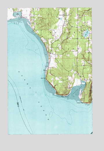
Maxwelton, WA USGS Topographic Map
Click on map above to begin viewing in our Map Viewer.

This topographic map contains these locations and features:
Feature Name Type Latitude Longitude GNIS ID View Map
Calvary ChapelChurchN47.9573°W122.4083°2608452View Map
Cultus BayBayN47.9166°W122.3994°1504297View Map
Dave Mackie County ParkParkN47.9418°W122.4413°1504328View Map
Deer LagoonBayN47.9934°W122.4894°1504415View Map
Deer LakeLakeN47.9742°W122.3840°1504417View Map
Indian PointCapeN47.9301°W122.4454°1505725View Map
Island County Fire Protection District 3 South Whidbey Fire / EMS Bayview Station 36BuildingN47.9986°W122.4568°2619501View Map
Island County Fire Protection District 3 South Whidbey Fire / EMS Maxwelton Station 33BuildingN47.9536°W122.4302°2643618View Map
Ken's Korner Shopping PlazaLocaleN47.9913°W122.3944°2605780View Map
MaxweltonPopulated PlaceN47.9373°W122.4443°1512437View Map
Midvale CornerPopulated PlaceN47.9926°W122.4176°1511151View Map
Miller LakeLakeN47.9888°W122.4215°1506706View Map
PossessionPopulated PlaceN47.9176°W122.3762°1512581View Map
Possession PointCapeN47.9059°W122.3887°1507595View Map
Sandy Hook Yacht Club EstatesLocaleN47.9152°W122.3928°2610254View Map
Scatchet HeadCliffN47.9129°W122.4190°1508140View Map
South Whidbey Island DivisionCivilN47.9824°W122.4563°1939637View Map
Sunlight BeachPopulated PlaceN47.9909°W122.4804°1512701View Map
Toddle Inn Daycare CenterSchoolN47.9853°W122.4596°2605828View Map
Useless BayBayN47.9827°W122.4898°1509198View Map
Whidbey Island Waldorf SchoolSchoolN47.9798°W122.4056°2518438View Map

Note: Coordinates in the location and feature list above are referenced to NAD83 datum.


Copyright (C) 2008-2024 Ryan Niemi / Sunset Dynamics ... All Rights Reserved