TopoQuest Logo
Do you find TopoQuest useful?
Help keep TopoQuest running and adding new maps/features by donating!
Bitcoin:  19c7KJd3qBynnjoSw5npx9KScwjBe4ifkT
Litecoin:  LXs6TkuXGGXo1vDsWCkWVdjQX94eUKd6ui
Home View Maps Find Maps Find Places Resources & Links


Maynard, Arkansas Topographic Map

USGS Map Title: Maynard, AR
USGS Map MRC: 36090D8
DRG (GeoTIFF) Download: o36090d8.tif


Neighboring USGS Topographic Map Quads:


  Gatewood, MO  
36091E1
 

  Poynor, MO  
36090E8
 

  Doniphan South, MO  
36090E7
 

  Warm Springs, AR  
36091D1
 

  Maynard, AR  
36090D8
 

  Supply, AR  
36090D7
 

  Ravenden Springs SE, AR  
36091C1
 

  Pocahontas, AR  
36090C8
 

  Reyno, AR  
36090C7


Map MRC Location:

N37°
W91°
N37°
W90°
H8 H7 H6 H5 H4 H3 H2 H1
G8 G7 G6 G5 G4 G3 G2 G1
F8 F7 F6 F5 F4 F3 F2 F1
E8 E7 E6 E5 E4 E3 E2 E1
D8 D7 D6 D5 D4 D3 D2 D1
C8 C7 C6 C5 C4 C3 C2 C1
B8 B7 B6 B5 B4 B3 B2 B1
A8 A7 A6 A5 A4 A3 A2 A1
N36°
W91°
N36°
W90°

Maynard, AR USGS 1:24K Topographic Map Preview:
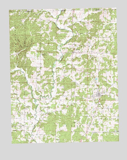
Maynard, AR USGS Topographic Map
Click on map above to begin viewing in our Map Viewer.

This topographic map contains these locations and features:
Feature Name Type Latitude Longitude GNIS ID View Map
Albritten CreekStreamN36.4320°W90.9496°45804View Map
Barnett CemeteryCemeteryN36.4070°W90.9851°46112View Map
Blue Spring HollowValleyN36.4626°W90.9848°46765View Map
BrakebillPopulated PlaceN36.4578°W90.9632°56937View Map
Brakebill Church of ChristChurchN36.4590°W90.9604°70162View Map
Camp CreekStreamN36.3851°W90.9810°47318View Map
Columbia Jarrett Baptist ChurchChurchN36.4023°W90.9593°76655View Map
Dry CreekStreamN36.4939°W90.9427°48643View Map
Elkins ParkPopulated PlaceN36.4098°W90.8993°57712View Map
Foster CemeteryCemeteryN36.3806°W90.9673°49191View Map
Glaze CreekPopulated PlaceN36.4795°W90.8829°70170View Map
Glaze Creek CemeteryCemeteryN36.4792°W90.8854°60421View Map
Glaze Creek Church of ChristChurchN36.4792°W90.8832°77023View Map
Hagood CreekStreamN36.4412°W90.9504°77103View Map
Harper CemeteryCemeteryN36.3934°W90.9257°49880View Map
Jarrett School (historical)SchoolN36.4026°W90.9548°70177View Map
JerrettPopulated PlaceN36.4028°W90.9576°70178View Map
Lewis CreekStreamN36.3951°W90.9685°51079View Map
Martin CemeteryCemeteryN36.3773°W90.9454°51711View Map
MaynardPopulated PlaceN36.4198°W90.8973°77620View Map
Maynard CemeteryCemeteryN36.4214°W90.8901°60423View Map
Maynard Elementary SchoolSchoolN36.4201°W90.8999°60424View Map
Maynard High SchoolSchoolN36.4184°W90.8986°60425View Map
Maynard Volunteer Fire DepartmentBuildingN36.4243°W90.9000°2116775View Map
MiddlebrookPopulated PlaceN36.4587°W90.9262°77651View Map
Middlebrook United Methodist ChurchChurchN36.4612°W90.9257°78894View Map
Mock (historical)Populated PlaceN36.4459°W90.9696°60420View Map
Mud CreekStreamN36.4134°W90.9715°52514View Map
Niccum HollowValleyN36.4623°W90.9846°52767View Map
Old SiloamPopulated PlaceN36.4531°W90.9046°70191View Map
Overby CemeteryCemeteryN36.3834°W90.9009°60426View Map
Overby ChurchChurchN36.3837°W90.9015°77934View Map
Rock Spring HollowValleyN36.4637°W90.9821°54109View Map
Salem Baptist Church (historical)ChurchN36.4023°W90.9590°70203View Map
Shaver CreekStreamN36.4165°W90.9929°54742View Map
Siloam CemeteryCemeteryN36.4537°W90.9026°60422View Map
Siloam ChurchChurchN36.4537°W90.9035°78363View Map
Sparkman CemeteryCemeteryN36.3914°W90.9862°60419View Map
Spencer CreekStreamN36.4809°W90.9362°55065View Map
Spring CreekStreamN36.4756°W90.9260°55092View Map
Tattle CreekStreamN36.3990°W90.9715°55451View Map
Tennessee CreekStreamN36.3823°W90.9773°55492View Map
Town of MaynardCivilN36.4223°W90.9025°2406114View Map
Township of IngramCivilN36.4189°W90.9868°69025View Map
Township of SiloamCivilN36.4666°W90.9247°69035View Map
Waldron CreekStreamN36.4195°W90.9648°55950View Map
WashingtonPopulated PlaceN36.3837°W90.8757°70207View Map
Washington CemeteryCemeteryN36.3842°W90.8757°60427View Map
Washington Church of ChristChurchN36.3840°W90.8754°78703View Map
Washington School (historical)SchoolN36.3837°W90.8848°70208View Map
Wright CreekStreamN36.4442°W90.9887°56558View Map

Note: Coordinates in the location and feature list above are referenced to NAD83 datum.


Copyright (C) 2008-2024 Ryan Niemi / Sunset Dynamics ... All Rights Reserved