TopoQuest Logo
Do you find TopoQuest useful?
Help keep TopoQuest running and adding new maps/features by donating!
Bitcoin:  19c7KJd3qBynnjoSw5npx9KScwjBe4ifkT
Litecoin:  LXs6TkuXGGXo1vDsWCkWVdjQX94eUKd6ui
Home View Maps Find Maps Find Places Resources & Links


Maysville, West Virginia Topographic Map

USGS Map Title: Maysville, WV
USGS Map MRC: 39079A2
DRG (GeoTIFF) Download: o39079a2.tif


Neighboring USGS Topographic Map Quads:


  Mount Storm Lake, WV  
39079B3
 

  Greenland Gap, WV  
39079B2
 

  Medley, WV  
39079B1
 

  Blackbird Knob, WV  
39079A3
 

  Maysville, WV  
39079A2
 

  Rig, WV  
39079A1
 

  Hopeville, WV  
38079H3
 

  Petersburg West, WV  
38079H2
 

  Petersburg East, WV  
38079H1


Map MRC Location:

N40°
W80°
N40°
W79°
H8 H7 H6 H5 H4 H3 H2 H1
G8 G7 G6 G5 G4 G3 G2 G1
F8 F7 F6 F5 F4 F3 F2 F1
E8 E7 E6 E5 E4 E3 E2 E1
D8 D7 D6 D5 D4 D3 D2 D1
C8 C7 C6 C5 C4 C3 C2 C1
B8 B7 B6 B5 B4 B3 B2 B1
A8 A7 A6 A5 A4 A3 A2 A1
N39°
W80°
N39°
W79°

Maysville, WV USGS 1:24K Topographic Map Preview:
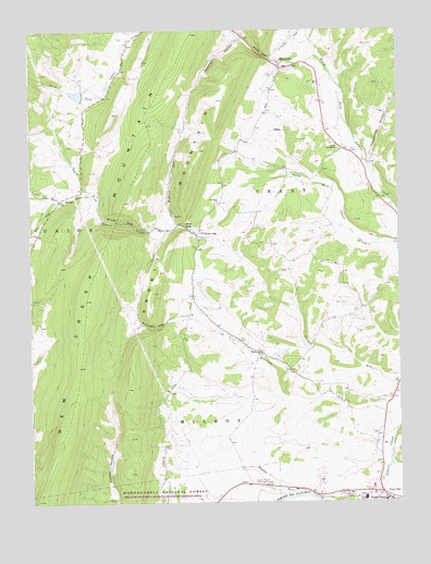
Maysville, WV USGS Topographic Map
Click on map above to begin viewing in our Map Viewer.

This topographic map contains these locations and features:
Feature Name Type Latitude Longitude GNIS ID View Map
Big Star RunStreamN39.0832°W79.2300°1550353View Map
Bodkins RunStreamN39.0732°W79.1995°1550411View Map
Eureka School (historical)SchoolN39.1076°W79.2250°1557001View Map
Fort HillSummitN39.0009°W79.1403°1554495View Map
Fort Mullegan (historical)MilitaryN39.0008°W79.1406°1697236View Map
Gospel TabernacleChurchN39.0943°W79.1456°1551259View Map
Grant CountyCivilN39.1051°W79.1956°1697238View Map
Grant Memorial HospitalHospitalN39.0014°W79.1371°1697241View Map
Harmony ChurchChurchN39.0793°W79.1859°1551364View Map
Hoglan RunStreamN39.0021°W79.1559°1551468View Map
Johnsonville School (historical)SchoolN39.0893°W79.1342°1557012View Map
Keplinger HollowValleyN39.1226°W79.1781°1551637View Map
Kline GapGapN39.0740°W79.2200°1551658View Map
Kline GapPopulated PlaceN39.0723°W79.1925°1551659View Map
Kline Gap School (historical)SchoolN39.0715°W79.1925°1557015View Map
Little Star RunStreamN39.0801°W79.2406°1551895View Map
Lunice Creek Structure Number Nine DamDamN39.1068°W79.2314°1557443View Map
Mays GapGapN39.1182°W79.1706°1552017View Map
MaysvillePopulated PlaceN39.1151°W79.1648°1555073View Map
Maysville Elementary SchoolSchoolN39.1154°W79.1627°1697257View Map
Maysville Post OfficePost OfficeN39.1076°W79.1519°1697258View Map
Maysville Volunteer Fire DepartmentBuildingN39.1164°W79.1667°2577570View Map
Mount Hebron CemeteryCemeteryN39.0404°W79.1725°1697260View Map
Mount Hebron ChurchChurchN39.0398°W79.1720°1552203View Map
Mountain Top School (historical)SchoolN39.1043°W79.1961°1557021View Map
Opossum HollowValleyN39.0898°W79.1342°1552392View Map
Patomac District Ranger StationLocaleN39.0043°W79.2209°1553636View Map
Petersburg Post OfficePost OfficeN39.0022°W79.1398°1697266View Map
Quantico School (historical)SchoolN39.0415°W79.1773°1557029View Map
Real GapGapN39.0732°W79.1973°1552596View Map
Robinson GapGapN39.0462°W79.2100°1552696View Map
Robinson RunStreamN39.0173°W79.1273°1552697View Map
Scott School (historical)SchoolN39.0515°W79.1378°1557032View Map
South Branch Memorial GardensCemeteryN39.0057°W79.1756°1552966View Map
StrebyPopulated PlaceN39.0804°W79.2395°1553097View Map
Town HillPopulated PlaceN39.0026°W79.1314°1555818View Map

Note: Coordinates in the location and feature list above are referenced to NAD83 datum.


Copyright (C) 2008-2024 Ryan Niemi / Sunset Dynamics ... All Rights Reserved