TopoQuest Logo
Do you find TopoQuest useful?
Help keep TopoQuest running and adding new maps/features by donating!
Bitcoin:  19c7KJd3qBynnjoSw5npx9KScwjBe4ifkT
Litecoin:  LXs6TkuXGGXo1vDsWCkWVdjQX94eUKd6ui
Home View Maps Find Maps Find Places Resources & Links


Medley, West Virginia Topographic Map

USGS Map Title: Medley, WV
USGS Map MRC: 39079B1
DRG (GeoTIFF) Download: o39079b1.tif


Neighboring USGS Topographic Map Quads:


  Mount Storm, WV  
39079C2
 

  Antioch, WV  
39079C1
 

  Burlington, WV  
39078C8
 

  Greenland Gap, WV  
39079B2
 

  Medley, WV  
39079B1
 

  Old Fields, WV  
39078B8
 

  Maysville, WV  
39079A2
 

  Rig, WV  
39079A1
 

  Moorefield, WV  
39078A8


Map MRC Location:

N40°
W80°
N40°
W79°
H8 H7 H6 H5 H4 H3 H2 H1
G8 G7 G6 G5 G4 G3 G2 G1
F8 F7 F6 F5 F4 F3 F2 F1
E8 E7 E6 E5 E4 E3 E2 E1
D8 D7 D6 D5 D4 D3 D2 D1
C8 C7 C6 C5 C4 C3 C2 C1
B8 B7 B6 B5 B4 B3 B2 B1
A8 A7 A6 A5 A4 A3 A2 A1
N39°
W80°
N39°
W79°

Medley, WV USGS 1:24K Topographic Map Preview:
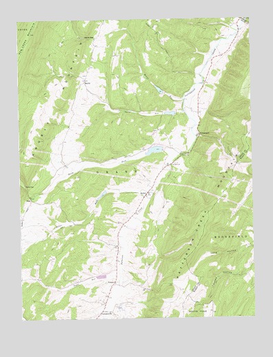
Medley, WV USGS Topographic Map
Click on map above to begin viewing in our Map Viewer.

This topographic map contains these locations and features:
Feature Name Type Latitude Longitude GNIS ID View Map
Baker School (historical)SchoolN39.2062°W79.0978°1556993View Map
FallsPopulated PlaceN39.1751°W79.1189°1549678View Map
Falls GapGapN39.1807°W79.1225°1538879View Map
Falls School (historical)SchoolN39.1734°W79.1061°1557004View Map
FormanPopulated PlaceN39.1401°W79.0750°1549690View Map
Grant DistrictCivilN39.1345°W79.1057°1928277View Map
Harris GapGapN39.2423°W79.0898°1540011View Map
Heaven's LandingAirportN39.1765°W79.0676°2443457View Map
LahmansvillePopulated PlaceN39.1282°W79.0814°1554900View Map
Lahmansville Post OfficePost OfficeN39.1376°W79.0773°1697252View Map
Long HollowValleyN39.1551°W79.0050°1542378View Map
MartinPopulated PlaceN39.2243°W79.0889°1549810View Map
MedleyPopulated PlaceN39.1762°W79.0578°1543107View Map
Medley Post OfficePost OfficeN39.1771°W79.0573°1697259View Map
Middle Fork Patterson CreekStreamN39.1776°W79.0531°1543192View Map
Mount Jackson Volunteer Rescue Squad, Company, Number 21BuildingN39.2489°W79.0736°2085906View Map
North Fork Patterson CreekStreamN39.1918°W79.0406°1544217View Map
Patterson Creek Structure 12 DamDamN39.2118°W79.0414°1557451View Map
Patterson Creek Structure 13 DamDamN39.2201°W79.0481°1557452View Map
Patterson Creek Structure 41 DamDamN39.1951°W79.0481°1557453View Map
Patterson Creek Structure 49 DamDamN39.1301°W79.0731°1557454View Map
Patterson Creek Structure Four DamDamN39.1784°W79.0798°1557449View Map
Patterson Creek Structure Three DamDamN39.1318°W79.0814°1557448View Map
Patterson Creek Structure Two DamDamN39.1251°W79.0814°1557447View Map
Poplar School (historical)SchoolN39.2476°W79.0531°1557028View Map
Powders School (historical)SchoolN39.1465°W79.0014°1556865View Map
Rosser RunStreamN39.2162°W79.0361°1546095View Map
Saint Pauls ChurchChurchN39.1893°W79.0428°1546270View Map
The Ridge Brethren ChurchChurchN39.2495°W79.0545°1697277View Map
Thorn RunStreamN39.2118°W79.0364°1548052View Map
Thorn RunStreamN39.1429°W79.0723°1548053View Map
Thorn Run School (historical)SchoolN39.2157°W79.0767°1557036View Map
Waterfall SpringSpringN39.1384°W79.0170°1678104View Map
WilliamsportPopulated PlaceN39.2015°W79.0281°1549990View Map
Wolf Den SpringSpringN39.1571°W79.0345°1677876View Map

Note: Coordinates in the location and feature list above are referenced to NAD83 datum.


Copyright (C) 2008-2024 Ryan Niemi / Sunset Dynamics ... All Rights Reserved