TopoQuest Logo
Do you find TopoQuest useful?
Help keep TopoQuest running and adding new maps/features by donating!
Bitcoin:  19c7KJd3qBynnjoSw5npx9KScwjBe4ifkT
Litecoin:  LXs6TkuXGGXo1vDsWCkWVdjQX94eUKd6ui
Home View Maps Find Maps Find Places Resources & Links


McAlevys Fort, Pennsylvania Topographic Map

USGS Map Title: McAlevys Fort, PA
USGS Map MRC: 40077F7
DRG (GeoTIFF) Download: o40077f7.tif


Neighboring USGS Topographic Map Quads:


  Julian, PA  
40077G8
 

  State College, PA  
40077G7
 

  Centre Hall, PA  
40077G6
 

  Pine Grove Mills, PA  
40077F8
 

  McAlevys Fort, PA  
40077F7
 

  Barrville, PA  
40077F6
 

  Donation, PA  
40077E8
 

  Allensville, PA  
40077E7
 

  Belleville, PA  
40077E6


Map MRC Location:

N41°
W78°
N41°
W77°
H8 H7 H6 H5 H4 H3 H2 H1
G8 G7 G6 G5 G4 G3 G2 G1
F8 F7 F6 F5 F4 F3 F2 F1
E8 E7 E6 E5 E4 E3 E2 E1
D8 D7 D6 D5 D4 D3 D2 D1
C8 C7 C6 C5 C4 C3 C2 C1
B8 B7 B6 B5 B4 B3 B2 B1
A8 A7 A6 A5 A4 A3 A2 A1
N40°
W78°
N40°
W77°

McAlevys Fort, PA USGS 1:24K Topographic Map Preview:
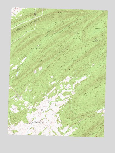
McAlevys Fort, PA USGS Topographic Map
Click on map above to begin viewing in our Map Viewer.

This topographic map contains these locations and features:
Feature Name Type Latitude Longitude GNIS ID View Map
Alan Seeger Natural AreaParkN40.6934°W77.7536°1198326View Map
Alan Seeger Picnic AreaAreaN40.6959°W77.7664°1206879View Map
Alexander TrailTrailN40.6626°W77.7736°1192061View Map
Bear MeadowsSwampN40.7291°W77.7634°1175516View Map
Bear Meadows Natural AreaParkN40.7292°W77.7622°1192103View Map
Beidler TrailTrailN40.6890°W77.8467°1192115View Map
Bell RidgeRidgeN40.7026°W77.8089°1169151View Map
Big FlatFlatN40.7215°W77.7903°1169505View Map
Big Flat Laurel Viewing AreaAreaN40.7234°W77.7847°1201964View Map
Black Lick RunStreamN40.6598°W77.8069°1169716View Map
Brush RidgeRidgeN40.6445°W77.7789°1170444View Map
Brush Ridge SchoolSchoolN40.6459°W77.7967°1197194View Map
Brush TrailTrailN40.6426°W77.7842°1170463View Map
Croyle RunStreamN40.6726°W77.8267°1172784View Map
Detweiler RunStreamN40.6945°W77.7586°1173185View Map
EnnisvillePopulated PlaceN40.6362°W77.8464°1174272View Map
Ennisville CemeteryCemeteryN40.6371°W77.8459°1813195View Map
Gettis RidgeRidgeN40.6945°W77.7983°1175573View Map
Goose Club TrailTrailN40.6426°W77.7842°1175825View Map
Greenlee CemeteryCemeteryN40.6514°W77.8289°1813197View Map
Greenlee MountainSummitN40.7090°W77.8169°1192554View Map
Greenlee RunStreamN40.6576°W77.8200°1176160View Map
Greenwood Furnace CemeteryCemeteryN40.6483°W77.7583°1813193View Map
Greenwood Furnace State ParkParkN40.6462°W77.7619°1192558View Map
Greenwood NurseryLocaleN40.6540°W77.7522°1206877View Map
Griffith TrailTrailN40.6598°W77.7647°1192563View Map
Hostetler AirportAirportN40.6310°W77.8500°1194052View Map
Hubler GapGapN40.7267°W77.8267°1177538View Map
Jackson Miller SchoolSchoolN40.6373°W77.8372°1177923View Map
Keith SpringSpringN40.7259°W77.7892°1178310View Map
Kepler TrailTrailN40.7295°W77.8683°1178394View Map
Koch RidgeRidgeN40.6717°W77.8564°1197197View Map
Koch RidgeRidgeN40.6526°W77.8353°1178628View Map
Laurel RunStreamN40.6390°W77.8375°1178981View Map
Little FlatFlatN40.7492°W77.7561°1179546View Map
McAlevys FortPopulated PlaceN40.6398°W77.8314°1180598View Map
McAlevys Fort Hill CemeteryCemeteryN40.6478°W77.8350°1813196View Map
McAlevys Fort United Presbyterian CemeteryCemeteryN40.6353°W77.8225°1813194View Map
Musser GapGapN40.7431°W77.8450°1182115View Map
Musser TrailTrailN40.7334°W77.8394°1206880View Map
Owl Gap CCC CampLocaleN40.7228°W77.8214°1197198View Map
Owl Gap TrailTrailN40.7090°W77.8089°1193072View Map
Ross RunStreamN40.6817°W77.7914°1197834View Map
Rothrock State ForestForestN40.7101°W77.8181°1193221View Map
Saint Stephens ChurchChurchN40.6623°W77.8617°1186729View Map
Saint Stephens Lutheran CemeteryCemeteryN40.6628°W77.8619°1813198View Map
Sand KnobSummitN40.7134°W77.8381°1186912View Map
Sand Knob TrailTrailN40.7015°W77.8264°1193281View Map
Seeger PlacePopulated PlaceN40.6967°W77.7678°1204602View Map
Shingletown BranchStreamN40.7187°W77.8331°1187545View Map
Slate Hill SchoolSchoolN40.6684°W77.8175°1197193View Map
Steffey SchoolSchoolN40.6612°W77.8603°1197196View Map
Stillhouse HollowValleyN40.6330°W77.8680°1188674View Map
Stone Creek Valley Volunteer Fire Company Station 19BuildingN40.6416°W77.8318°2644773View Map
Stone Valley SchoolSchoolN40.6345°W77.8264°1197195View Map
Telephone TrailTrailN40.6690°W77.7619°1193515View Map
The Pennsylvania State University Experimental ForestForestN40.6392°W77.8694°1214025View Map
Township of JacksonCivilN40.6749°W77.8004°1216511View Map
Wallace TrailTrailN40.6662°W77.7747°1193603View Map
Whipple DamDamN40.6834°W77.8647°1194978View Map
Whipple Dam State ParkParkN40.6870°W77.8636°1191232View Map
White ChurchChurchN40.6501°W77.8294°1191257View Map

Note: Coordinates in the location and feature list above are referenced to NAD83 datum.


Copyright (C) 2008-2025 Ryan Niemi / Sunset Dynamics ... All Rights Reserved