TopoQuest Logo
Do you find TopoQuest useful?
Help keep TopoQuest running and adding new maps/features by donating!
Bitcoin:  19c7KJd3qBynnjoSw5npx9KScwjBe4ifkT
Litecoin:  LXs6TkuXGGXo1vDsWCkWVdjQX94eUKd6ui
Home View Maps Find Maps Find Places Resources & Links


Pine Grove Mills, Pennsylvania Topographic Map

USGS Map Title: Pine Grove Mills, PA
USGS Map MRC: 40077F8
DRG (GeoTIFF) Download: o40077f8.tif


Neighboring USGS Topographic Map Quads:


  Port Matilda, PA  
40078G1
 

  Julian, PA  
40077G8
 

  State College, PA  
40077G7
 

  Franklinville, PA  
40078F1
 

  Pine Grove Mills, PA  
40077F8
 

  McAlevys Fort, PA  
40077F7
 

  Alexandria, PA  
40078E1
 

  Donation, PA  
40077E8
 

  Allensville, PA  
40077E7


Map MRC Location:

N41°
W78°
N41°
W77°
H8 H7 H6 H5 H4 H3 H2 H1
G8 G7 G6 G5 G4 G3 G2 G1
F8 F7 F6 F5 F4 F3 F2 F1
E8 E7 E6 E5 E4 E3 E2 E1
D8 D7 D6 D5 D4 D3 D2 D1
C8 C7 C6 C5 C4 C3 C2 C1
B8 B7 B6 B5 B4 B3 B2 B1
A8 A7 A6 A5 A4 A3 A2 A1
N40°
W78°
N40°
W77°

Pine Grove Mills, PA USGS 1:24K Topographic Map Preview:
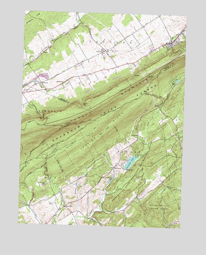
Pine Grove Mills, PA USGS Topographic Map
Click on map above to begin viewing in our Map Viewer.

This topographic map contains these locations and features:
Feature Name Type Latitude Longitude GNIS ID View Map
Armond RunStreamN40.6342°W77.9369°1168400View Map
BaileyvillePopulated PlaceN40.7081°W77.9853°1168584View Map
Baileyville Census Designated PlaceCensusN40.7111°W77.9924°2627942View Map
Beaver PondLakeN40.7114°W77.8805°1169022View Map
Bennett CemeteryCemeteryN40.6795°W77.8969°1988416View Map
Carolus CemeteryCemeteryN40.6292°W77.9155°1988415View Map
CharteroakPopulated PlaceN40.6778°W77.9094°1203251View Map
Crownover TrailTrailN40.7001°W77.9311°1206549View Map
Diamond ValleyValleyN40.6628°W77.9916°1173230View Map
Erb GapGapN40.7134°W77.9136°1174299View Map
FairbrookPopulated PlaceN40.7273°W77.9375°1174419View Map
FairbrookLocaleN40.7428°W77.9614°1196992View Map
Gobbler KnobSummitN40.6992°W77.9467°1175763View Map
Harrys ValleyValleyN40.6621°W77.9776°1176597View Map
Henrys RunStreamN40.6290°W77.9453°1176849View Map
Homan AirportAirportN40.7180°W77.9626°1194078View Map
Hutchinson PondReservoirN40.6525°W77.9287°1177655View Map
Hutchison DamDamN40.6501°W77.9797°1194955View Map
Indian Steps TrailTrailN40.7034°W77.9344°1206550View Map
Lake PerezReservoirN40.6631°W77.9144°1211883View Map
Leading RidgeRidgeN40.6695°W77.9533°1179081View Map
Massey CemeteryCemeteryN40.6574°W77.9395°1958418View Map
MasseyburgPopulated PlaceN40.6595°W77.9272°1180535View Map
Monroe FurnacePopulated PlaceN40.6970°W77.8928°1204201View Map
MooresvillePopulated PlaceN40.6376°W77.9625°1212137View Map
Mooresville CemeteryCemeteryN40.6383°W77.9634°1813199View Map
MusserPopulated PlaceN40.7262°W77.9844°1204248View Map
Neffs MillsPopulated PlaceN40.6359°W77.9639°1182215View Map
Pennsylvania Furnace CemeteryCemeteryN40.7042°W77.9976°1183536View Map
Pennsylvania Furnace Post OfficePost OfficeN40.7058°W77.9914°2779691View Map
Pennsylvania State University C E CampLocaleN40.6634°W77.9167°1183544View Map
Pennsylvania State University Experimental ForestForestN40.6628°W77.9039°1192047View Map
Pennsylvania State University Forestry CampLocaleN40.6673°W77.9100°1183546View Map
Pennsylvania State University Recreation AreParkN40.7120°W77.8828°1183547View Map
Phranton RunStreamN40.6303°W77.9553°1183692View Map
Pine Grove MillsPopulated PlaceN40.7337°W77.8856°1183816View Map
Pine Grove Mills Census Designated PlaceCensusN40.7315°W77.8884°2389673View Map
Pine Grove Mills GapGapN40.7284°W77.8842°1196991View Map
Pine Grove Mills Post OfficePost OfficeN40.7338°W77.8849°2779633View Map
RamblewoodPopulated PlaceN40.7195°W77.9564°1867506View Map
Ramblewood Census Designated PlaceCensusN40.7238°W77.9432°2389723View Map
Roaring RunStreamN40.6998°W77.8894°1193197View Map
Rock SpringSpringN40.7059°W77.9678°1202445View Map
RockspringPopulated PlaceN40.7090°W77.9675°1185323View Map
Rudy CemeteryCemeteryN40.6769°W77.8889°1822701View Map
Rudy RidgeRidgeN40.7040°W77.8814°1185599View Map
Schalls GapGapN40.6956°W77.9525°1187071View Map
Shavers Creek Volunteer Fire Company Station 11BuildingN40.6366°W77.9633°2645385View Map
Stone ValleyValleyN40.6590°W77.9173°1829105View Map
Stone Valley Recreation AreaParkN40.6712°W77.9203°1829102View Map
Township of BarreeCivilN40.6516°W77.9153°1216501View Map
Township of FergusonCivilN40.7431°W77.9404°1216123View Map
Township of WestCivilN40.6308°W77.9905°1216529View Map
Twin Creeks Community Volunteer Ambulance 1100BuildingN40.6318°W77.9715°2719495View Map
University DamDamN40.6587°W77.9172°1190214View Map
University Watershed Reservoir ProjectReservoirN40.6667°W77.9472°1201707View Map
White Deer LakeLakeN40.6491°W77.9800°1191271View Map

Note: Coordinates in the location and feature list above are referenced to NAD83 datum.


Copyright (C) 2008-2025 Ryan Niemi / Sunset Dynamics ... All Rights Reserved