TopoQuest Logo
Do you find TopoQuest useful?
Help keep TopoQuest running and adding new maps/features by donating!
Bitcoin:  19c7KJd3qBynnjoSw5npx9KScwjBe4ifkT
Litecoin:  LXs6TkuXGGXo1vDsWCkWVdjQX94eUKd6ui
Home View Maps Find Maps Find Places Resources & Links


Belleville, Pennsylvania Topographic Map

USGS Map Title: Belleville, PA
USGS Map MRC: 40077E6
DRG (GeoTIFF) Download: o40077e6.tif


Neighboring USGS Topographic Map Quads:


  McAlevys Fort, PA  
40077F7
 

  Barrville, PA  
40077F6
 

  Burnham, PA  
40077F5
 

  Allensville, PA  
40077E7
 

  Belleville, PA  
40077E6
 

  Lewistown, PA  
40077E5
 

  Newton Hamilton, PA  
40077D7
 

  McVeytown, PA  
40077D6
 

  McCoysville, PA  
40077D5


Map MRC Location:

N41°
W78°
N41°
W77°
H8 H7 H6 H5 H4 H3 H2 H1
G8 G7 G6 G5 G4 G3 G2 G1
F8 F7 F6 F5 F4 F3 F2 F1
E8 E7 E6 E5 E4 E3 E2 E1
D8 D7 D6 D5 D4 D3 D2 D1
C8 C7 C6 C5 C4 C3 C2 C1
B8 B7 B6 B5 B4 B3 B2 B1
A8 A7 A6 A5 A4 A3 A2 A1
N40°
W78°
N40°
W77°

Belleville, PA USGS 1:24K Topographic Map Preview:
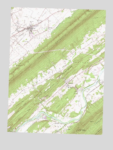
Belleville, PA USGS Topographic Map
Click on map above to begin viewing in our Map Viewer.

This topographic map contains these locations and features:
Feature Name Type Latitude Longitude GNIS ID View Map
AndersonPopulated PlaceN40.5398°W77.6455°1202973View Map
Anderson GapGapN40.5134°W77.6411°1168286View Map
BellevillePopulated PlaceN40.6051°W77.7256°1169172View Map
Belleville Census Designated PlaceCensusN40.6059°W77.7211°2389198View Map
Belleville Fire Company Station 24BuildingN40.6083°W77.7173°2645818View Map
Belleville Post OfficePost OfficeN40.6079°W77.7165°2772592View Map
Belleville SchoolSchoolN40.5909°W77.7258°1169173View Map
Big Valley Ambulance ClubBuildingN40.6098°W77.7126°2719626View Map
Big Valley ChurchChurchN40.6112°W77.7242°1169605View Map
Blue Juniata CampLocaleN40.5548°W77.6311°1169880View Map
Bratton Airport (historical)AirportN40.5501°W77.6997°1194022View Map
Cargill Airport (historical)AirportN40.5417°W77.6455°1194017View Map
Carlisle RunStreamN40.5098°W77.6733°1171216View Map
Center SchoolSchoolN40.5654°W77.6436°1197212View Map
Centre Union ChurchChurchN40.5687°W77.6428°1171517View Map
Chestnut RidgeRidgeN40.5317°W77.6778°1171741View Map
Church RidgeRidgeN40.5292°W77.7342°1171863View Map
Corbin CemeteryCemeteryN40.5323°W77.6453°1172448View Map
Ferguson ValleyBasinN40.5665°W77.6872°1192455View Map
Front RidgeRidgeN40.5179°W77.7289°1175295View Map
GranvillePopulated PlaceN40.5537°W77.6255°1175970View Map
HorningfordPopulated PlaceN40.5101°W77.6878°1203844View Map
Juniata Memorial CemeteryCemeteryN40.5628°W77.6480°1178198View Map
Lapolds Ford (historical)LocaleN40.5454°W77.6447°1197218View Map
Lewistown Airport (historical)AirportN40.5667°W77.6330°1194027View Map
Lewistown Country ClubLocaleN40.5601°W77.6333°1213266View Map
Little Kishacoquillas CreekStreamN40.6009°W77.7244°1179579View Map
LockportPopulated PlaceN40.5431°W77.6589°1179762View Map
Locust Grove CemeteryCemeteryN40.5926°W77.7425°1179776View Map
Locust Grove ChurchChurchN40.5965°W77.7450°1179778View Map
Locust Grove SchoolSchoolN40.5295°W77.7067°1197215View Map
LongfellowPopulated PlaceN40.5045°W77.6736°1179915View Map
Longfellow Census Designated PlaceCensusN40.5062°W77.6665°2584481View Map
Longfellow SchoolSchoolN40.5065°W77.6703°1197217View Map
Maple Grove ChurchChurchN40.6128°W77.7139°1180334View Map
Maple Grove SchoolSchoolN40.5020°W77.7086°1197214View Map
Mattawana CemeteryCemeteryN40.5023°W77.7403°1180553View Map
McKee SchoolSchoolN40.5801°W77.6680°1197211View Map
Mechanic Street (historical)LocaleN40.5990°W77.7364°1197209View Map
MechanicsvillePopulated PlaceN40.6017°W77.7397°1201870View Map
Middle RidgeRidgeN40.5242°W77.7325°1181042View Map
Miller DamDamN40.5451°W77.6597°1194896View Map
Minehart RunStreamN40.5565°W77.6308°1181312View Map
Oak Grove SchoolSchoolN40.5306°W77.6694°1197216View Map
Ore Bank SchoolSchoolN40.5892°W77.7294°1197210View Map
Pennsylvania CanalCanalN40.5154°W77.6722°1183530View Map
Pine GlenPopulated PlaceN40.5017°W77.6803°1183790View Map
Saint Johns ChurchChurchN40.6006°W77.7386°1186122View Map
School Number 7 (historical)SchoolN40.5495°W77.7108°1197213View Map
Soft RunStreamN40.6034°W77.7400°1187975View Map
State Game Lands Number 113ParkN40.5454°W77.6972°1188435View Map
Strodes MillsPopulated PlaceN40.5509°W77.6730°1188884View Map
Strodes Mills Census Designated PlaceCensusN40.5488°W77.6751°2584516View Map
Strodes RunStreamN40.5445°W77.6517°1214658View Map
Town RunStreamN40.5004°W77.7380°1193545View Map
Township of OliverCivilN40.5135°W77.7388°1216831View Map
Township of UnionCivilN40.6173°W77.7152°1216832View Map
Union MillsPopulated PlaceN40.6059°W77.6994°1190166View Map
Valley ChurchChurchN40.6126°W77.6997°1190291View Map
Wakefield RunStreamN40.5190°W77.6972°1190488View Map
Wesley ChapelChurchN40.5409°W77.6586°1190855View Map
West Granville Fire Company Station 17BuildingN40.5534°W77.6681°2645258View Map

Note: Coordinates in the location and feature list above are referenced to NAD83 datum.


Copyright (C) 2008-2025 Ryan Niemi / Sunset Dynamics ... All Rights Reserved