TopoQuest Logo
Do you find TopoQuest useful?
Help keep TopoQuest running and adding new maps/features by donating!
Bitcoin:  19c7KJd3qBynnjoSw5npx9KScwjBe4ifkT
Litecoin:  LXs6TkuXGGXo1vDsWCkWVdjQX94eUKd6ui
Home View Maps Find Maps Find Places Resources & Links


Stephenson, Michigan Topographic Map

USGS Map Title: Stephenson, MI
USGS Map MRC: 45087D5
DRG (GeoTIFF) Download: o45087d5.tif


Neighboring USGS Topographic Map Quads:


  Banat, MI  
45087E6
 

  Nadeau, MI  
45087E5
 

  Gourley, MI  
45087E4
 

  Swanson, MI  
45087D6
 

  Stephenson, MI  
45087D5
 

  North Lake, MI  
45087D4
 

  McAllister, WI  
45087C6
 

  Wallace, MI  
45087C5
 

  Arthur Bay, MI  
45087C4


Map MRC Location:

N46°
W88°
N46°
W87°
H8 H7 H6 H5 H4 H3 H2 H1
G8 G7 G6 G5 G4 G3 G2 G1
F8 F7 F6 F5 F4 F3 F2 F1
E8 E7 E6 E5 E4 E3 E2 E1
D8 D7 D6 D5 D4 D3 D2 D1
C8 C7 C6 C5 C4 C3 C2 C1
B8 B7 B6 B5 B4 B3 B2 B1
A8 A7 A6 A5 A4 A3 A2 A1
N45°
W88°
N45°
W87°

Stephenson, MI USGS 1:24K Topographic Map Preview:
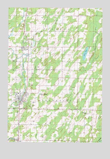
Stephenson, MI USGS Topographic Map
Click on map above to begin viewing in our Map Viewer.

This topographic map contains these locations and features:
Feature Name Type Latitude Longitude GNIS ID View Map
Assembly of God ChurchChurchN45.4172°W87.6150°2353213View Map
Baird CreekStreamN45.3925°W87.5196°620467View Map
Bethlehem ChurchChurchN45.4028°W87.5240°621236View Map
Bethlehem Covenant CemeteryCemeteryN45.4028°W87.5233°2353263View Map
City of StephensonCivilN45.4138°W87.6090°1627124View Map
Curtis Memorial ParkParkN45.4019°W87.5236°2099837View Map
Dagget Medical ClinicHospitalN45.4617°W87.5989°2353242View Map
Dagget Moravian ChurchChurchN45.4606°W87.6064°2353243View Map
Dagget Post OfficePost OfficeN45.4617°W87.6000°2353241View Map
Dagget Station (historical)LocaleN45.4619°W87.6056°2353240View Map
DaggettPopulated PlaceN45.4636°W87.6065°624271View Map
Daggett CemeteryCemeteryN45.4619°W87.5730°2099839View Map
Daggett ChurchChurchN45.4641°W87.5751°624272View Map
Daggett Volunteer Fire DepartmentBuildingN45.4615°W87.6017°2626933View Map
Danish CemeteryCemeteryN45.4092°W87.5933°2099838View Map
First Methodist ChurchChurchN45.4167°W87.6100°2353211View Map
Grant BrookStreamN45.3836°W87.5382°627145View Map
Hays CreekStreamN45.4555°W87.5990°628005View Map
Hugos BrookStreamN45.4266°W87.6029°628791View Map
Indian Hills Golf CourseLocaleN45.4333°W87.6167°2353208View Map
IngallsPopulated PlaceN45.3769°W87.6112°629032View Map
Ingalls Post OfficePost OfficeN45.3772°W87.6111°2353228View Map
Ingalls StationLocaleN45.3769°W87.6122°2353227View Map
Menominee County LibraryBuildingN45.4153°W87.6078°2353203View Map
Michigan Department of Natural Resources Stephenson Field OfficeBuildingN45.4215°W87.6002°2626970View Map
Mid County Rescue SquadBuildingN45.4116°W87.6082°2662007View Map
North Stephenson CemeteryCemeteryN45.4139°W87.5930°2353260View Map
PalestinePopulated PlaceN45.4055°W87.5335°1617766View Map
Peterson ParkFlatN45.4569°W87.5996°634725View Map
Precious Blood ChurchChurchN45.4150°W87.6056°2353212View Map
Ross CreekStreamN45.4727°W87.6246°636247View Map
Roubal Nursing HomeHospitalN45.4197°W87.5981°2353207View Map
Saint Stephen Lutheran ChurchChurchN45.4158°W87.6081°2353210View Map
StephensonPopulated PlaceN45.4153°W87.6076°638791View Map
Stephenson CemeteryCemeteryN45.4122°W87.5940°638792View Map
Stephenson City HallBuildingN45.4156°W87.6119°2353204View Map
Stephenson Elementary SchoolSchoolN45.4203°W87.6111°2353201View Map
Stephenson High SchoolSchoolN45.4181°W87.6194°2353202View Map
Stephenson Lookout TowerTowerN45.4200°W87.5779°1623653View Map
Stephenson Police DepartmentBuildingN45.4156°W87.6134°2353205View Map
Stephenson Post OfficePost OfficeN45.4156°W87.6111°2353206View Map
Stephenson StationLocaleN45.4150°W87.6103°2353214View Map
Stephenson Volunteer Fire DepartmentBuildingN45.4155°W87.6134°2626920View Map
Township of DaggettCivilN45.4783°W87.5425°1626155View Map
Township of StephensonCivilN45.4149°W87.5372°1627125View Map
Village of DaggettCivilN45.4619°W87.6043°2398668View Map
Wagner LakeLakeN45.4569°W87.5232°1615667View Map

Note: Coordinates in the location and feature list above are referenced to NAD83 datum.


Copyright (C) 2008-2025 Ryan Niemi / Sunset Dynamics ... All Rights Reserved