TopoQuest Logo
Do you find TopoQuest useful?
Help keep TopoQuest running and adding new maps/features by donating!
Bitcoin:  19c7KJd3qBynnjoSw5npx9KScwjBe4ifkT
Litecoin:  LXs6TkuXGGXo1vDsWCkWVdjQX94eUKd6ui
Home View Maps Find Maps Find Places Resources & Links


Zeni Ridge, California Topographic Map

USGS Map Title: Zeni Ridge, CA
USGS Map MRC: 38123H4
DRG (GeoTIFF) Download: o38123h4.tif


Neighboring USGS Topographic Map Quads:


  Cold Spring, CA  
39123A5
 

  Philo, CA  
39123A4
 

  Boonville, CA  
39123A3
 

  Eureka Hill, CA  
38123H5
 

  Zeni Ridge, CA  
38123H4
 

  Ornbaun Valley, CA  
38123H3
 

  Gualala, CA  
38123G5
 

  McGuire Ridge, CA  
38123G4
 

  Gube Mountain, CA  
38123G3


Map MRC Location:

N39°
W124°
N39°
W123°
H8 H7 H6 H5 H4 H3 H2 H1
G8 G7 G6 G5 G4 G3 G2 G1
F8 F7 F6 F5 F4 F3 F2 F1
E8 E7 E6 E5 E4 E3 E2 E1
D8 D7 D6 D5 D4 D3 D2 D1
C8 C7 C6 C5 C4 C3 C2 C1
B8 B7 B6 B5 B4 B3 B2 B1
A8 A7 A6 A5 A4 A3 A2 A1
N38°
W124°
N38°
W123°

Zeni Ridge, CA USGS 1:24K Topographic Map Preview:
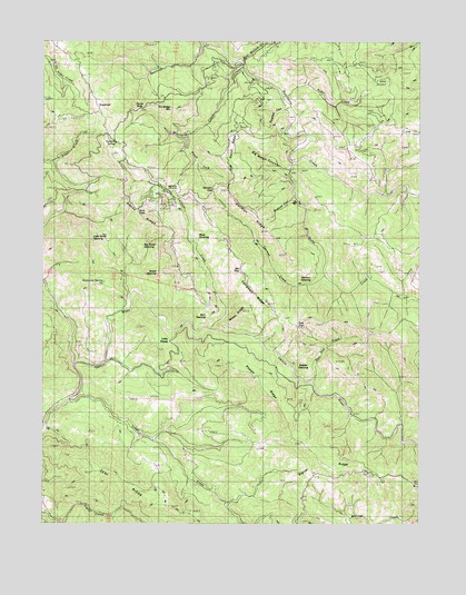
Zeni Ridge, CA USGS Topographic Map
Click on map above to begin viewing in our Map Viewer.

This topographic map contains these locations and features:
Feature Name Type Latitude Longitude GNIS ID View Map
Alder CreekStreamN38.9860°W123.4211°218089View Map
Barn OpeningFlatN38.9307°W123.4456°218679View Map
Bear Wallow CreekStreamN38.9949°W123.4342°218905View Map
Beartrap CreekStreamN38.9988°W123.4478°218921View Map
Beebe OpeningFlatN38.9399°W123.4620°218967View Map
Big Horse OpeningFlatN38.9488°W123.4592°219199View Map
Big Rough CanyonValleyN38.9660°W123.4186°219246View Map
Bobcat CanyonValleyN38.9630°W123.4175°219564View Map
Buck PeakSummitN38.9552°W123.4658°1658155View Map
Camp CreekStreamN38.9685°W123.4158°220449View Map
Campbell RidgeRidgeN38.9341°W123.4258°220513View Map
Devils SlideSlopeN38.9832°W123.4700°222327View Map
Dry Bridge MountainSummitN38.9827°W123.4583°1658439View Map
East EndFlatN38.9257°W123.4158°222877View Map
East End CreekStreamN38.9118°W123.4106°222878View Map
German CreekStreamN38.9391°W123.4072°224129View Map
German GapGapN38.9613°W123.4436°224130View Map
German OpeningFlatN38.9402°W123.4133°224131View Map
German RidgeRidgeN38.9555°W123.4314°224132View Map
Hanes RidgeRidgeN38.9557°W123.4695°224870View Map
Helvetian Gun ClubLocaleN38.9607°W123.4575°1654278View Map
Hog Ranch RidgeRidgeN38.9688°W123.4408°225410View Map
Inman CreekStreamN38.9071°W123.4920°225942View Map
Larmour CreekStreamN38.9257°W123.4442°226882View Map
Little Horse OpeningFlatN38.9518°W123.4772°227275View Map
Little PennyPopulated PlaceN38.9227°W123.4578°1658977View Map
Mal PassGapN38.9410°W123.4347°227977View Map
Mikes RidgeRidgeN38.9305°W123.4336°228644View Map
Minnie CreekStreamN38.9930°W123.4342°228805View Map
Mule OpeningFlatN38.9499°W123.4495°229310View Map
Phelps RidgeRidgeN38.9071°W123.4214°230594View Map
Rawles CanyonValleyN38.9827°W123.4186°231286View Map
Saddle OpeningFlatN38.9199°W123.4139°232104View Map
South Fork Minnie CreekStreamN38.9749°W123.4522°235028View Map
Stansbury SpringSpringN38.9374°W123.4803°235378View Map
SugarloafSummitN38.9816°W123.4803°1659896View Map
Summit SpringSpringN38.9727°W123.4767°235765View Map
Zeni RidgeRidgeN38.8838°W123.4622°238312View Map

Note: Coordinates in the location and feature list above are referenced to NAD83 datum.


Copyright (C) 2008-2025 Ryan Niemi / Sunset Dynamics ... All Rights Reserved