TopoQuest Logo
Do you find TopoQuest useful?
Help keep TopoQuest running and adding new maps/features by donating!
Bitcoin:  19c7KJd3qBynnjoSw5npx9KScwjBe4ifkT
Litecoin:  LXs6TkuXGGXo1vDsWCkWVdjQX94eUKd6ui
Home View Maps Find Maps Find Places Resources & Links


Mecate Meadow, New Mexico Topographic Map

USGS Map Title: Mecate Meadow, NM
USGS Map MRC: 34107F6
DRG (GeoTIFF) Download: o34107f6.tif


Neighboring USGS Topographic Map Quads:


  Laguna Honda, NM  
34107G7
 

  Blue Mesa, NM  
34107G6
 

  East Mesa, NM  
34107G5
 

  Cebollita Peak, NM  
34107F7
 

  Mecate Meadow, NM  
34107F6
 

  Broom Mountain, NM  
34107F5
 

  Wild Horse Canyon, NM  
34107E7
 

  Wiley Mesa, NM  
34107E6
 

  Pueblo Viejo Mesa, NM  
34107E5


Map MRC Location:

N35°
W108°
N35°
W107°
H8 H7 H6 H5 H4 H3 H2 H1
G8 G7 G6 G5 G4 G3 G2 G1
F8 F7 F6 F5 F4 F3 F2 F1
E8 E7 E6 E5 E4 E3 E2 E1
D8 D7 D6 D5 D4 D3 D2 D1
C8 C7 C6 C5 C4 C3 C2 C1
B8 B7 B6 B5 B4 B3 B2 B1
A8 A7 A6 A5 A4 A3 A2 A1
N34°
W108°
N34°
W107°

Mecate Meadow, NM USGS 1:24K Topographic Map Preview:
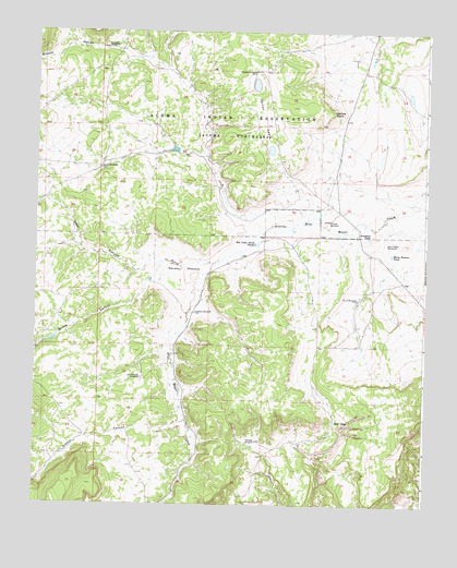
Mecate Meadow, NM USGS Topographic Map
Click on map above to begin viewing in our Map Viewer.

This topographic map contains these locations and features:
Feature Name Type Latitude Longitude GNIS ID View Map
Blue Water Water WellWellN34.6939°W107.6373°918476View Map
Blue Water WindmillLocaleN34.6939°W107.6375°886534View Map
Bluewater Water WellWellN34.6931°W107.6817°918475View Map
Brazo CanyonValleyN34.6839°W107.7134°886719View Map
Cactus LakesLakeN34.7361°W107.6803°887061View Map
Cactus PointCapeN34.7289°W107.6539°887063View Map
Chance Water WellWellN34.6587°W107.7162°918871View Map
Dunn WindmillLocaleN34.6795°W107.6464°888580View Map
Dunn WM Water WellWellN34.6795°W107.6464°918488View Map
G Owsley Water WellWellN34.6758°W107.6986°918495View Map
G Owsley WindmillLocaleN34.6756°W107.6992°889267View Map
Gibson CanyonValleyN34.6456°W107.7039°889398View Map
Horse Pasture TankReservoirN34.6914°W107.6359°890165View Map
Knoblock WindmillLocaleN34.7453°W107.7278°890740View Map
Last Chance WindmillLocaleN34.6584°W107.7162°890971View Map
Major WindmillLocaleN34.7137°W107.7295°891550View Map
McCord PlaceLocaleN34.6987°W107.6745°899757View Map
McCord Place Water WellWellN34.7001°W107.6762°918513View Map
Mecate MeadowAreaN34.6876°W107.7020°891817View Map
Mirabal WindmillLocaleN34.7003°W107.6559°908801View Map
Penasco Water WellWellN34.6420°W107.6803°918530View Map
Peņasco WindmillLocaleN34.6417°W107.6789°893163View Map
Red Lakes North TanksReservoirN34.6940°W107.6798°893770View Map
Rincon HondoValleyN34.7412°W107.7120°893938View Map
Rock TankReservoirN34.6474°W107.6537°894089View Map
Sandia WindmillLocaleN34.7395°W107.6803°894547View Map
Summers TankReservoirN34.6959°W107.6435°895428View Map
West CanyonValleyN34.6867°W107.7181°896342View Map

Note: Coordinates in the location and feature list above are referenced to NAD83 datum.


Copyright (C) 2008-2024 Ryan Niemi / Sunset Dynamics ... All Rights Reserved