TopoQuest Logo
Do you find TopoQuest useful?
Help keep TopoQuest running and adding new maps/features by donating!
Bitcoin:  19c7KJd3qBynnjoSw5npx9KScwjBe4ifkT
Litecoin:  LXs6TkuXGGXo1vDsWCkWVdjQX94eUKd6ui
Home View Maps Find Maps Find Places Resources & Links


Smedley, Indiana Topographic Map

USGS Map Title: Smedley, IN
USGS Map MRC: 38086F2
DRG (GeoTIFF) Download: o38086f2.tif


Neighboring USGS Topographic Map Quads:


  Tunnelton, IN  
38086G3
 

  Medora, IN  
38086G2
 

  Vallonia, IN  
38086G1
 

  Campbellsburg, IN  
38086F3
 

  Smedley, IN  
38086F2
 

  Kossuth, IN  
38086F1
 

  Livonia, IN  
38086E3
 

  Becks Mill, IN  
38086E2
 

  Salem, IN  
38086E1


Map MRC Location:

N39°
W87°
N39°
W86°
H8 H7 H6 H5 H4 H3 H2 H1
G8 G7 G6 G5 G4 G3 G2 G1
F8 F7 F6 F5 F4 F3 F2 F1
E8 E7 E6 E5 E4 E3 E2 E1
D8 D7 D6 D5 D4 D3 D2 D1
C8 C7 C6 C5 C4 C3 C2 C1
B8 B7 B6 B5 B4 B3 B2 B1
A8 A7 A6 A5 A4 A3 A2 A1
N38°
W87°
N38°
W86°

Smedley, IN USGS 1:24K Topographic Map Preview:
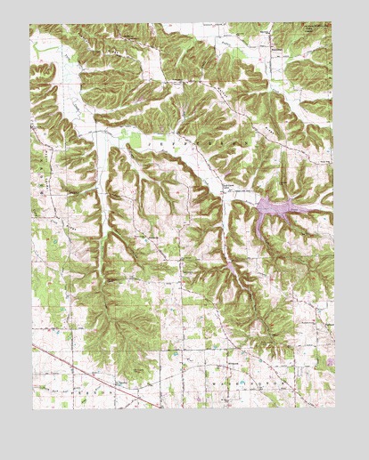
Smedley, IN USGS Topographic Map
Click on map above to begin viewing in our Map Viewer.

This topographic map contains these locations and features:
Feature Name Type Latitude Longitude GNIS ID View Map
Covenanter CemeteryCemeteryN38.6979°W86.1479°433049View Map
Enon ChurchChurchN38.6953°W86.1686°434213View Map
Fleener RidgeRidgeN38.7420°W86.2253°434580View Map
Four Corners SchoolSchoolN38.6734°W86.1883°434720View Map
Haleysburg SchoolSchoolN38.7464°W86.1511°435602View Map
HaleysburyPopulated PlaceN38.7420°W86.1508°435601View Map
Hamilton CemeteryCemeteryN38.6281°W86.2441°435640View Map
HighlandPopulated PlaceN38.6495°W86.1275°436147View Map
Highland Friends ChurchChurchN38.6523°W86.1333°436166View Map
HitchcockPopulated PlaceN38.6381°W86.1697°452924View Map
John Hays LakeReservoirN38.6886°W86.1491°452504View Map
Lick CreekStreamN38.6898°W86.1566°437856View Map
McKinleyPopulated PlaceN38.7448°W86.2105°438896View Map
Mount CarmelPopulated PlaceN38.7170°W86.2494°447650View Map
Mount Carmel ChurchChurchN38.7167°W86.2500°439546View Map
Mount Carmel RidgeRidgeN38.6898°W86.2394°439555View Map
Mount Eden ChurchChurchN38.7353°W86.1519°439559View Map
Mount Zion ChurchChurchN38.6273°W86.1697°439754View Map
New Philadelphia CemeteryCemeteryN38.6256°W86.1761°440098View Map
New Zion ChurchChurchN38.7462°W86.1650°440129View Map
Oak Grove ChurchChurchN38.7451°W86.2091°440418View Map
Old Smedley CemeteryCemeteryN38.6375°W86.2083°440598View Map
Oxonia Post OfficePost OfficeN38.6381°W86.1697°453056View Map
Prow HollowValleyN38.6836°W86.2181°441626View Map
ProwsvillePopulated PlaceN38.6801°W86.2016°441627View Map
Rinkers CreekStreamN38.6926°W86.1705°442053View Map
Rotary Springs CampParkN38.6456°W86.1558°442331View Map
Rush CreekStreamN38.7123°W86.2191°442399View Map
Rush Creek ChurchChurchN38.6692°W86.1839°442404View Map
Rush Creek ValleyPopulated PlaceN38.6953°W86.1705°442406View Map
SmedleyPopulated PlaceN38.6331°W86.2158°443654View Map
Stone Poultry FarmsLocaleN38.6308°W86.1958°2635316View Map
Township of JeffersonCivilN38.7129°W86.1849°453501View Map
Walnut Grove ChurchChurchN38.6806°W86.2030°445426View Map
Walnut Grove SchoolSchoolN38.7306°W86.1880°445429View Map
Walnut RidgeRidgeN38.7212°W86.1636°445438View Map
Walnut Ridge ChurchChurchN38.7037°W86.1266°445440View Map
Washington County LandfillLocaleN38.6397°W86.1286°2708760View Map
Wonder Valley CampParkN38.6659°W86.2183°446269View Map

Note: Coordinates in the location and feature list above are referenced to NAD83 datum.


Copyright (C) 2008-2025 Ryan Niemi / Sunset Dynamics ... All Rights Reserved