TopoQuest Logo
Do you find TopoQuest useful?
Help keep TopoQuest running and adding new maps/features by donating!
Bitcoin:  19c7KJd3qBynnjoSw5npx9KScwjBe4ifkT
Litecoin:  LXs6TkuXGGXo1vDsWCkWVdjQX94eUKd6ui
Home View Maps Find Maps Find Places Resources & Links


Melvina, Wisconsin Topographic Map

USGS Map Title: Melvina, WI
USGS Map MRC: 43090G7
DRG (GeoTIFF) Download: o43090g7.tif


Neighboring USGS Topographic Map Quads:


  Bangor, WI  
43090H8
 

  Sparta, WI  
43090H7
 

  City Rock, WI  
43090H6
 

  Middle Ridge, WI  
43090G8
 

  Melvina, WI  
43090G7
 

  Saint Marys, WI  
43090G6
 

  Esofea, WI  
43090F8
 

  Westby, WI  
43090F7
 

  Dell, WI  
43090F6


Map MRC Location:

N44°
W91°
N44°
W90°
H8 H7 H6 H5 H4 H3 H2 H1
G8 G7 G6 G5 G4 G3 G2 G1
F8 F7 F6 F5 F4 F3 F2 F1
E8 E7 E6 E5 E4 E3 E2 E1
D8 D7 D6 D5 D4 D3 D2 D1
C8 C7 C6 C5 C4 C3 C2 C1
B8 B7 B6 B5 B4 B3 B2 B1
A8 A7 A6 A5 A4 A3 A2 A1
N43°
W91°
N43°
W90°

Melvina, WI USGS 1:24K Topographic Map Preview:
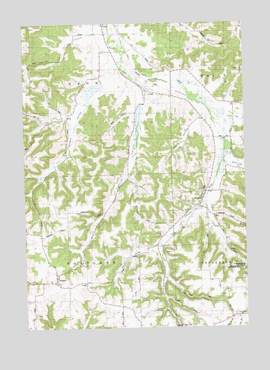
Melvina, WI USGS Topographic Map
Click on map above to begin viewing in our Map Viewer.

This topographic map contains these locations and features:
Feature Name Type Latitude Longitude GNIS ID View Map
1 ReservoirReservoirN43.7566°W90.8401°1792368View Map
Cannon ValleyValleyN43.8462°W90.8068°1562704View Map
Cannon Valley SchoolSchoolN43.8044°W90.8237°1562705View Map
Coon Creek 24 D6025 DamDamN43.7566°W90.8401°1792367View Map
Halls ValleyValleyN43.8167°W90.7594°1566002View Map
Hohn SchoolSchoolN43.8452°W90.7907°1566532View Map
Link CouleeValleyN43.8710°W90.8342°1846239View Map
Link HillSummitN43.8600°W90.8624°1846240View Map
Lyon ValleyValleyN43.8352°W90.7573°1577222View Map
Maple Ridge OrchardLocaleN43.7994°W90.8589°2612471View Map
MelvinaPopulated PlaceN43.8055°W90.7721°1569329View Map
Pine HollowValleyN43.7701°W90.7951°1571468View Map
Pine Hollow CemeteryCemeteryN43.7544°W90.7537°1846261View Map
Pinnacle Rock PondLakeN43.7747°W90.7509°1846262View Map
Pinnacle Rock State Fishery AreaParkN43.7750°W90.7521°1846263View Map
Pleasant ValleyValleyN43.8580°W90.8241°1571639View Map
Pleasant Valley SchoolSchoolN43.8352°W90.8499°1571657View Map
PortlandPopulated PlaceN43.7689°W90.8582°1571811View Map
Portland ChurchChurchN43.7683°W90.8412°1846265View Map
Russell ValleyValleyN43.7841°W90.8000°1572753View Map
Russell Valley SchoolSchoolN43.7850°W90.8010°1572754View Map
Saints Peter and Paul School (historical)SchoolN43.7541°W90.7549°1573602View Map
Steele CouleeValleyN43.8359°W90.7757°2772264View Map
Town of LeonCivilN43.8561°W90.8508°1583544View Map
Town of PortlandCivilN43.7695°W90.8514°1583959View Map
Union CemeteryCemeteryN43.8063°W90.7737°1846313View Map
Village of MelvinaCivilN43.8024°W90.7815°1583691View Map

Note: Coordinates in the location and feature list above are referenced to NAD83 datum.


Copyright (C) 2008-2025 Ryan Niemi / Sunset Dynamics ... All Rights Reserved