TopoQuest Logo
Do you find TopoQuest useful?
Help keep TopoQuest running and adding new maps/features by donating!
Bitcoin:  19c7KJd3qBynnjoSw5npx9KScwjBe4ifkT
Litecoin:  LXs6TkuXGGXo1vDsWCkWVdjQX94eUKd6ui
Home View Maps Find Maps Find Places Resources & Links


Saint Marys, Wisconsin Topographic Map

USGS Map Title: Saint Marys, WI
USGS Map MRC: 43090G6
DRG (GeoTIFF) Download: o43090g6.tif


Neighboring USGS Topographic Map Quads:


  Sparta, WI  
43090H7
 

  City Rock, WI  
43090H6
 

  Tomah, WI  
43090H5
 

  Melvina, WI  
43090G7
 

  Saint Marys, WI  
43090G6
 

  Wilton, WI  
43090G5
 

  Westby, WI  
43090F7
 

  Dell, WI  
43090F6
 

  Ontario, WI  
43090F5


Map MRC Location:

N44°
W91°
N44°
W90°
H8 H7 H6 H5 H4 H3 H2 H1
G8 G7 G6 G5 G4 G3 G2 G1
F8 F7 F6 F5 F4 F3 F2 F1
E8 E7 E6 E5 E4 E3 E2 E1
D8 D7 D6 D5 D4 D3 D2 D1
C8 C7 C6 C5 C4 C3 C2 C1
B8 B7 B6 B5 B4 B3 B2 B1
A8 A7 A6 A5 A4 A3 A2 A1
N43°
W91°
N43°
W90°

Saint Marys, WI USGS 1:24K Topographic Map Preview:
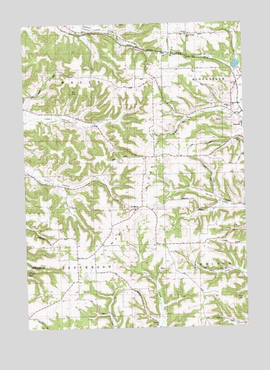
Saint Marys, WI USGS Topographic Map
Click on map above to begin viewing in our Map Viewer.

This topographic map contains these locations and features:
Feature Name Type Latitude Longitude GNIS ID View Map
0.6 ReservoirReservoirN43.8100°W90.6451°1793564View Map
Bohn SchoolSchoolN43.8555°W90.6699°1562026View Map
Catholic CemeteryCemeteryN43.8402°W90.6326°1846195View Map
Cook Valley SchoolSchoolN43.7727°W90.6315°1563344View Map
Farmers Valley SchoolSchoolN43.8711°W90.7065°1564864View Map
Haldeman G5500 DamDamN43.8100°W90.6451°1793563View Map
Leon Valley SchoolSchoolN43.8386°W90.7351°1567980View Map
McCrary Lake 4.61ReservoirN43.8533°W90.6268°1793087View Map
Number Three TunnelTunnelN43.8622°W90.6624°1575718View Map
Oak Grove SchoolSchoolN43.8239°W90.6757°1570627View Map
Pilgrims Home CemeteryCemeteryN43.8411°W90.6326°1846260View Map
Red RockSummitN43.8472°W90.7226°1846268View Map
Saint Jacobs CemeteryCemeteryN43.8266°W90.6273°1846271View Map
Saint Johns ChurchChurchN43.8700°W90.6562°1573090View Map
Saint MarysPopulated PlaceN43.7980°W90.6874°1577807View Map
Saint Marys RidgeRidgeN43.7875°W90.7029°1573328View Map
Summit RidgeRidgeN43.8555°W90.6746°1846301View Map
Summit Ridge CemeteryCemeteryN43.8697°W90.6573°1846302View Map
Thompson SchoolSchoolN43.7686°W90.7210°1575387View Map
Town of JeffersonCivilN43.7697°W90.7293°1583453View Map
Town of WellsCivilN43.8561°W90.7308°1584395View Map
Tri Creek Number One 3WR1378 DamDamN43.8533°W90.6268°1793086View Map
Village of NorwalkCivilN43.8342°W90.6269°1583832View Map
Wells Town HallBuildingN43.8530°W90.7135°1576419View Map

Note: Coordinates in the location and feature list above are referenced to NAD83 datum.


Copyright (C) 2008-2025 Ryan Niemi / Sunset Dynamics ... All Rights Reserved