TopoQuest Logo
Do you find TopoQuest useful?
Help keep TopoQuest running and adding new maps/features by donating!
Bitcoin:  19c7KJd3qBynnjoSw5npx9KScwjBe4ifkT
Litecoin:  LXs6TkuXGGXo1vDsWCkWVdjQX94eUKd6ui
Home View Maps Find Maps Find Places Resources & Links


Shivers, Mississippi Topographic Map

USGS Map Title: Shivers, MS
USGS Map MRC: 31089G8
DRG (GeoTIFF) Download: o31089g8.tif


Neighboring USGS Topographic Map Quads:


  Harrisville, MS  
31090H1
 

  Mendenhall West, MS  
31089H8
 

  Mendenhall East, MS  
31089H7
 

  Schley, MS  
31090G1
 

  Shivers, MS  
31089G8
 

  Mendenhall SE, MS  
31089G7
 

  Monticello NE, MS  
31090F1
 

  New Hebron, MS  
31089F8
 

  Mount Carmel, MS  
31089F7


Map MRC Location:

N32°
W90°
N32°
W89°
H8 H7 H6 H5 H4 H3 H2 H1
G8 G7 G6 G5 G4 G3 G2 G1
F8 F7 F6 F5 F4 F3 F2 F1
E8 E7 E6 E5 E4 E3 E2 E1
D8 D7 D6 D5 D4 D3 D2 D1
C8 C7 C6 C5 C4 C3 C2 C1
B8 B7 B6 B5 B4 B3 B2 B1
A8 A7 A6 A5 A4 A3 A2 A1
N31°
W90°
N31°
W89°

Shivers, MS USGS 1:24K Topographic Map Preview:
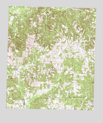
Shivers, MS USGS Topographic Map
Click on map above to begin viewing in our Map Viewer.

This topographic map contains these locations and features:
Feature Name Type Latitude Longitude GNIS ID View Map
Ashley Mill (historical)LocaleN31.8296°W89.9123°685109View Map
Berry CemeteryCemeteryN31.7593°W89.8851°691307View Map
BogganPopulated PlaceN31.7949°W89.8790°685112View Map
Boggan CemeteryCemeteryN31.8724°W89.8912°667365View Map
Buck BranchStreamN31.8727°W89.9076°667725View Map
BushPopulated PlaceN31.8621°W89.9867°691740View Map
Dry Ridge CemeteryCemeteryN31.7946°W89.8773°1805882View Map
Dry Ridge ChurchChurchN31.7952°W89.8776°669458View Map
Dupre FarmsLocaleN31.8183°W89.8794°2674585View Map
Grubbs CemeteryCemeteryN31.8388°W89.8848°670759View Map
GwinvillePopulated PlaceN31.7516°W89.8992°691912View Map
Hale BranchStreamN31.8727°W89.9179°670826View Map
Hank Harris Lake DamDamN31.8235°W89.8934°680907View Map
Hermitage (historical)LocaleN31.8288°W89.9120°685143View Map
James ChapelChurchN31.7882°W89.9623°671801View Map
Middle Prong Silver CreekStreamN31.7532°W89.9704°673533View Map
Moore BranchStreamN31.8710°W89.9237°673771View Map
Newsom School (historical)SchoolN31.7566°W89.9520°689754View Map
Oak Grove CemeteryCemeteryN31.8327°W89.9023°675010View Map
Oak Grove ChurchChurchN31.8296°W89.8990°675031View Map
Owens CemeteryCemeteryN31.7893°W89.9876°675349View Map
Pilgrim Rest ChurchChurchN31.8702°W89.9590°675745View Map
Pinola CemeteryCemeteryN31.8724°W89.9584°675922View Map
Pinola Volunteer Fire Department Station 2BuildingN31.8232°W89.8899°2667989View Map
Rose Hill CemeteryCemeteryN31.8488°W89.9581°676846View Map
Rose Hill ChurchChurchN31.8315°W89.9615°676856View Map
Saint Mary CemeteryCemeteryN31.7552°W89.9406°691308View Map
ShiversPopulated PlaceN31.7966°W89.9876°677728View Map
Shivers CemeteryCemeteryN31.7779°W89.9879°677729View Map
Silverena School (historical)SchoolN31.7566°W89.8826°689775View Map
Stonewall Baptist ChurchChurchN31.8010°W89.9337°678315View Map
Stonewall CemeteryCemeteryN31.8018°W89.9329°1959825View Map
Strong River Baptist ChurchChurchN31.8635°W89.9942°678370View Map
Strong River CemeteryCemeteryN31.8640°W89.9945°1959826View Map
Supervisor District 4CivilN31.8378°W89.9802°712068View Map
WestvillePopulated PlaceN31.8663°W89.9412°685187View Map
Westville CemeteryCemeteryN31.8677°W89.9451°679547View Map

Note: Coordinates in the location and feature list above are referenced to NAD83 datum.


Copyright (C) 2008-2025 Ryan Niemi / Sunset Dynamics ... All Rights Reserved