TopoQuest Logo
Do you find TopoQuest useful?
Help keep TopoQuest running and adding new maps/features by donating!
Bitcoin:  19c7KJd3qBynnjoSw5npx9KScwjBe4ifkT
Litecoin:  LXs6TkuXGGXo1vDsWCkWVdjQX94eUKd6ui
Home View Maps Find Maps Find Places Resources & Links


Mendenhall West, Mississippi Topographic Map

USGS Map Title: Mendenhall West, MS
USGS Map MRC: 31089H8
DRG (GeoTIFF) Download: o31089h8.tif


Neighboring USGS Topographic Map Quads:


  Star, MS  
32090A1
 

  Braxton, MS  
32089A8
 

  Puckett, MS  
32089A7
 

  Harrisville, MS  
31090H1
 

  Mendenhall West, MS  
31089H8
 

  Mendenhall East, MS  
31089H7
 

  Schley, MS  
31090G1
 

  Shivers, MS  
31089G8
 

  Mendenhall SE, MS  
31089G7


Map MRC Location:

N32°
W90°
N32°
W89°
H8 H7 H6 H5 H4 H3 H2 H1
G8 G7 G6 G5 G4 G3 G2 G1
F8 F7 F6 F5 F4 F3 F2 F1
E8 E7 E6 E5 E4 E3 E2 E1
D8 D7 D6 D5 D4 D3 D2 D1
C8 C7 C6 C5 C4 C3 C2 C1
B8 B7 B6 B5 B4 B3 B2 B1
A8 A7 A6 A5 A4 A3 A2 A1
N31°
W90°
N31°
W89°

Mendenhall West, MS USGS 1:24K Topographic Map Preview:
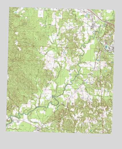
Mendenhall West, MS USGS Topographic Map
Click on map above to begin viewing in our Map Viewer.

This topographic map contains these locations and features:
Feature Name Type Latitude Longitude GNIS ID View Map
Adams Egg Farm Lagoon DamDamN31.8835°W89.9851°680928View Map
Allen CreekStreamN31.9010°W89.9623°666211View Map
Bishop CemeteryCemeteryN31.8827°W89.9551°667186View Map
Boggan BranchStreamN31.8771°W89.8992°667364View Map
Boggan School (historical)SchoolN31.8982°W89.8804°685113View Map
Cable BridgeBridgeN31.9007°W89.9626°685117View Map
Camp MondaminLocaleN31.8854°W89.9967°667983View Map
D Lo Post OfficePost OfficeN31.9839°W89.9018°2768757View Map
D'LoPopulated PlaceN31.9857°W89.9012°669070View Map
D'Lo CemeteryCemeteryN31.9868°W89.9031°1959801View Map
Dabbs CreekStreamN31.9654°W89.9104°669071View Map
Fellowship ChurchChurchN31.9279°W89.8906°669935View Map
Gowan BranchStreamN31.9463°W89.9148°670558View Map
Gullage Lake DamDamN31.9918°W89.9134°680974View Map
Harper SchoolSchoolN31.9618°W89.8809°670959View Map
Harrigan BranchStreamN31.9152°W89.9031°670964View Map
Indian CreekStreamN31.9946°W89.8767°671684View Map
Jones BranchStreamN31.9346°W89.9165°671959View Map
Jupiter ChurchChurchN31.9563°W89.9345°672064View Map
Mendenhall Bible ChurchChurchN31.9585°W89.8787°685154View Map
MeritPopulated PlaceN31.9279°W89.9087°692068View Map
Merit CemeteryCemeteryN31.9252°W89.9031°673495View Map
Merit Oil and Gas FieldOilfieldN31.9254°W89.9073°673496View Map
Mississippi No Name 35 DamDamN31.9652°W89.8834°680963View Map
Nazareth Baptist ChurchChurchN31.9604°W89.8787°685161View Map
Needham CreekStreamN31.9565°W89.9420°674539View Map
PinolaPopulated PlaceN31.8771°W89.9620°675921View Map
Pinola Attendance Center (historical)SchoolN31.8824°W89.9623°708952View Map
Pinola Post OfficePost OfficeN31.8785°W89.9619°2768814View Map
Pinola Volunteer Fire Department Station 1BuildingN31.8768°W89.9612°2667990View Map
Pleasant Valley ChurchChurchN31.9199°W89.9156°676137View Map
Rials CreekStreamN31.9315°W89.9195°676620View Map
Riverside ChapelChurchN31.8774°W89.9609°685175View Map
Sanders CreekStreamN31.9115°W89.9442°677359View Map
Scotts BridgeBridgeN31.9340°W89.9167°685181View Map
Sellers CreekStreamN31.9768°W89.8937°677508View Map
Shallow ChurchChurchN31.9602°W89.9306°677606View Map
Simpson CountyCivilN31.9132°W89.9195°695784View Map
Simpson General HospitalHospitalN31.9690°W89.8865°707314View Map
Smith BranchStreamN31.9021°W89.9423°677892View Map
Tanyard CreekStreamN31.8765°W89.9454°678568View Map
Town of D'LoCivilN31.9870°W89.9011°2406380View Map
Westville CreekStreamN31.8954°W89.9723°679548View Map

Note: Coordinates in the location and feature list above are referenced to NAD83 datum.


Copyright (C) 2008-2025 Ryan Niemi / Sunset Dynamics ... All Rights Reserved