TopoQuest Logo
Do you find TopoQuest useful?
Help keep TopoQuest running and adding new maps/features by donating!
Bitcoin:  19c7KJd3qBynnjoSw5npx9KScwjBe4ifkT
Litecoin:  LXs6TkuXGGXo1vDsWCkWVdjQX94eUKd6ui
Home View Maps Find Maps Find Places Resources & Links


Meredith, Colorado Topographic Map

USGS Map Title: Meredith, CO
USGS Map MRC: 39106C6
DRG (GeoTIFF) Download: o39106c6.tif


Neighboring USGS Topographic Map Quads:


  Red Creek, CO  
39106D7
 

  Crooked Creek Pass, CO  
39106D6
 

  Mount Jackson, CO  
39106D5
 

  Ruedi Reservoir, CO  
39106C7
 

  Meredith, CO  
39106C6
 

  Nast, CO  
39106C5
 

  Aspen, CO  
39106B7
 

  Thimble Rock, CO  
39106B6
 

  Mount Champion, CO  
39106B5


Map MRC Location:

N40°
W107°
N40°
W106°
H8 H7 H6 H5 H4 H3 H2 H1
G8 G7 G6 G5 G4 G3 G2 G1
F8 F7 F6 F5 F4 F3 F2 F1
E8 E7 E6 E5 E4 E3 E2 E1
D8 D7 D6 D5 D4 D3 D2 D1
C8 C7 C6 C5 C4 C3 C2 C1
B8 B7 B6 B5 B4 B3 B2 B1
A8 A7 A6 A5 A4 A3 A2 A1
N39°
W107°
N39°
W106°

Meredith, CO USGS 1:24K Topographic Map Preview:
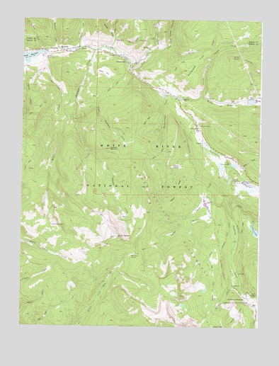
Meredith, CO USGS Topographic Map
Click on map above to begin viewing in our Map Viewer.

This topographic map contains these locations and features:
Feature Name Type Latitude Longitude GNIS ID View Map
Basalt and Rural Fire Protection District Station 43BuildingN39.3623°W106.7076°2735540View Map
Bessie ParkFlatN39.3533°W106.7075°179744View Map
BiglowPopulated PlaceN39.3436°W106.6673°197215View Map
Chapman CampgroundLocaleN39.3086°W106.6370°179753View Map
Chapman DamDamN39.3164°W106.6406°179752View Map
Chapman GulchValleyN39.3042°W106.6375°169580View Map
Chapman LakeLakeN39.2895°W106.6277°179757View Map
Chapman ReservoirReservoirN39.3160°W106.6389°199401View Map
Chapman TrailTrailN39.2855°W106.6425°179758View Map
Conroy GulchValleyN39.3559°W106.7484°179720View Map
Country Boy MineMineN39.3000°W106.7006°1735961View Map
Crowley PointSummitN39.3719°W106.7114°2496981View Map
Cyclone MountainSummitN39.3222°W106.7039°179740View Map
Deadman CreekStreamN39.3625°W106.7125°179735View Map
Dearhamer CampgroundLocaleN39.3611°W106.7378°197214View Map
Deeds CreekStreamN39.3228°W106.6542°179756View Map
Diamond J RanchLocaleN39.3447°W106.6770°179747View Map
Foster GulchValleyN39.2938°W106.6526°179738View Map
Fryingpan Group MineMineN39.2817°W106.7025°1684270View Map
Fryingpan-Arkansaw South Side Collection SystemLocaleN39.2608°W106.6373°179761View Map
Himmelland DamDamN39.3417°W106.6323°199406View Map
Himmelland ReservoirReservoirN39.3421°W106.6301°199407View Map
Jakeman CreekStreamN39.3630°W106.7211°179477View Map
Lamont PastureFlatN39.3153°W106.6695°179742View Map
Last Chance CreekStreamN39.3430°W106.6570°179506View Map
Lime CreekStreamN39.3542°W106.6936°179469View Map
Lime Creek CanyonValleyN39.3628°W106.6798°179470View Map
Little Deadman CreekStreamN39.3428°W106.7217°179733View Map
MeredithPopulated PlaceN39.3630°W106.7300°179732View Map
Meredith Forest Service FacilityLocaleN39.3594°W106.7381°197213View Map
Meredith MineMineN39.3555°W106.7386°1684271View Map
Meredith Post OfficePost OfficeN39.3623°W106.7299°2734631View Map
Meredith Post Office (historical)Post OfficeN39.3630°W106.7300°2026919View Map
Middle GulchValleyN39.3689°W106.7031°179475View Map
Miller CreekStreamN39.3611°W106.7398°179734View Map
Montgomery FlatsFlatN39.3575°W106.6589°179748View Map
Mount YeckelSummitN39.2869°W106.6998°179737View Map
Muckawanago CreekStreamN39.3458°W106.6789°179743View Map
Nelson GulchValleyN39.3663°W106.7032°179746View Map
NorriePopulated PlaceN39.3247°W106.6556°179751View Map
Norrie Census Designated PlaceCensusN39.3281°W106.6563°2583272View Map
Norrrie Guard StationLocaleN39.3322°W106.6575°179750View Map
North Fork Fryingpan RiverStreamN39.3439°W106.6723°179749View Map
Riley MountainSummitN39.3308°W106.6942°196447View Map
Sawmill ParkFlatN39.2794°W106.6920°179736View Map
Sawyer CreekStreamN39.2689°W106.6359°179763View Map
Sawyer Creek ConduitCanalN39.2642°W106.6348°179760View Map
Sawyer Lake TrailTrailN39.2694°W106.6486°179759View Map
Sellar CreekStreamN39.3167°W106.6425°179755View Map
Silver CreekStreamN39.3628°W106.6764°179471View Map
Spring CreekStreamN39.3628°W106.6806°179473View Map
Suicide GulchValleyN39.3636°W106.7046°179476View Map
Teetum RidgeRidgeN39.3055°W106.6673°179741View Map
ThomasvillePopulated PlaceN39.3603°W106.7025°179745View Map
Twin MeadowsFlatN39.3003°W106.6525°179754View Map
Two by Four CreekStreamN39.3625°W106.7403°179432View Map
Waterbury CreekStreamN39.3630°W106.7320°179474View Map
Wellington MineMineN39.3200°W106.7006°1735960View Map

Note: Coordinates in the location and feature list above are referenced to NAD83 datum.


Copyright (C) 2008-2024 Ryan Niemi / Sunset Dynamics ... All Rights Reserved