TopoQuest Logo
Do you find TopoQuest useful?
Help keep TopoQuest running and adding new maps/features by donating!
Bitcoin:  19c7KJd3qBynnjoSw5npx9KScwjBe4ifkT
Litecoin:  LXs6TkuXGGXo1vDsWCkWVdjQX94eUKd6ui
Home View Maps Find Maps Find Places Resources & Links


Miccosukee, Florida Topographic Map

USGS Map Title: Miccosukee, FL
USGS Map MRC: 30084E1
DRG (GeoTIFF) Download: o30084e1.tif


Neighboring USGS Topographic Map Quads:


  Beachton, GA  
30084F2
 

  Miccosukee NE, GA  
30084F1
 

  Metcalf, GA  
30083F8
 

  Bradfordville, FL  
30084E2
 

  Miccosukee, FL  
30084E1
 

  Lake Miccosukee, FL  
30083E8
 

  Lafayette, FL  
30084D2
 

  Lloyd, FL  
30084D1
 

  Waukeenah, FL  
30083D8


Map MRC Location:

N31°
W85°
N31°
W84°
H8 H7 H6 H5 H4 H3 H2 H1
G8 G7 G6 G5 G4 G3 G2 G1
F8 F7 F6 F5 F4 F3 F2 F1
E8 E7 E6 E5 E4 E3 E2 E1
D8 D7 D6 D5 D4 D3 D2 D1
C8 C7 C6 C5 C4 C3 C2 C1
B8 B7 B6 B5 B4 B3 B2 B1
A8 A7 A6 A5 A4 A3 A2 A1
N30°
W85°
N30°
W84°

Miccosukee, FL USGS 1:24K Topographic Map Preview:
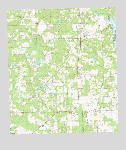
Miccosukee, FL USGS Topographic Map
Click on map above to begin viewing in our Map Viewer.

This topographic map contains these locations and features:
Feature Name Type Latitude Longitude GNIS ID View Map
Alberta LakeLakeN30.6098°W84.0642°277729View Map
Alligator PondLakeN30.5972°W84.0199°277806View Map
BaumPopulated PlaceN30.5141°W84.0802°294667View Map
Beer Can PondLakeN30.5952°W84.0218°278401View Map
Black CreekPopulated PlaceN30.5083°W84.0882°295135View Map
Black Creek Pass AirportAirportN30.5007°W84.0778°2676695View Map
Centenary ChurchChurchN30.6183°W84.1091°280234View Map
Cody PondLakeN30.5493°W84.0812°280626View Map
ConcordPopulated PlaceN30.5638°W84.0454°295214View Map
Concord SchoolSchoolN30.5813°W84.0421°280707View Map
Drag Line Pond (historical)LakeN30.6044°W84.0304°281746View Map
Dry CreekStreamN30.6183°W84.0116°293994View Map
East Leon DivisionCivilN30.5269°W84.1007°1935749View Map
Emma Lee PondReservoirN30.6144°W84.0528°282202View Map
FelkelPopulated PlaceN30.5971°W84.1177°294763View Map
Gum PondReservoirN30.5469°W84.0868°283544View Map
Halls CemeteryCemeteryN30.6180°W84.0410°283633View Map
Hammock SinkBasinN30.6105°W84.0891°283662View Map
Harolds PondReservoirN30.5900°W84.0390°283752View Map
Homestead RidgePopulated PlaceN30.5016°W84.1202°295356View Map
Indian Springs ChurchChurchN30.5446°W84.0446°284537View Map
Ingalls FieldAirportN30.5862°W84.0215°2676710View Map
Lake LonnieReservoirN30.5997°W84.0331°286090View Map
Lake LouiseLakeN30.5743°W84.0253°286145View Map
Long PondLakeN30.5166°W84.0413°286057View Map
MiccosukeePopulated PlaceN30.5946°W84.0413°286769View Map
Miccosukee CemeteryCemeteryN30.5927°W84.0549°286770View Map
Micosukee Lookout TowerTowerN30.5946°W84.0368°301649View Map
Moccasin GapGapN30.6026°W84.1178°287037View Map
Mount Sinai ChurchChurchN30.5294°W84.0227°287318View Map
New Jerusalem ChurchChurchN30.5219°W84.0279°287656View Map
Old PondLakeN30.5978°W84.0314°288107View Map
PeckPopulated PlaceN30.5399°W84.0916°295528View Map
Runner CemeteryCemeteryN30.5441°W84.0141°290054View Map
Saint Pauls ChurchChurchN30.6244°W84.0121°290365View Map
Sanders Hammock PondSwampN30.5926°W84.0926°290593View Map
Shady Grove ChurchChurchN30.5863°W84.1232°301650View Map
Shemonie LakeReservoirN30.5394°W84.0724°290998View Map
Spring Head PondLakeN30.5978°W84.0375°291534View Map
Straw PondLakeN30.6049°W84.0831°291743View Map
Sunset PondLakeN30.6230°W84.0553°291880View Map
WadesboroPopulated PlaceN30.5052°W84.0657°294962View Map
Windy Hill FarmLocaleN30.5194°W84.0311°2558862View Map

Note: Coordinates in the location and feature list above are referenced to NAD83 datum.


Copyright (C) 2008-2025 Ryan Niemi / Sunset Dynamics ... All Rights Reserved