TopoQuest Logo
Do you find TopoQuest useful?
Help keep TopoQuest running and adding new maps/features by donating!
Bitcoin:  19c7KJd3qBynnjoSw5npx9KScwjBe4ifkT
Litecoin:  LXs6TkuXGGXo1vDsWCkWVdjQX94eUKd6ui
Home View Maps Find Maps Find Places Resources & Links


Michie, Tennessee Topographic Map

USGS Map Title: Michie, TN
USGS Map MRC: 35088A4
DRG (GeoTIFF) Download: o35088a4.tif


Neighboring USGS Topographic Map Quads:


  Purdy, TN  
35088B5
 

  Stantonville, TN  
35088B4
 

  Pittsburg Landing, TN  
35088B3
 

  Guys, TN  
35088A5
 

  Michie, TN  
35088A4
 

  Counce, TN  
35088A3
 

  Corinth, MS  
34088H5
 

  Kendrick, MS  
34088H4
 

  Doskie, MS  
34088H3


Map MRC Location:

N36°
W89°
N36°
W88°
H8 H7 H6 H5 H4 H3 H2 H1
G8 G7 G6 G5 G4 G3 G2 G1
F8 F7 F6 F5 F4 F3 F2 F1
E8 E7 E6 E5 E4 E3 E2 E1
D8 D7 D6 D5 D4 D3 D2 D1
C8 C7 C6 C5 C4 C3 C2 C1
B8 B7 B6 B5 B4 B3 B2 B1
A8 A7 A6 A5 A4 A3 A2 A1
N35°
W89°
N35°
W88°

Michie, TN USGS 1:24K Topographic Map Preview:
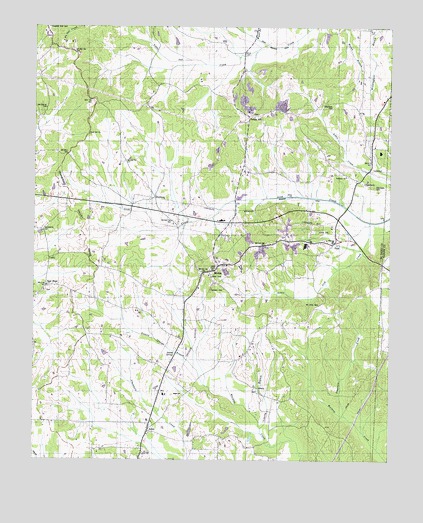
Michie, TN USGS Topographic Map
Click on map above to begin viewing in our Map Viewer.

This topographic map contains these locations and features:
Feature Name Type Latitude Longitude GNIS ID View Map
ActonPopulated PlaceN35.0081°W88.4595°1275443View Map
Acton Church of ChristChurchN35.0073°W88.4595°1701064View Map
Atkins Mill (historical)LocaleN35.0565°W88.3903°1642914View Map
Brooks School (historical)SchoolN35.1240°W88.3870°1308641View Map
CaffeyPopulated PlaceN35.0581°W88.4948°1314779View Map
Carter CemeteryCemeteryN35.0662°W88.4003°1279783View Map
ChambersPopulated PlaceN35.0806°W88.3859°1280205View Map
Chambers CemeteryCemeteryN35.0787°W88.3806°1305842View Map
Chambers CemeteryCemeteryN35.1020°W88.3953°1280210View Map
Church of God of ProphecyChurchN35.0568°W88.4295°1308647View Map
Commissioner District 7CivilN35.0835°W88.4362°2464628View Map
Donald SpringsSpringN35.0310°W88.4500°1282631View Map
Donald Springs BranchStreamN35.0215°W88.4400°1282632View Map
Lebanon CemeteryCemeteryN35.0987°W88.3914°1308681View Map
Lebanon ChurchChurchN35.0820°W88.3906°1290905View Map
LibertyPopulated PlaceN35.0198°W88.4206°1315383View Map
Liberty BranchStreamN35.0093°W88.4198°1291108View Map
Liberty CemeteryCemeteryN35.0204°W88.4209°1308683View Map
Liberty ChurchChurchN35.0195°W88.4209°1308685View Map
Liberty School (historical)SchoolN35.0206°W88.4212°1308686View Map
Little Lick CreekStreamN35.0687°W88.3823°1291559View Map
Little Owl CreekStreamN35.1201°W88.4189°1291600View Map
McCullar Church (historical)ChurchN35.0306°W88.4862°1308694View Map
MichiePopulated PlaceN35.0562°W88.4353°1293644View Map
Michie Division (historical)CensusN35.0770°W88.4242°1648847View Map
Michie Elementary SchoolSchoolN35.0693°W88.4342°1308700View Map
Michie First Baptist ChurchChurchN35.0565°W88.4328°1320097View Map
Michie Post OfficePost OfficeN35.0543°W88.4380°2767907View Map
Michie Volunteer Fire and RescueBuildingN35.0569°W88.4342°2653708View Map
Moore School (historical)SchoolN35.1234°W88.4475°1308703View Map
Mount Olive CemeteryCemeteryN35.0451°W88.3995°1294691View Map
Mount Olivet Church (historical)ChurchN35.0459°W88.3995°1642917View Map
NeedmorePopulated PlaceN35.0759°W88.4578°1295303View Map
New HopePopulated PlaceN35.0504°W88.4953°1295503View Map
New Hope CemeteryCemeteryN35.0484°W88.4959°1308717View Map
New Hope ChurchChurchN35.0487°W88.4964°1308718View Map
New Hope School (historical)SchoolN35.0484°W88.4967°1308719View Map
Pebble HillPopulated PlaceN35.0993°W88.4250°1297092View Map
Pebble Hill CemeteryCemeteryN35.0995°W88.4228°1308725View Map
Pebble Hill ChurchChurchN35.0990°W88.4228°1308726View Map
Pebble Hill School (historical)SchoolN35.1034°W88.4298°1308727View Map
Rushing School (historical)SchoolN35.0779°W88.4598°1308739View Map
Sand Hill CemeteryCemeteryN35.0937°W88.4806°1308740View Map
Sand Hill ChurchChurchN35.0940°W88.4812°1300667View Map
Sand Hill School (historical)SchoolN35.1018°W88.4956°1308741View Map
Sanders CemeteryCemeteryN35.0492°W88.4381°1300686View Map
Sharp BranchStreamN35.0154°W88.4248°1308745View Map
Singleton CreekStreamN35.0129°W88.3900°1270365View Map
Spring BranchStreamN35.1240°W88.4273°1271056View Map
Town of MichieCivilN35.0603°W88.4257°2406154View Map
TuluPopulated PlaceN35.0629°W88.3939°1272968View Map
Wyatt BranchStreamN35.1218°W88.4228°1275194View Map

Note: Coordinates in the location and feature list above are referenced to NAD83 datum.


Copyright (C) 2008-2024 Ryan Niemi / Sunset Dynamics ... All Rights Reserved