TopoQuest Logo
Do you find TopoQuest useful?
Help keep TopoQuest running and adding new maps/features by donating!
Bitcoin:  19c7KJd3qBynnjoSw5npx9KScwjBe4ifkT
Litecoin:  LXs6TkuXGGXo1vDsWCkWVdjQX94eUKd6ui
Home View Maps Find Maps Find Places Resources & Links


Midway, Ohio Topographic Map

USGS Map Title: Midway, OH
USGS Map MRC: 39083F4
DRG (GeoTIFF) Download: o39083f4.tif


Neighboring USGS Topographic Map Quads:


  Florence, OH  
39083G5
 

  Walnut Run, OH  
39083G4
 

  Big Plain, OH  
39083G3
 

  Jeffersonville, OH  
39083F5
 

  Midway, OH  
39083F4
 

  Mount Sterling, OH  
39083F3
 

  Milledgeville, OH  
39083E5
 

  Washington Court House, OH  
39083E4
 

  New Holland, OH  
39083E3


Map MRC Location:

N40°
W84°
N40°
W83°
H8 H7 H6 H5 H4 H3 H2 H1
G8 G7 G6 G5 G4 G3 G2 G1
F8 F7 F6 F5 F4 F3 F2 F1
E8 E7 E6 E5 E4 E3 E2 E1
D8 D7 D6 D5 D4 D3 D2 D1
C8 C7 C6 C5 C4 C3 C2 C1
B8 B7 B6 B5 B4 B3 B2 B1
A8 A7 A6 A5 A4 A3 A2 A1
N39°
W84°
N39°
W83°

Midway, OH USGS 1:24K Topographic Map Preview:
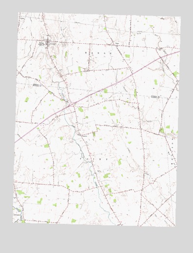
Midway, OH USGS Topographic Map
Click on map above to begin viewing in our Map Viewer.

This topographic map contains these locations and features:
Feature Name Type Latitude Longitude GNIS ID View Map
BethelPopulated PlaceN39.7303°W83.3935°1054068View Map
Bethel CemeteryCemeteryN39.7303°W83.3905°1037908View Map
Bethel Methodist Episcopal Church (historical)ChurchN39.7306°W83.3933°1068981View Map
Bock FarmsLocaleN39.7486°W83.4377°2729983View Map
Brock DitchCanalN39.6734°W83.4896°1065937View Map
Counts CemeteryCemeteryN39.7159°W83.4680°1039398View Map
Dews DitchCanalN39.6284°W83.3835°1039693View Map
Interchange 75CrossingN39.6962°W83.4560°1080260View Map
MidwayPopulated PlaceN39.7334°W83.4777°1057845View Map
Midway Elementary SchoolSchoolN39.7314°W83.4774°1054069View Map
RangePopulated PlaceN39.7320°W83.4246°1070908View Map
Range CemeteryCemeteryN39.7320°W83.4649°1068829View Map
Range Post Office (historical)Post OfficeN39.7320°W83.4249°2030250View Map
Range Township Fire DepartmentBuildingN39.7336°W83.4766°2549761View Map
Stardust DairyLocaleN39.7072°W83.4936°2703619View Map
Township of PaintCivilN39.6534°W83.4484°1086092View Map
Township of RangeCivilN39.7428°W83.4160°1086551View Map
Union Chapel CemeteryCemeteryN39.6790°W83.4506°1055157View Map
Union Chapel Methodist ChurchChurchN39.6792°W83.4510°1070971View Map
Vallery DitchCanalN39.7420°W83.4908°1047393View Map
Vesey CemeteryCemeteryN39.6571°W83.4335°1070975View Map
Village of MidwayCivilN39.7330°W83.4764°2399339View Map
William Cathcart DitchCanalN39.7389°W83.4660°1047921View Map
YatesvillePopulated PlaceN39.6778°W83.4494°1063106View Map
Yatesville Post Office (historical)Post OfficeN39.6778°W83.4499°1985481View Map

Note: Coordinates in the location and feature list above are referenced to NAD83 datum.


Copyright (C) 2008-2025 Ryan Niemi / Sunset Dynamics ... All Rights Reserved