TopoQuest Logo
Do you find TopoQuest useful?
Help keep TopoQuest running and adding new maps/features by donating!
Bitcoin:  19c7KJd3qBynnjoSw5npx9KScwjBe4ifkT
Litecoin:  LXs6TkuXGGXo1vDsWCkWVdjQX94eUKd6ui
Home View Maps Find Maps Find Places Resources & Links


Mount Sterling, Ohio Topographic Map

USGS Map Title: Mount Sterling, OH
USGS Map MRC: 39083F3
DRG (GeoTIFF) Download: o39083f3.tif


Neighboring USGS Topographic Map Quads:


  Walnut Run, OH  
39083G4
 

  Big Plain, OH  
39083G3
 

  Harrisburg, OH  
39083G2
 

  Midway, OH  
39083F4
 

  Mount Sterling, OH  
39083F3
 

  Five Points, OH  
39083F2
 

  Washington Court House, OH  
39083E4
 

  New Holland, OH  
39083E3
 

  Clarksburg, OH  
39083E2


Map MRC Location:

N40°
W84°
N40°
W83°
H8 H7 H6 H5 H4 H3 H2 H1
G8 G7 G6 G5 G4 G3 G2 G1
F8 F7 F6 F5 F4 F3 F2 F1
E8 E7 E6 E5 E4 E3 E2 E1
D8 D7 D6 D5 D4 D3 D2 D1
C8 C7 C6 C5 C4 C3 C2 C1
B8 B7 B6 B5 B4 B3 B2 B1
A8 A7 A6 A5 A4 A3 A2 A1
N39°
W84°
N39°
W83°

Mount Sterling, OH USGS 1:24K Topographic Map Preview:
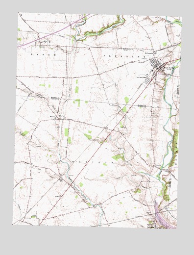
Mount Sterling, OH USGS Topographic Map
Click on map above to begin viewing in our Map Viewer.

This topographic map contains these locations and features:
Feature Name Type Latitude Longitude GNIS ID View Map
Baldwin CemeteryCemeteryN39.7009°W83.3574°1037593View Map
Bostwick-Loofbourrow CemeteryCemeteryN39.6925°W83.2710°1071563View Map
Bradford CreekStreamN39.7342°W83.3310°1038250View Map
Bragg DitchCanalN39.6998°W83.3357°1038258View Map
Burr Oaks HeightsPopulated PlaceN39.7114°W83.2744°1056230View Map
ChenowethPopulated PlaceN39.7312°W83.3574°1056240View Map
Chenoweth Post Office (historical)Post OfficeN39.7306°W83.3583°2030231View Map
CookPopulated PlaceN39.6831°W83.3071°1070722View Map
Cook CemeteryCemeteryN39.6898°W83.3405°1039331View Map
Cook Post Office (historical)Post OfficeN39.6834°W83.3069°1985350View Map
Duffs ForkStreamN39.6528°W83.2632°1039855View Map
Galbreath DitchCanalN39.7459°W83.3377°1040743View Map
Leavell CemeteryCemeteryN39.6559°W83.2813°1042460View Map
Lick RunStreamN39.6303°W83.2657°1042547View Map
Long BranchStreamN39.6487°W83.2610°1042728View Map
Madison MillsPopulated PlaceN39.6537°W83.3396°1070830View Map
Madison Mills CemeteryCemeteryN39.6459°W83.3266°1042888View Map
Madison Mills Elementary SchoolSchoolN39.6492°W83.3330°1055153View Map
Madison Mills Post Office (historical)Post OfficeN39.6542°W83.3402°1985483View Map
Madison Mills United Methodist ChurchChurchN39.6481°W83.3305°1063488View Map
McClimansvillePopulated PlaceN39.7287°W83.2716°1056415View Map
Methodist CemeteryCemeteryN39.7178°W83.2635°1961343View Map
Mount SterlingPopulated PlaceN39.7195°W83.2652°1065077View Map
Mount Sterling Elementary SchoolSchoolN39.7192°W83.2680°1054067View Map
Mount Sterling Historic DistrictParkN39.7195°W83.2652°1069670View Map
Mount Sterling Post OfficePost OfficeN39.7201°W83.2652°2030271View Map
Mount Sterling United Methodist ChurchChurchN39.7181°W83.2638°1068823View Map
Mud RunStreamN39.7342°W83.3307°1043705View Map
Pleasant CemeteryCemeteryN39.7395°W83.2510°1044527View Map
Plumwood Mobile Home ParkPopulated PlaceN39.7297°W83.3331°2630804View Map
Sterling Joint Ambulance DistrictBuildingN39.7197°W83.2654°2550755View Map
Thompson CreekStreamN39.6676°W83.3407°1047034View Map
Township of MadisonCivilN39.6613°W83.3188°1086090View Map
Township of PleasantCivilN39.7471°W83.2904°1086550View Map
Tri - County Joint Fire District Station 491BuildingN39.7188°W83.2652°2550276View Map
Village of Mount SterlingCivilN39.7134°W83.2735°2399417View Map
Waterloo CemeteryCemeteryN39.6273°W83.2674°1070983View Map
White OakPopulated PlaceN39.6889°W83.3444°1056571View Map
White Oak Post Office (historical)Post OfficeN39.6889°W83.3444°1985480View Map
Wolf RunStreamN39.6556°W83.3349°1048049View Map
YankeetownPopulated PlaceN39.6615°W83.2682°1063105View Map
Yankeetown CemeteryCemeteryN39.6585°W83.2560°1961518View Map

Note: Coordinates in the location and feature list above are referenced to NAD83 datum.


Copyright (C) 2008-2025 Ryan Niemi / Sunset Dynamics ... All Rights Reserved