TopoQuest Logo
Do you find TopoQuest useful?
Help keep TopoQuest running and adding new maps/features by donating!
Bitcoin:  19c7KJd3qBynnjoSw5npx9KScwjBe4ifkT
Litecoin:  LXs6TkuXGGXo1vDsWCkWVdjQX94eUKd6ui
Home View Maps Find Maps Find Places Resources & Links


Simons Butte, Montana Topographic Map

USGS Map Title: Simons Butte, MT
USGS Map MRC: 46104G7
DRG (GeoTIFF) Download: o46104g7.tif


Neighboring USGS Topographic Map Quads:


  Marsh, MT  
46104H8
 

  Hoyt, MT  
46104H7
 

  Upper Magpie Reservoir, MT  
46104H6
 

  Marsh SW, MT  
46104G8
 

  Simons Butte, MT  
46104G7
 

  Graveyard Hill SW, MT  
46104G6
 

  Mildred, MT  
46104F8
 

  Mildred NE, MT  
46104F7
 

  Dorothy Draw, MT  
46104F6


Map MRC Location:

N47°
W105°
N47°
W104°
H8 H7 H6 H5 H4 H3 H2 H1
G8 G7 G6 G5 G4 G3 G2 G1
F8 F7 F6 F5 F4 F3 F2 F1
E8 E7 E6 E5 E4 E3 E2 E1
D8 D7 D6 D5 D4 D3 D2 D1
C8 C7 C6 C5 C4 C3 C2 C1
B8 B7 B6 B5 B4 B3 B2 B1
A8 A7 A6 A5 A4 A3 A2 A1
N46°
W105°
N46°
W104°

Simons Butte, MT USGS 1:24K Topographic Map Preview:
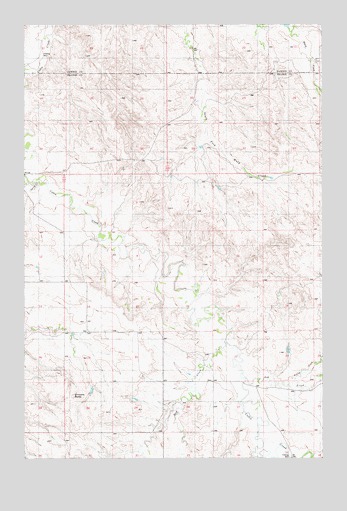
Simons Butte, MT USGS Topographic Map
Click on map above to begin viewing in our Map Viewer.

This topographic map contains these locations and features:
Feature Name Type Latitude Longitude GNIS ID View Map
12N54E01BA__01 WellWellN46.8286°W104.8725°818635View Map
12N54E12CD__01 WellWellN46.8033°W104.8725°818404View Map
12N54E13DC__01 WellWellN46.7889°W104.8672°818322View Map
12N54E25BBBD01 WellWellN46.7700°W104.8691°818185View Map
12N54E36AB__01 WellWellN46.7561°W104.8672°818115View Map
12N55E01BB__01 WellWellN46.8286°W104.7513°818634View Map
12N55E05CDAA01 WellWellN46.8189°W104.8294°818541View Map
12N55E08CC__01 WellWellN46.8033°W104.8355°818403View Map
12N55E15BC__01 WellWellN46.7961°W104.7936°818369View Map
12N55E16DB__01 WellWellN46.7925°W104.8039°818349View Map
12N55E18CA__01 WellWellN46.7925°W104.8514°818350View Map
12N55E20BC__01 WellWellN46.7814°W104.8355°818261View Map
12N55E20DCCD01 WellWellN46.7742°W104.8250°818217View Map
12N55E21DD__01 WellWellN46.7742°W104.7986°818216View Map
12N55E22BC__01 WellWellN46.7814°W104.7936°818260View Map
12N55E25BB__01 WellWellN46.7706°W104.7513°818194View Map
12N55E25BB__02 WellWellN46.7706°W104.7513°818195View Map
12N55E26BBCA01 WellWellN46.7697°W104.7739°818184View Map
12N55E26BC__01 WellWellN46.7670°W104.7725°818169View Map
12N55E27AB__01 WellWellN46.7706°W104.7830°818196View Map
12N55E27BADD01 WellWellN46.7681°W104.7852°818177View Map
12N55E28BD__01 WellWellN46.7670°W104.8091°818170View Map
12N55E29DD__01 WellWellN46.7597°W104.8197°818131View Map
12N55E30DA__01 WellWellN46.7633°W104.8408°818146View Map
12N55E32AA__01 WellWellN46.7561°W104.8197°818114View Map
12N55E33AC__01 WellWellN46.7525°W104.8039°818096View Map
12N55E35AC__01 WellWellN46.7525°W104.7619°818095View Map
13N54E22ACD_01 WellWellN46.8708°W104.8658°818972View Map
13N54E22CA__01 WellWellN46.8672°W104.8719°818943View Map
13N54E35ACAA01 WellWellN46.8422°W104.8427°818714View Map
13N55E20AA__01 WellWellN46.8742°W104.7750°818998View Map
13N55E20AA__02 WellWellN46.8742°W104.7750°818999View Map
13N55E21BB__01 WellWellN46.8742°W104.7697°818997View Map
13N55E21CC__01 WellWellN46.8633°W104.7697°818910View Map
13N55E28BB__01 WellWellN46.8597°W104.7697°818874View Map
13N55E28BB__02 WellWellN46.8597°W104.7697°818875View Map
13N55E30DBBA01 WellWellN46.8533°W104.8025°818811View Map
Ash CreekStreamN46.7745°W104.7844°799190View Map
Bossert School (historical)SchoolN46.8000°W104.8577°1715675View Map
Brost School (historical)SchoolN46.8006°W104.8691°1715677View Map
Brown CouleeValleyN46.8131°W104.8441°1715822View Map
Buckley School (historical)SchoolN46.7717°W104.8180°1715678View Map
Buckskin GulchValleyN46.7861°W104.7886°1715835View Map
Bull CouleeValleyN46.7872°W104.7889°1715836View Map
Cabin Creek Rural Fire DistrictBuildingN46.7766°W104.7988°2546542View Map
Crop Land CouleeValleyN46.7861°W104.8552°1715832View Map
Crow CouleeValleyN46.7986°W104.8075°1715825View Map
Gaub CreekStreamN46.8142°W104.8452°1715821View Map
Gulch OneValleyN46.8028°W104.8172°1715824View Map
Gulch TwoValleyN46.8083°W104.8319°1715823View Map
Hay CreekStreamN46.7772°W104.7872°772256View Map
North Fork Ash CreekStreamN46.7706°W104.7614°799191View Map
Red Barn CouleeValleyN46.7661°W104.7866°1715834View Map
Roehl CouleeValleyN46.8222°W104.8527°1715820View Map
Sand Butte CreekStreamN46.7875°W104.8750°1715833View Map
Simons ButteSummitN46.7681°W104.8547°799192View Map
Spring CreekStreamN46.8286°W104.8683°777047View Map
Strobel School (historical)SchoolN46.7728°W104.8005°1715738View Map
Valley School (historical)SchoolN46.8325°W104.7839°1715748View Map
West Fork Hay CreekStreamN46.7645°W104.8116°1715815View Map

Note: Coordinates in the location and feature list above are referenced to NAD83 datum.


Copyright (C) 2008-2025 Ryan Niemi / Sunset Dynamics ... All Rights Reserved