TopoQuest Logo
Do you find TopoQuest useful?
Help keep TopoQuest running and adding new maps/features by donating!
Bitcoin:  19c7KJd3qBynnjoSw5npx9KScwjBe4ifkT
Litecoin:  LXs6TkuXGGXo1vDsWCkWVdjQX94eUKd6ui
Home View Maps Find Maps Find Places Resources & Links


Mill Fork, Utah Topographic Map

USGS Map Title: Mill Fork, UT
USGS Map MRC: 39111H3
DRG (GeoTIFF) Download: o39111h3.tif


Neighboring USGS Topographic Map Quads:


  Billies Mountain, UT  
40111A4
 

  Rays Valley, UT  
40111A3
 

  Strawberry Reservoir SW, UT  
40111A2
 

  Thistle, UT  
39111H4
 

  Mill Fork, UT  
39111H3
 

  Tucker, UT  
39111H2
 

  Indianola, UT  
39111G4
 

  C Canyon, UT  
39111G3
 

  Scofield Reservoir, UT  
39111G2


Map MRC Location:

N40°
W112°
N40°
W111°
H8 H7 H6 H5 H4 H3 H2 H1
G8 G7 G6 G5 G4 G3 G2 G1
F8 F7 F6 F5 F4 F3 F2 F1
E8 E7 E6 E5 E4 E3 E2 E1
D8 D7 D6 D5 D4 D3 D2 D1
C8 C7 C6 C5 C4 C3 C2 C1
B8 B7 B6 B5 B4 B3 B2 B1
A8 A7 A6 A5 A4 A3 A2 A1
N39°
W112°
N39°
W111°

Mill Fork, UT USGS 1:24K Topographic Map Preview:
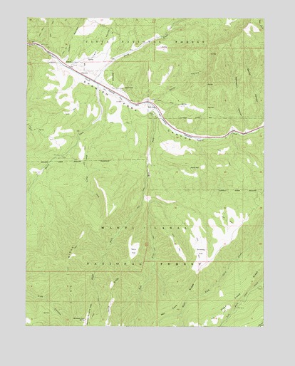
Mill Fork, UT USGS Topographic Map
Click on map above to begin viewing in our Map Viewer.

This topographic map contains these locations and features:
Feature Name Type Latitude Longitude GNIS ID View Map
Big RidgeRidgeN39.8975°W111.3530°1438725View Map
Clear Creek RidgeRidgeN39.8858°W111.2668°1439798View Map
Dairy ForkStreamN39.9730°W111.3377°1440231View Map
Dairy Fork Wildlife Management AreaParkN39.9658°W111.3507°1448320View Map
Davis HillSummitN39.9388°W111.2882°1440285View Map
Driveway FlatFlatN39.9052°W111.2838°1440556View Map
East Dairy ForkStreamN39.9594°W111.3371°1440778View Map
Garner CanyonValleyN39.9577°W111.2513°1441280View Map
Garner HollowValleyN39.9527°W111.2696°1451249View Map
Heslington CanyonValleyN39.9555°W111.2605°1441723View Map
Knoll HollowValleyN39.9827°W111.3568°1442349View Map
Left Fork Mill ForkStreamN39.9280°W111.3141°1442516View Map
Mill ForkPopulated PlaceN39.9638°W111.3080°1443443View Map
Mill ForkStreamN39.9655°W111.3118°1443444View Map
Mill Fork CemeteryCemeteryN39.9667°W111.3096°1448659View Map
Mill Fork RidgeRidgeN39.8772°W111.3068°1443450View Map
Mountain Lion SpringSpringN39.8776°W111.3445°1443642View Map
Mountain Lion Spring RidgeRidgeN39.8794°W111.3418°1443643View Map
NarrowsLocaleN39.9772°W111.3468°1443762View Map
Right Fork MillStreamN39.9280°W111.3138°1444941View Map
Sheep CreekStreamN39.9741°W111.3405°1445491View Map
Tank HollowValleyN39.9808°W111.3524°1446330View Map
Terry FlatFlatN39.9055°W111.3196°1446400View Map
Terry RidgeRidgeN39.8802°W111.3318°1446401View Map
Water HollowValleyN39.9663°W111.3099°1447053View Map
Wheeler Sawmill CanyonValleyN39.9561°W111.2675°2786354View Map

Note: Coordinates in the location and feature list above are referenced to NAD83 datum.


Copyright (C) 2008-2024 Ryan Niemi / Sunset Dynamics ... All Rights Reserved