TopoQuest Logo
Do you find TopoQuest useful?
Help keep TopoQuest running and adding new maps/features by donating!
Bitcoin:  19c7KJd3qBynnjoSw5npx9KScwjBe4ifkT
Litecoin:  LXs6TkuXGGXo1vDsWCkWVdjQX94eUKd6ui
Home View Maps Find Maps Find Places Resources & Links


C Canyon, Utah Topographic Map

USGS Map Title: C Canyon, UT
USGS Map MRC: 39111G3
DRG (GeoTIFF) Download: o39111g3.tif


Neighboring USGS Topographic Map Quads:


  Thistle, UT  
39111H4
 

  Mill Fork, UT  
39111H3
 

  Tucker, UT  
39111H2
 

  Indianola, UT  
39111G4
 

  C Canyon, UT  
39111G3
 

  Scofield Reservoir, UT  
39111G2
 

  Fairview, UT  
39111F4
 

  Fairview Lakes, UT  
39111F3
 

  Scofield, UT  
39111F2


Map MRC Location:

N40°
W112°
N40°
W111°
H8 H7 H6 H5 H4 H3 H2 H1
G8 G7 G6 G5 G4 G3 G2 G1
F8 F7 F6 F5 F4 F3 F2 F1
E8 E7 E6 E5 E4 E3 E2 E1
D8 D7 D6 D5 D4 D3 D2 D1
C8 C7 C6 C5 C4 C3 C2 C1
B8 B7 B6 B5 B4 B3 B2 B1
A8 A7 A6 A5 A4 A3 A2 A1
N39°
W112°
N39°
W111°

C Canyon, UT USGS 1:24K Topographic Map Preview:
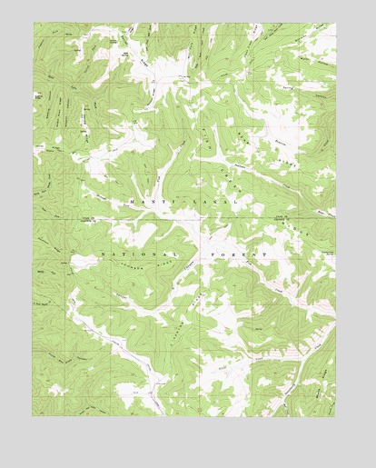
C Canyon, UT USGS Topographic Map
Click on map above to begin viewing in our Map Viewer.

This topographic map contains these locations and features:
Feature Name Type Latitude Longitude GNIS ID View Map
Bean RidgeRidgeN39.7589°W111.2574°1438436View Map
Bear RidgeRidgeN39.8286°W111.2649°1438484View Map
Beehive CanyonValleyN39.8563°W111.3666°1438563View Map
C CanyonValleyN39.8030°W111.3032°1439405View Map
C Canyon RidgeRidgeN39.7808°W111.3130°1439406View Map
Commissary SpringSpringN39.8015°W111.2518°1439909View Map
Fish Creek National Recreation TrailTrailN39.7925°W111.2793°1450046View Map
Fish Creek RidgeRidgeN39.8102°W111.2691°1441082View Map
Garret ForkStreamN39.8536°W111.3580°1441281View Map
Garret RidgeRidgeN39.8658°W111.3343°1441282View Map
Garret SpringSpringN39.8690°W111.3443°1441283View Map
Johnson RidgeRidgeN39.7969°W111.3293°1442192View Map
Johnson Ridge OverlookLocaleN39.8044°W111.3574°1453019View Map
Mill CreekStreamN39.7552°W111.2724°1443428View Map
Poison RidgeRidgeN39.8513°W111.3260°1444507View Map
Rock SpringSpringN39.8650°W111.3364°1445094View Map
Sawmill CanyonValleyN39.8538°W111.3599°1445345View Map
Silver CreekStreamN39.7680°W111.2641°1445588View Map
Spring RidgeRidgeN39.8416°W111.3538°1446054View Map
Spring Ridge Administrative SiteLocaleN39.8416°W111.3535°1451356View Map
Straight ForkStreamN39.8141°W111.3243°1446174View Map
Wagon Road RidgeRidgeN39.8477°W111.3643°1446951View Map

Note: Coordinates in the location and feature list above are referenced to NAD83 datum.


Copyright (C) 2008-2025 Ryan Niemi / Sunset Dynamics ... All Rights Reserved