TopoQuest Logo
Do you find TopoQuest useful?
Help keep TopoQuest running and adding new maps/features by donating!
Bitcoin:  19c7KJd3qBynnjoSw5npx9KScwjBe4ifkT
Litecoin:  LXs6TkuXGGXo1vDsWCkWVdjQX94eUKd6ui
Home View Maps Find Maps Find Places Resources & Links


Indianola, Utah Topographic Map

USGS Map Title: Indianola, UT
USGS Map MRC: 39111G4
DRG (GeoTIFF) Download: o39111g4.tif


Neighboring USGS Topographic Map Quads:


  Birdseye, UT  
39111H5
 

  Thistle, UT  
39111H4
 

  Mill Fork, UT  
39111H3
 

  Spencer Canyon, UT  
39111G5
 

  Indianola, UT  
39111G4
 

  C Canyon, UT  
39111G3
 

  Big Hollow, UT  
39111F5
 

  Fairview, UT  
39111F4
 

  Fairview Lakes, UT  
39111F3


Map MRC Location:

N40°
W112°
N40°
W111°
H8 H7 H6 H5 H4 H3 H2 H1
G8 G7 G6 G5 G4 G3 G2 G1
F8 F7 F6 F5 F4 F3 F2 F1
E8 E7 E6 E5 E4 E3 E2 E1
D8 D7 D6 D5 D4 D3 D2 D1
C8 C7 C6 C5 C4 C3 C2 C1
B8 B7 B6 B5 B4 B3 B2 B1
A8 A7 A6 A5 A4 A3 A2 A1
N39°
W112°
N39°
W111°

Indianola, UT USGS 1:24K Topographic Map Preview:
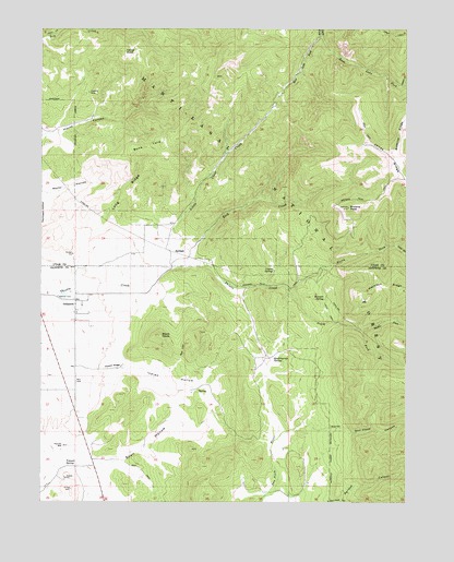
Indianola, UT USGS Topographic Map
Click on map above to begin viewing in our Map Viewer.

This topographic map contains these locations and features:
Feature Name Type Latitude Longitude GNIS ID View Map
Beehive RidgeRidgeN39.8486°W111.3774°1438565View Map
Black HawkSummitN39.7941°W111.4599°1425662View Map
Bone YardSummitN39.8441°W111.4649°1425870View Map
Browns PeakSummitN39.8280°W111.3957°1426020View Map
Browns Peak TrailTrailN39.8247°W111.3966°1439177View Map
Cedar HollowValleyN39.7544°W111.4982°1439573View Map
Cedar KnollSummitN39.8691°W111.4730°1426456View Map
Coyote SpringSpringN39.8114°W111.4209°1427063View Map
Crotons MineMineN39.8580°W111.4846°1427120View Map
East Lake ForkStreamN39.8736°W111.4049°1440834View Map
Haystack RidgeRidgeN39.8063°W111.3757°1441653View Map
Indian HollowValleyN39.7855°W111.4663°1429004View Map
IndianolaPopulated PlaceN39.8030°W111.4888°1442039View Map
Jones RidgeRidgeN39.8411°W111.3810°1442217View Map
Lasson Draw Wildlife Management AreaParkN39.8416°W111.4946°1448579View Map
Lasson SpringSpringN39.8450°W111.4769°1454790View Map
Little Clear CreekStreamN39.8108°W111.4596°1429693View Map
Loggers ForkStreamN39.8600°W111.3774°1442862View Map
Long RidgeRidgeN39.8311°W111.4721°1429917View Map
Lucy ForkStreamN39.8180°W111.3791°1443041View Map
Middle Fork Thistle CreekStreamN39.7950°W111.3905°1443357View Map
Mormon SpringSpringN39.8049°W111.4041°1430496View Map
North Fork Thistle CreekStreamN39.8069°W111.4160°1443940View Map
North San Pitch CanyonValleyN39.7675°W111.4191°1443972View Map
Parleys CanyonValleyN39.7505°W111.3982°1431118View Map
Poison RidgeRidgeN39.7858°W111.4757°1431360View Map
Poulson WellWellN39.7650°W111.4932°1431451View Map
Quakingasp SpringSpringN39.7886°W111.4204°1431516View Map
Red CliffCliffN39.7900°W111.4521°1431629View Map
Rock CreekStreamN39.8125°W111.4521°1431908View Map
Snail HollowValleyN39.7616°W111.4827°1432581View Map
South Fork Thistle CreekStreamN39.8069°W111.4163°1445881View Map
South San Pitch CanyonValleyN39.7502°W111.4024°1445919View Map
Spencer CemeteryCemeteryN39.8042°W111.4946°1432787View Map
Tidwell SpringSpringN39.7595°W111.4918°1433519View Map
West Lake ForkStreamN39.8738°W111.4052°1434092View Map

Note: Coordinates in the location and feature list above are referenced to NAD83 datum.


Copyright (C) 2008-2025 Ryan Niemi / Sunset Dynamics ... All Rights Reserved