TopoQuest Logo
Do you find TopoQuest useful?
Help keep TopoQuest running and adding new maps/features by donating!
Bitcoin:  19c7KJd3qBynnjoSw5npx9KScwjBe4ifkT
Litecoin:  LXs6TkuXGGXo1vDsWCkWVdjQX94eUKd6ui
Home View Maps Find Maps Find Places Resources & Links


Millen, Georgia Topographic Map

USGS Map Title: Millen, GA
USGS Map MRC: 32081G8
DRG (GeoTIFF) Download: o32081g8.tif


Neighboring USGS Topographic Map Quads:


  Bellevue, GA  
32082H1
 

  Perkins, GA  
32081H8
 

  Sardis, GA  
32081H7
 

  Birdsville, GA  
32082G1
 

  Millen, GA  
32081G8
 

  Bay Branch, GA  
32081G7
 

  Garfield, GA  
32082F1
 

  Four Points, GA  
32081F8
 

  Rocky Ford, GA  
32081F7


Map MRC Location:

N33°
W82°
N33°
W81°
H8 H7 H6 H5 H4 H3 H2 H1
G8 G7 G6 G5 G4 G3 G2 G1
F8 F7 F6 F5 F4 F3 F2 F1
E8 E7 E6 E5 E4 E3 E2 E1
D8 D7 D6 D5 D4 D3 D2 D1
C8 C7 C6 C5 C4 C3 C2 C1
B8 B7 B6 B5 B4 B3 B2 B1
A8 A7 A6 A5 A4 A3 A2 A1
N32°
W82°
N32°
W81°

Millen, GA USGS 1:24K Topographic Map Preview:
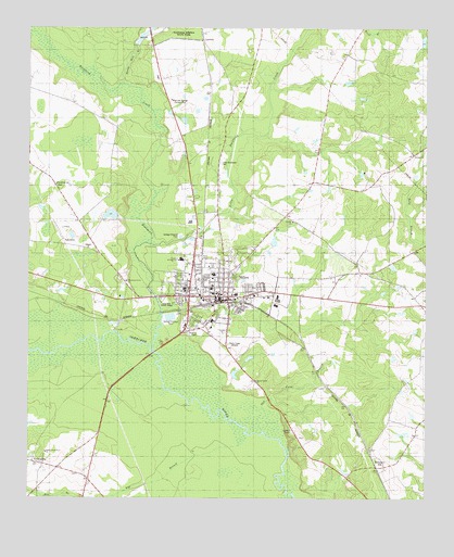
Millen, GA USGS Topographic Map
Click on map above to begin viewing in our Map Viewer.

This topographic map contains these locations and features:
Feature Name Type Latitude Longitude GNIS ID View Map
Bay BranchStreamN32.7688°W81.9334°310882View Map
Bethel Methodist Episcopal ChurchChurchN32.8041°W81.9359°342972View Map
Buckhead CreekStreamN32.7893°W81.9601°311978View Map
Christian Endeavor Hall (historical)ChurchN32.8007°W81.9337°342975View Map
City of MillenCivilN32.8071°W81.9423°2404263View Map
Daniel Grove ChurchChurchN32.7816°W81.9282°313284View Map
Davis LakeReservoirN32.8254°W81.9742°337716View Map
Davis Lake DamDamN32.8252°W81.9715°337715View Map
EmmalanePopulated PlaceN32.7599°W81.9982°313938View Map
First Baptist ChurchChurchN32.8060°W81.9473°342980View Map
Friendship ChurchChurchN32.8338°W81.9912°314413View Map
Friendship School (historical)SchoolN32.8335°W81.9912°334856View Map
Jenkins Correctional FacilityBuildingN32.7908°W81.9254°2735690View Map
Jenkins CountyCivilN32.7925°W81.9635°342985View Map
Jenkins County CourthouseBuildingN32.8043°W81.9393°342986View Map
Jenkins County Elementary SchoolSchoolN32.8138°W81.9521°342987View Map
Jenkins County High SchoolSchoolN32.8096°W81.9415°342988View Map
Jenkins County HospitalHospitalN32.8043°W81.9346°342989View Map
Jenkins County JailBuildingN32.8016°W81.9366°342990View Map
Jenkins County Middle SchoolSchoolN32.8132°W81.9521°342991View Map
Jenkins County Primary SchoolSchoolN32.8060°W81.9423°342992View Map
Jenkins County Sheriff's DepartmentBuildingN32.8016°W81.9367°2733931View Map
Kelsey ChurchChurchN32.8418°W81.8790°316368View Map
Kelsey School (historical)SchoolN32.8413°W81.8796°334859View Map
Lane CemeteryCemeteryN32.7696°W81.9937°342993View Map
LawtonPopulated PlaceN32.8718°W81.9454°332191View Map
Lincoln State ParkParkN32.8024°W81.9562°316893View Map
Little Buckhead CemeteryCemeteryN32.8393°W81.9398°316970View Map
Little Buckhead Church (historical)ChurchN32.8385°W81.9398°334860View Map
Little Buckhead CreekStreamN32.8182°W81.9629°316971View Map
Little Buckhead School (historical)SchoolN32.8682°W81.9001°334861View Map
Magnolia Springs Country ClubLocaleN32.8560°W81.9551°344281View Map
MillenPopulated PlaceN32.8041°W81.9493°356393View Map
Millen Baptist ChurchChurchN32.8046°W81.9421°342997View Map
Millen City HallBuildingN32.8029°W81.9415°342998View Map
Millen DivisionCivilN32.8495°W81.9360°1936442View Map
Millen HospitalHospitalN32.7974°W81.9421°342999View Map
Millen Jenkins County Fire DepartmentBuildingN32.8053°W81.9351°2603775View Map
Millen Police DepartmentBuildingN32.8053°W81.9351°2733609View Map
Millen Post OfficePost OfficeN32.8035°W81.9393°352135View Map
Millen View LakeReservoirN32.8728°W81.9086°340297View Map
Millen View Lake DamDamN32.8718°W81.9082°340296View Map
Morrison Grove ChurchChurchN32.8079°W81.9687°318500View Map
Mulkey HospitalHospitalN32.8043°W81.9398°343001View Map
Needful ChurchChurchN32.8238°W81.9171°319228View Map
Needful School (historical)SchoolN32.8235°W81.9165°334863View Map
Oak Cane BranchStreamN32.7685°W81.9262°356435View Map
Old Fort Lawton (historical)LocaleN32.8668°W81.9504°334865View Map
Paramore HillSummitN32.7638°W81.9109°334866View Map
Paramore HillPopulated PlaceN32.7585°W81.8879°356457View Map
Rosenwald School (historical)SchoolN32.8082°W81.9462°343006View Map
Sculls Creek Number 2 ChurchChurchN32.7624°W81.9940°344343View Map
South Millen (historical)Populated PlaceN32.7941°W81.9512°343009View Map
Spring Mill BranchStreamN32.8604°W81.9704°323448View Map
West Millen Baptist ChurchChurchN32.8068°W81.9504°343011View Map
WGSR-AM (Millen)TowerN32.7913°W81.9368°352499View Map
Zion Baptist ChurchChurchN32.8032°W81.9312°343012View Map
Zion Church (historical)ChurchN32.7991°W81.9243°334869View Map

Note: Coordinates in the location and feature list above are referenced to NAD83 datum.


Copyright (C) 2008-2024 Ryan Niemi / Sunset Dynamics ... All Rights Reserved