TopoQuest Logo
Do you find TopoQuest useful?
Help keep TopoQuest running and adding new maps/features by donating!
Bitcoin:  19c7KJd3qBynnjoSw5npx9KScwjBe4ifkT
Litecoin:  LXs6TkuXGGXo1vDsWCkWVdjQX94eUKd6ui
Home View Maps Find Maps Find Places Resources & Links


Milton, Delaware Topographic Map

USGS Map Title: Milton, DE
USGS Map MRC: 38075G3
DRG (GeoTIFF) Download: o38075g3.tif


Neighboring USGS Topographic Map Quads:


  Milford, DE  
38075H4
 

  Mispillion River, DE  
38075H3


  Ellendale, DE  
38075G4
 

  Milton, DE  
38075G3
 

  Lewes, DE  
38075G2
 

  Georgetown, DE  
38075F4
 

  Harbeson, DE  
38075F3
 

  Fairmount, DE  
38075F2


Map MRC Location:

N39°
W76°
N39°
W75°
H8 H7 H6 H5 H4 H3 H2 H1
G8 G7 G6 G5 G4 G3 G2 G1
F8 F7 F6 F5 F4 F3 F2 F1
E8 E7 E6 E5 E4 E3 E2 E1
D8 D7 D6 D5 D4 D3 D2 D1
C8 C7 C6 C5 C4 C3 C2 C1
B8 B7 B6 B5 B4 B3 B2 B1
A8 A7 A6 A5 A4 A3 A2 A1
N38°
W76°
N38°
W75°

Milton, DE USGS 1:24K Topographic Map Preview:
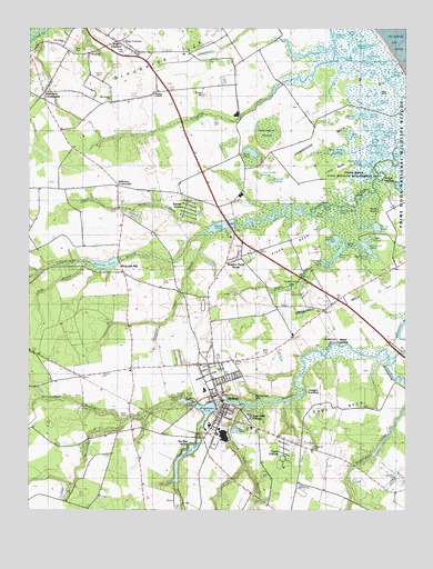
Milton, DE USGS Topographic Map
Click on map above to begin viewing in our Map Viewer.

This topographic map contains these locations and features:
Feature Name Type Latitude Longitude GNIS ID View Map
Anderson CrossroadsPopulated PlaceN38.8587°W75.3699°216016View Map
Argo CornersPopulated PlaceN38.8715°W75.3455°213571View Map
Beaverdam CreekStreamN38.7890°W75.2532°213626View Map
Bennett PondLakeN38.8704°W75.2644°213635View Map
Bethel CemeteryCemeteryN38.7885°W75.3071°213642View Map
Betts CemeteryCemeteryN38.7905°W75.2963°213649View Map
Big Round PondLakeN38.8598°W75.2569°213663View Map
Blind PondLakeN38.8427°W75.3010°214619View Map
Brittingham BranchStreamN38.7732°W75.3427°213710View Map
Broadkill NeckCapeN38.8090°W75.2705°213714View Map
Broadkill SchoolSchoolN38.8065°W75.2685°217396View Map
Broken MarshesSwampN38.8451°W75.2591°213719View Map
Buzzard SwampSwampN38.8358°W75.2949°213742View Map
Caleb PondLakeN38.8558°W75.2586°214187View Map
Cave ColonyPopulated PlaceN38.7640°W75.2899°216897View Map
Cave NeckCapeN38.7737°W75.2716°213769View Map
Cedar Creek HundredCivilN38.8668°W75.2996°217205View Map
Cods Hammocks (historical)IslandN38.8621°W75.2663°215273View Map
Collins and Russell DevelopmentPopulated PlaceN38.7876°W75.3230°215535View Map
Conwell PondLakeN38.8421°W75.2520°213826View Map
Davis CemeteryCemeteryN38.8512°W75.3131°213858View Map
Deep BranchStreamN38.8132°W75.2799°216901View Map
Diamond PondReservoirN38.7649°W75.3220°213885View Map
Diamond Pond Dam (historical)DamN38.7687°W75.3177°217415View Map
DrawbridgePopulated PlaceN38.7909°W75.2519°216900View Map
East Side VillagePopulated PlaceN38.7743°W75.3016°216898View Map
First HillIslandN38.8621°W75.2663°213958View Map
Flaxhole PondLakeN38.8165°W75.2724°213967View Map
Fleetwood PondLakeN38.8180°W75.2629°213968View Map
Foord LandingPopulated PlaceN38.8351°W75.2577°216097View Map
Full Gospel Holiness ChurchChurchN38.8715°W75.3641°217286View Map
Goose PondLakeN38.8191°W75.2736°214007View Map
Goose PondLakeN38.8526°W75.2657°214008View Map
Goshen United Methodist ChurchChurchN38.7776°W75.3107°215048View Map
Grace ChurchChurchN38.7834°W75.3135°215045View Map
H O Brittingham Elementary SchoolSchoolN38.7813°W75.3169°214920View Map
Hay HummockIslandN38.8543°W75.2507°214066View Map
Hazzard CemeteryCemeteryN38.8171°W75.2794°214070View Map
Hickory CemeteryCemeteryN38.8621°W75.3522°214092View Map
Holly Lake Mobile Home ParkPopulated PlaceN38.7779°W75.3191°216638View Map
Horse IslandIslandN38.8268°W75.2613°214120View Map
Horseshoe PondLakeN38.8154°W75.2621°214126View Map
Huckleberry SwampSwampN38.8479°W75.2960°214130View Map
Ingram BranchStreamN38.8204°W75.3157°214145View Map
Ingram BranchStreamN38.7723°W75.3180°214147View Map
Ingram PondLakeN38.8718°W75.2683°214148View Map
Jack Roach PondLakeN38.8275°W75.2724°214160View Map
Jefferson CrossroadsPopulated PlaceN38.8343°W75.3452°216125View Map
Jones PondLakeN38.8498°W75.2603°214178View Map
Landmark Baptist TabernacleChurchN38.7876°W75.3182°215047View Map
Lavinia CausewayBridgeN38.7771°W75.3191°214206View Map
Little NeckCapeN38.8382°W75.2727°214236View Map
Little Rabbit SwampSwampN38.8371°W75.2992°214238View Map
Little Round PondLakeN38.8643°W75.2529°214241View Map
MiltonPopulated PlaceN38.7776°W75.3099°214325View Map
Milton Federal Street Elementary (historical)SchoolN38.7712°W75.3149°217420View Map
Milton Fire DepartmentBuildingN38.7773°W75.3097°2610790View Map
Milton Junior High SchoolSchoolN38.7715°W75.3146°214921View Map
Milton Police DepartmentBuildingN38.7774°W75.3101°2131090View Map
Milton Post OfficePost OfficeN38.7872°W75.3201°2378965View Map
Milton Public LibraryBuildingN38.7787°W75.3107°2378966View Map
Milton Town HallBuildingN38.7773°W75.3097°2378967View Map
Miry PondLakeN38.8472°W75.2688°214328View Map
Mount Calvary Pentecostal ChurchChurchN38.8571°W75.3485°217285View Map
Negro IslandIslandN38.8587°W75.2552°214377View Map
Noah PondLakeN38.8262°W75.2803°214390View Map
North ProngStreamN38.8234°W75.3163°214393View Map
Oak HillIslandN38.8634°W75.2757°216340View Map
Oak PondLakeN38.8201°W75.2620°214402View Map
Ockel Farms AirportAirportN38.7505°W75.3585°2625366View Map
Old Slaughter CreekStreamN38.8665°W75.2732°214416View Map
Peach PondLakeN38.8183°W75.2665°213609View Map
Pemberton BranchStreamN38.7782°W75.3252°214434View Map
Pikes NeckCapeN38.8171°W75.2877°214451View Map
Pilgrim Holiness Tabernacle (historical)ChurchN38.7759°W75.3221°217403View Map
Piney BranchStreamN38.8143°W75.3549°214459View Map
Ponder CemeteryCemeteryN38.7793°W75.3238°214473View Map
Poplar Woods PondLakeN38.8422°W75.2730°214475View Map
Prime Hook National Wildlife RefugeParkN38.8461°W75.2609°216903View Map
Prime Hook State Wildlife Management AreaParkN38.8390°W75.2691°217284View Map
Primehook NeckCapeN38.8468°W75.2749°214497View Map
Rattlesnake HillSummitN38.7798°W75.2980°214517View Map
Reynolds Church (historical)ChurchN38.8109°W75.3424°217407View Map
Reynolds MillPopulated PlaceN38.8132°W75.3441°216194View Map
Reynolds PondReservoirN38.8138°W75.3493°214541View Map
Reynolds Pond Dam (historical)DamN38.8148°W75.3449°217416View Map
Round Pole BranchStreamN38.7762°W75.3032°214567View Map
Second HillIslandN38.8604°W75.2613°214628View Map
Siloam CemeteryCemeteryN38.8678°W75.3551°2378963View Map
Siloam ChurchChurchN38.8684°W75.3546°214645View Map
Slaughter Neck CemeteryCemeteryN38.8694°W75.3390°214666View Map
Slaughter Neck ChurchChurchN38.8696°W75.3391°215633View Map
Slaughter Neck SchoolSchoolN38.8562°W75.3416°217408View Map
Smith LandingPopulated PlaceN38.7937°W75.2732°217283View Map
Solid Rock Holiness ChurchChurchN38.7729°W75.3035°215046View Map
Southwest PondLakeN38.8673°W75.2635°214679View Map
Sowbridge BranchStreamN38.8209°W75.3171°214680View Map
Spatterdock PondLakeN38.8420°W75.2588°214681View Map
Stickweed PondLakeN38.8400°W75.2641°214693View Map
Streak PondsLakeN38.8276°W75.2741°214702View Map
Sugar HillSummitN38.8573°W75.3160°214706View Map
Teal PondLakeN38.8144°W75.2766°214726View Map
The Rookery Golf CourseLocaleN38.8024°W75.2644°2378976View Map
Town of MiltonCivilN38.7751°W75.3104°2391306View Map
Turkle PondLakeN38.8233°W75.2596°214772View Map
Twin PondsLakeN38.8411°W75.2609°214778View Map
Vaughn LandingPopulated PlaceN38.7787°W75.2821°216899View Map
Wagamons PondReservoirN38.7771°W75.3130°214800View Map
Wagamons Pond DamDamN38.7771°W75.3130°216904View Map
WaplesPopulated PlaceN38.8259°W75.3074°216902View Map
Waples PondLakeN38.8732°W75.2730°214805View Map
Waples PondReservoirN38.8227°W75.3135°214806View Map
Waples Pond AcresPopulated PlaceN38.8173°W75.3046°215536View Map
Waples Pond Dam (historical)DamN38.8243°W75.3080°217417View Map
Weigands CemeteryCemeteryN38.7660°W75.2808°214815View Map
Wesley ChapelChurchN38.8582°W75.3327°214820View Map
Wilson PondLakeN38.8524°W75.2644°214869View Map
Zion CemeteryCemeteryN38.8017°W75.2776°2378975View Map
Zion ChurchChurchN38.8018°W75.2771°214890View Map

Note: Coordinates in the location and feature list above are referenced to NAD83 datum.


Copyright (C) 2008-2025 Ryan Niemi / Sunset Dynamics ... All Rights Reserved