TopoQuest Logo
Do you find TopoQuest useful?
Help keep TopoQuest running and adding new maps/features by donating!
Bitcoin:  19c7KJd3qBynnjoSw5npx9KScwjBe4ifkT
Litecoin:  LXs6TkuXGGXo1vDsWCkWVdjQX94eUKd6ui
Home View Maps Find Maps Find Places Resources & Links


Hanland Peak, California Topographic Map

USGS Map Title: Hanland Peak, CA
USGS Map MRC: 40122H3
DRG (GeoTIFF) Download: o40122h3.tif


Neighboring USGS Topographic Map Quads:


  Chicken Hawk Hill, CA  
41122A4
 

  Tombstone Mountain, CA  
41122A3
 

  Yellowjacket Mountain, CA  
41122A2
 

  Lamoine, CA  
40122H4
 

  Hanland Peak, CA  
40122H3
 

  Bollibokka Mountain, CA  
40122H2
 

  Bohemotash Mountain, CA  
40122G4
 

  O'Brien, CA  
40122G3
 

  Minnesota Mountain, CA  
40122G2


Map MRC Location:

N41°
W123°
N41°
W122°
H8 H7 H6 H5 H4 H3 H2 H1
G8 G7 G6 G5 G4 G3 G2 G1
F8 F7 F6 F5 F4 F3 F2 F1
E8 E7 E6 E5 E4 E3 E2 E1
D8 D7 D6 D5 D4 D3 D2 D1
C8 C7 C6 C5 C4 C3 C2 C1
B8 B7 B6 B5 B4 B3 B2 B1
A8 A7 A6 A5 A4 A3 A2 A1
N40°
W123°
N40°
W122°

Hanland Peak, CA USGS 1:24K Topographic Map Preview:
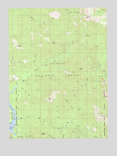
Hanland Peak, CA USGS Topographic Map
Click on map above to begin viewing in our Map Viewer.

This topographic map contains these locations and features:
Feature Name Type Latitude Longitude GNIS ID View Map
Albert CreekStreamN40.9379°W122.3447°256150View Map
AntlersPopulated PlaceN40.8954°W122.3711°1657937View Map
Bastard CanyonValleyN40.9013°W122.2922°256586View Map
Bucks PeakSummitN40.9135°W122.3253°257641View Map
Crane MountainSummitN40.9663°W122.3647°1658343View Map
Doe GulchValleyN40.9132°W122.2864°259429View Map
Eye CreekStreamN40.9424°W122.3414°260014View Map
Fannie CreekStreamN40.9302°W122.3600°260049View Map
Green MountainSummitN40.9677°W122.3200°260862View Map
Gregory Beach CampgroundLocaleN40.8852°W122.3697°276977View Map
Gregory CreekStreamN40.8821°W122.3720°260883View Map
Gregory Creek CampgroundLocaleN40.8874°W122.3686°260884View Map
Hanland PeakSummitN40.9418°W122.2853°261066View Map
High MountainSummitN40.9913°W122.2736°261322View Map
Indian CreekStreamN40.8954°W122.3675°261722View Map
Indian SpringSpringN40.8944°W122.3393°261764View Map
Johnny Sisk CreekStreamN40.9260°W122.3639°261965View Map
Kabyai CreekStreamN40.9329°W122.2503°262059View Map
Little Kabyai CreekStreamN40.9315°W122.2500°262648View Map
Long Tom CreekStreamN40.8865°W122.3075°262881View Map
Matquaw FlatFlatN40.8904°W122.2989°263268View Map
Middle Salt CreekStreamN40.9279°W122.3633°263549View Map
North Fork North Salt CreekStreamN40.9990°W122.3670°229701View Map
North Fork Salt CreekStreamN40.9213°W122.2789°264206View Map
Rabbit FlatFlatN40.9313°W122.3583°265119View Map
Sacramento Canyon DivisionCivilN40.9952°W122.3590°1935275View Map
Sacramento MountainSummitN40.8799°W122.3353°265708View Map
Tom Head CreekStreamN40.8838°W122.3108°268332View Map
West Fork Salt CreekStreamN40.9213°W122.2789°268914View Map

Note: Coordinates in the location and feature list above are referenced to NAD83 datum.


Copyright (C) 2008-2025 Ryan Niemi / Sunset Dynamics ... All Rights Reserved