TopoQuest Logo
Do you find TopoQuest useful?
Help keep TopoQuest running and adding new maps/features by donating!
Bitcoin:  19c7KJd3qBynnjoSw5npx9KScwjBe4ifkT
Litecoin:  LXs6TkuXGGXo1vDsWCkWVdjQX94eUKd6ui
Home View Maps Find Maps Find Places Resources & Links


O'Brien, California Topographic Map

USGS Map Title: O'Brien, CA
USGS Map MRC: 40122G3
DRG (GeoTIFF) Download: o40122g3.tif


Neighboring USGS Topographic Map Quads:


  Lamoine, CA  
40122H4
 

  Hanland Peak, CA  
40122H3
 

  Bollibokka Mountain, CA  
40122H2
 

  Bohemotash Mountain, CA  
40122G4
 

  O'Brien, CA  
40122G3
 

  Minnesota Mountain, CA  
40122G2
 

  Shasta Dam, CA  
40122F4
 

  Project City, CA  
40122F3
 

  Bella Vista, CA  
40122F2


Map MRC Location:

N41°
W123°
N41°
W122°
H8 H7 H6 H5 H4 H3 H2 H1
G8 G7 G6 G5 G4 G3 G2 G1
F8 F7 F6 F5 F4 F3 F2 F1
E8 E7 E6 E5 E4 E3 E2 E1
D8 D7 D6 D5 D4 D3 D2 D1
C8 C7 C6 C5 C4 C3 C2 C1
B8 B7 B6 B5 B4 B3 B2 B1
A8 A7 A6 A5 A4 A3 A2 A1
N40°
W123°
N40°
W122°

O'Brien, CA USGS 1:24K Topographic Map Preview:
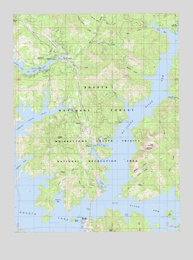
O'Brien, CA USGS Topographic Map
Click on map above to begin viewing in our Map Viewer.

This topographic map contains these locations and features:
Feature Name Type Latitude Longitude GNIS ID View Map
Allie CoveBayN40.7624°W122.2920°266379View Map
Allie Cove CampgroundLocaleN40.7546°W122.2892°276658View Map
American Trails Recreation SiteLocaleN40.8582°W122.3403°276661View Map
Azelle CreekStreamN40.7718°W122.2572°266394View Map
Bailey CoveBayN40.7990°W122.3058°266400View Map
Bailey Cove CampgroundLocaleN40.8015°W122.2831°276655View Map
Baird (historical)Populated PlaceN40.7924°W122.2964°1682457View Map
Bass Mountain MarkerLocaleN40.7507°W122.3189°266418View Map
Beaver IslandIslandN40.7568°W122.3328°266435View Map
Bridge Bay ResortLocaleN40.7560°W122.3228°266484View Map
Bridge Bay Resort Seaplane BaseAirportN40.7574°W122.3245°1653866View Map
Cascade Cove ResortLocaleN40.8713°W122.3633°276652View Map
Coal CreekStreamN40.8485°W122.3350°266583View Map
Curl CreekStreamN40.8171°W122.2725°266615View Map
Dead Horse CreekStreamN40.8635°W122.3139°266626View Map
Fall CreekStreamN40.8593°W122.3167°266698View Map
Goat CreekStreamN40.7713°W122.3217°266751View Map
Greens CreekStreamN40.8271°W122.2553°266775View Map
Greens Creek CampgroundLocaleN40.8260°W122.2561°266776View Map
Halfway CoveBayN40.7915°W122.3658°266788View Map
Hirz BayBayN40.8663°W122.2672°266808View Map
Hirz Bay CampgroundsLocaleN40.8665°W122.2542°266810View Map
Hirz CreekStreamN40.8677°W122.2731°266809View Map
Holiday Harbor ResortPopulated PlaceN40.8024°W122.3103°276663View Map
Keluche CreekStreamN40.8374°W122.2700°266875View Map
Lakeview ResortPopulated PlaceN40.8143°W122.2920°276664View Map
Lightning CanyonValleyN40.8702°W122.3100°266910View Map
Lower Salt Creek CampgroundLocaleN40.8432°W122.3531°276665View Map
Lower Salt Creek ResortLocaleN40.8421°W122.3483°266953View Map
Marble CreekStreamN40.7843°W122.2883°266971View Map
Mariners Point CampgroundLocaleN40.7529°W122.2522°266974View Map
McCloud RiverStreamN40.7702°W122.3036°266985View Map
McCloud River ArmBayN40.8535°W122.2556°266986View Map
Moss CreekStreamN40.8718°W122.3072°267034View Map
Nelson CreekStreamN40.8496°W122.3461°267055View Map
Nelson Point CampgroundLocaleN40.8482°W122.3445°276662View Map
North Gray RocksSummitN40.7993°W122.2708°267080View Map
O'BrienPopulated PlaceN40.8121°W122.3242°1659769View Map
O'Brien Creek InletBayN40.8154°W122.3620°267085View Map
O'Brien MountainSummitN40.8032°W122.3383°267086View Map
Oak Grove CampgroundLocaleN40.8479°W122.3539°276651View Map
Packers BayBayN40.7671°W122.3433°267104View Map
Packers Bay MarinaLocaleN40.7757°W122.3397°276668View Map
Packers GulchValleyN40.7729°W122.3428°267105View Map
Pit RiverStreamN40.7563°W122.3706°1654947View Map
Pit River ArmBayN40.7643°W122.2845°267131View Map
Pit River BridgeBridgeN40.7624°W122.3189°1661849View Map
Potter CreekStreamN40.7804°W122.2886°234509View Map
Salt Creek Group CampgroundsLocaleN40.8490°W122.3375°1661859View Map
Salt Creek InletBayN40.8443°W122.3692°267206View Map
Salt Creek Picnic AreaParkN40.8510°W122.3372°234614View Map
Shasta Iron MineMineN40.7774°W122.2828°267229View Map
Shasta LakeReservoirN40.7695°W122.3652°253897View Map
Shasta MarinaLocaleN40.8179°W122.3289°267230View Map
Ski IslandIslandN40.7599°W122.2589°267257View Map
Ski Island CampgroundLocaleN40.7604°W122.2575°276659View Map
Turntable BayBayN40.7771°W122.3086°1661872View Map
Turntable Forest Service FacilityLocaleN40.7721°W122.3097°276657View Map
Upper Salt Creek CampgroundLocaleN40.8502°W122.3395°276660View Map
Upper Salt Creek ResortLocaleN40.8529°W122.3364°268637View Map
Waters GulchValleyN40.7810°W122.3522°268811View Map
Wintoon CampgroundLocaleN40.8029°W122.3047°269254View Map
Ycotto CreekStreamN40.8215°W122.2900°269336View Map

Note: Coordinates in the location and feature list above are referenced to NAD83 datum.


Copyright (C) 2008-2025 Ryan Niemi / Sunset Dynamics ... All Rights Reserved