TopoQuest Logo
Do you find TopoQuest useful?
Help keep TopoQuest running and adding new maps/features by donating!
Bitcoin:  19c7KJd3qBynnjoSw5npx9KScwjBe4ifkT
Litecoin:  LXs6TkuXGGXo1vDsWCkWVdjQX94eUKd6ui
Home View Maps Find Maps Find Places Resources & Links


Beaverdam Creek, Oregon Topographic Map

USGS Map Title: Beaverdam Creek, OR
USGS Map MRC: 44118E1
DRG (GeoTIFF) Download: o44118e1.tif


Neighboring USGS Topographic Map Quads:


  Sumpter, OR  
44118F2
 

  Phillips Lake, OR  
44118F1
 

  Blue Canyon, OR  
44117F8
 

  Unity Reservoir, OR  
44118E2
 

  Beaverdam Creek, OR  
44118E1
 

  Brannan Gulch, OR  
44117E8
 

  Unity, OR  
44118D2
 

  Hereford, OR  
44118D1
 

  Devils Heel, OR  
44117D8


Map MRC Location:

N45°
W119°
N45°
W118°
H8 H7 H6 H5 H4 H3 H2 H1
G8 G7 G6 G5 G4 G3 G2 G1
F8 F7 F6 F5 F4 F3 F2 F1
E8 E7 E6 E5 E4 E3 E2 E1
D8 D7 D6 D5 D4 D3 D2 D1
C8 C7 C6 C5 C4 C3 C2 C1
B8 B7 B6 B5 B4 B3 B2 B1
A8 A7 A6 A5 A4 A3 A2 A1
N44°
W119°
N44°
W118°

Beaverdam Creek, OR USGS 1:24K Topographic Map Preview:
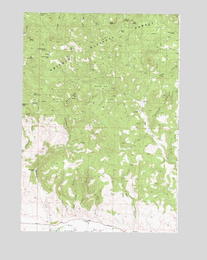
Beaverdam Creek, OR USGS Topographic Map
Click on map above to begin viewing in our Map Viewer.

This topographic map contains these locations and features:
Feature Name Type Latitude Longitude GNIS ID View Map
Alkali SpringSpringN44.5176°W118.0722°1131454View Map
Asa Fleetwood Family CemeteryCemeteryN44.5060°W118.0716°1120830View Map
Beaverdam ButtesSummitN44.5777°W118.0844°1117460View Map
Beaverdam CreekStreamN44.5016°W118.0955°1117461View Map
Beaverdam PondLakeN44.5348°W118.1139°1117463View Map
Big Creek SpringSpringN44.6207°W118.0454°1117610View Map
Boiler SpringSpringN44.6149°W118.0478°1117914View Map
Bull SpringSpringN44.6040°W118.0876°1118294View Map
Camp CreekStreamN44.5024°W118.0819°1118505View Map
Camp Crunch SpringSpringN44.6148°W118.0042°1118516View Map
China Creek Corral PondLakeN44.5730°W118.1126°1118909View Map
Clayton SpringSpringN44.6099°W118.1202°1118990View Map
Cleary DitchCanalN44.6113°W118.0010°1131457View Map
East China SpringSpringN44.5990°W118.1175°1120284View Map
Ernie SpringSpringN44.6193°W118.0677°1120517View Map
Fir Tree SpringSpringN44.5668°W118.1223°1120738View Map
Hereford DitchCanalN44.5032°W118.0594°1131456View Map
Hudspeth CorralLocaleN44.5749°W118.0297°1122106View Map
Hudspeth Cow CampLocaleN44.5699°W118.0335°1122107View Map
Jack McCord SpringSpringN44.6238°W118.1117°1122331View Map
Jordan CreekStreamN44.5407°W118.0058°1122526View Map
Long GulchValleyN44.5066°W118.0891°1123414View Map
Mud SpringsSpringN44.5173°W118.0807°1131455View Map
Mud Springs GulchValleyN44.5082°W118.0805°1124500View Map
Quartz GulchValleyN44.5066°W118.0660°1125732View Map
Rattlesnake GulchValleyN44.5582°W118.0247°1125834View Map
Sheep RockLocaleN44.6193°W118.0537°1126837View Map
South China SpringSpringN44.5774°W118.1158°1127241View Map
Spud SpringSpringN44.6197°W118.0351°1127464View Map
Sunflower FlatFlatN44.5829°W118.0619°1158513View Map
Sunflower FlatFlatN44.6013°W118.1030°1158514View Map
Sunflower Flat PondLakeN44.5988°W118.1046°1127726View Map
Sunflower Flat SpringSpringN44.6039°W118.1069°1127727View Map
Whipple GulchValleyN44.5877°W118.0235°1128934View Map
Wood GulchValleyN44.5082°W118.0733°1129297View Map

Note: Coordinates in the location and feature list above are referenced to NAD83 datum.


Copyright (C) 2008-2025 Ryan Niemi / Sunset Dynamics ... All Rights Reserved